

Strong Storms Affecting Madison & Limestone Counties
…SIGNIFICANT WEATHER ADVISORY FOR NORTHWESTERN MADISON AND
NORTHEASTERN LIMESTONE COUNTIES UNTIL 315 PM CDT…
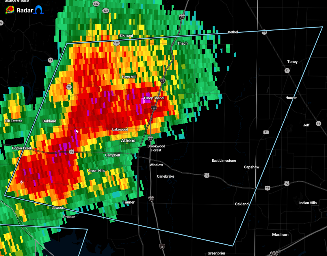
At 228 PM CDT, Doppler radar was tracking a strong thunderstorm near
Athens, moving east at 10 mph.
Pea size hail and wind gusts up to 50 mph will be possible with this
storm.
Locations impacted include…
Athens, Tanner, Harvest, Elkmont, Cartwright, French Mill, Toney,
Capshaw and Ripley.
PRECAUTIONARY/PREPAREDNESS ACTIONS…
Very heavy rainfall is also occurring with this storm, and may lead
to localized flooding. Do not drive your vehicle through flooded
roadways.
Category: Alabama's Weather, ALL POSTS, Severe Weather
About the Author (Author Profile)
Scott Martin is an operational meteorologist, professional graphic artist, musician, husband, and father. Not only is Scott a member of the National Weather Association, but he is also the Central Alabama Chapter of the NWA president. Scott is also the co-founder of Racecast Weather, which provides forecasts for many racing series across the USA. He also supplies forecasts for the BassMaster Elite Series events including the BassMaster Classic.Subscribe
If you enjoyed this article, subscribe to receive more just like it.


