At Midday: Mostly Cloudy but Dry for Now; Zeta Remains Just Shy of Hurricane Strength
OTHER THAN CLOUDS, NO MAJOR ISSUES WITH OUR WEATHER TODAY
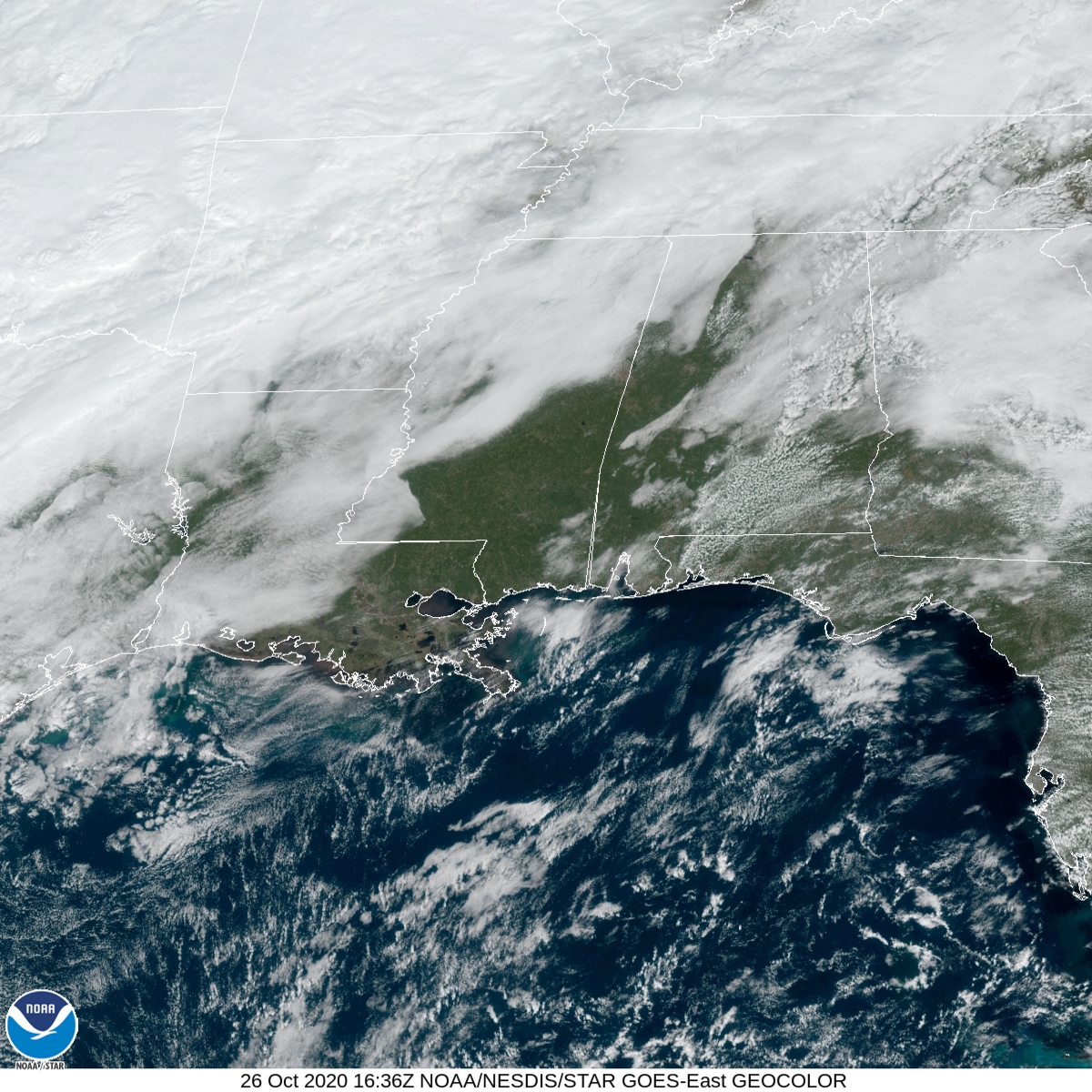
As of 11:36 am, we have some clouds over a good bit of Central Alabama, but several locations in the west and southwestern parts of the area are getting a good bit of sunshine. Radar is free from any rainfall at the moment, but I wouldn’t rule out a few stray light showers for the eastern half of the area later in the afternoon and this evening. Temperatures as of the 11:00 am roundup were in the mid-60s to the upper 70s across the area and should warm into the lower 70s to the lower 80s for the afternoon highs. Skies will remain mostly cloudy to overcast across much of Central Alabama throughout the remainder of the day and through the late-night and overnight hours. A few sprinkles may fall over the extreme eastern parts of the area during the overnight hours as well. Lows will be in the mid-50s to the mid-60s.
TROPICAL STORM ZETA
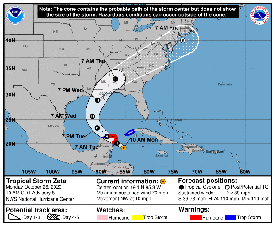
As of the 10:00 am update from the National Hurricane Center, Zeta remains a tropical storm with maximum sustained winds at 70 MPH, but is expected to strengthen into a hurricane this afternoon. The center was located about 140 miles southeast of Cozumel, Mexico, and movement is to the northwest at 10 MPH. A northwestward motion with some increase in forward speed is expected over the next day or so, followed by a turn toward the north Tuesday night. A faster northward to north-northeastward motion is forecast on Wednesday. On the forecast track, the center of Zeta will move near or over the northern Yucatan Peninsula later today or tonight, move over the southern Gulf of Mexico on Tuesday, and approach the northern Gulf Coast on Wednesday.
Once it makes landfall a curve to the northeast will happen and bring the center of Zeta across Central Alabama starting late on Wednesday night and through the morning hours on Thursday. Zeta is forecast to still be a tropical storm at 7:00 am Thursday morning as the center moves very close to Birmingham. Forward motion will increase greatly as an incoming cold front will help push Zeta out of the area. The center is forecast to be just offshore of New Jersey just 24 hours later.
Impacts we may see across Central Alabama from Tropical Storm Zeta:
• Wind gusts up to 30-45 MPH possible starting Wednesday night and persisting into the morning hours on Thursday.
• A brief spin-up tornado or two possible Wednesday night for the southern half of Central Alabama.
• Rainfall amounts of 2 to 4 inches from Wednesday night through all of Thursday possibly leading to some localized flash flooding issues.
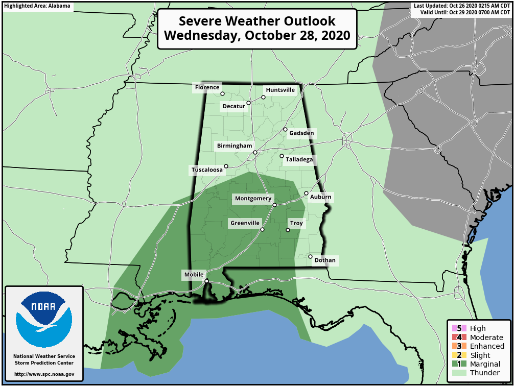
The Storm Prediction Center has a level 1 Marginal Risk for severe storms up for much of the southern half of Central Alabama for Wednesday due to the potential of brief spin-up tornadoes.
The forecast for Central Alabama may change with any shift in the forecast track, so it is very important that you keep up-to-date with the latest information. We’ll have frequent updates on the blog until Zeta leaves the area on Thursday. Stay tuned.
Category: Alabama's Weather, ALL POSTS, Severe Weather, Tropical
About the Author (Author Profile)
Scott Martin is an operational meteorologist, professional graphic artist, musician, husband, and father. Not only is Scott a member of the National Weather Association, but he is also the Central Alabama Chapter of the NWA president. Scott is also the co-founder of Racecast Weather, which provides forecasts for many racing series across the USA. He also supplies forecasts for the BassMaster Elite Series events including the BassMaster Classic.Subscribe
If you enjoyed this article, subscribe to receive more just like it.


