

A Brief Check on Our Weather as of 1:40 pm
RADAR CHECK AT 1:40 PM
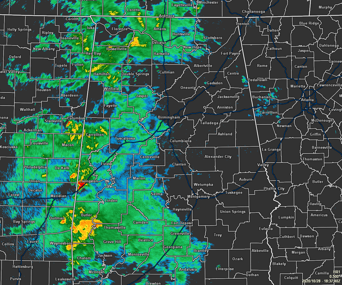
We have a good bit of light to moderate showers over the western half of North/Central Alabama as we head into the mid-afternoon hours on this gray and very humid Wednesday. The eastern half of the area remains mostly dry at this point, but that will change come later this afternoon and through the night-time hours as rain and storms will become even more likely. Other than the watches, warnings, and advisories listed below, we do not have any severe thunderstorm or tornado watches or warnings issued at this time.
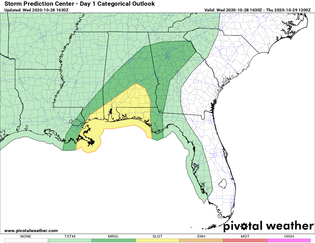
Just about all of Central Alabama along and south of the I-59 corridor continues under a level 1 Marginal Risk through the rest of your Wednesday and into the early morning hours on Thursday. A level 2 Slight Risk is up for portions of the southeastern parts of the area.
Temperatures as of the 1:00 pm roundup were in the lower 70s to the mid-80s across the area. Eufaula was leading the way as the warm spot at 85 degrees. Haleyville was the cool spot at 72 degrees. Birmingham was sitting at 77 degrees. These temperatures are relatively close to what we’ll see for afternoon highs, but we may see those rise 1 or 2 degrees warmer before we start to lose the daytime heating.
TROPICAL STORM WARNING CONTINUES
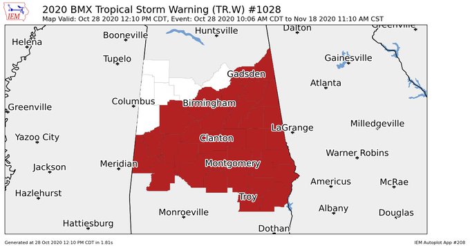
NWS Birmingham continues the Tropical Storm Warning for Etowah, Cherokee, Jefferson, St. Clair, Calhoun, Cleburne, Tuscaloosa, Shelby, Talladega, Clay, Randolph, Bibb, Sumter, Greene, Hale, Perry, Chilton, Coosa, Tallapoosa, Chambers, Marengo, Dallas, Autauga, Elmore, Lee, Lowndes, Montgomery, Macon, Russell, Pike, Bullock, and Barbour counties in Central Alabama until further notice.
FLASH FLOOD WATCH CONTINUES
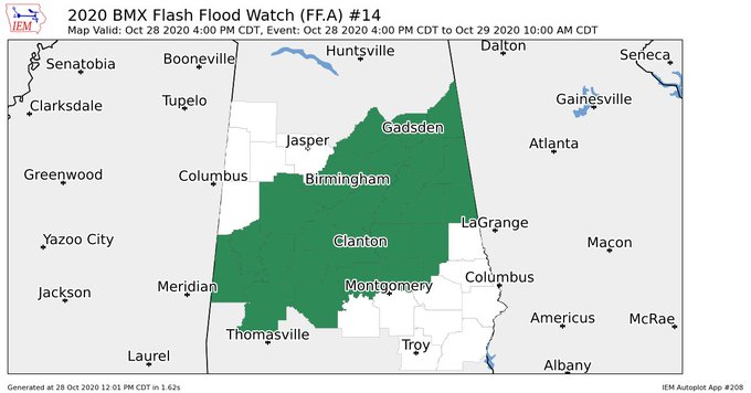
NWS Birmingham continues the Flash Flood Watch for Etowah, Cherokee, Jefferson, St. Clair, Calhoun, Cleburne, Tuscaloosa, Shelby, Talladega, Clay, Randolph, Bibb, Sumter, Greene, Hale, Perry, Chilton, Coosa, Tallapoosa, Marengo, Dallas, Autauga, and Elmore counties in Central Alabama until 10:00 am Thursday.
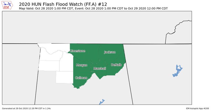
NWS Huntsville continues the Flash Flood Watch for Cullman, DeKalb, Jackson, Limestone, Madison, Marshall, Morgan counties in North Alabama until 12:00 pm Thursday.
WIND ADVISORY CONTINUES
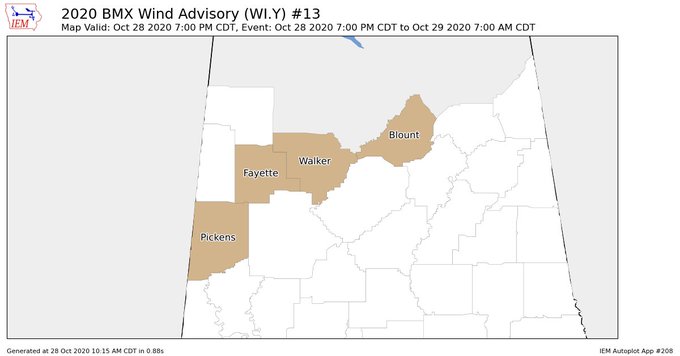
NWS Birmingham continues the Wind Advisory for Blount, Fayette, Pickens, and Walker counties in Central Alabama until 7:00 am Thursday.
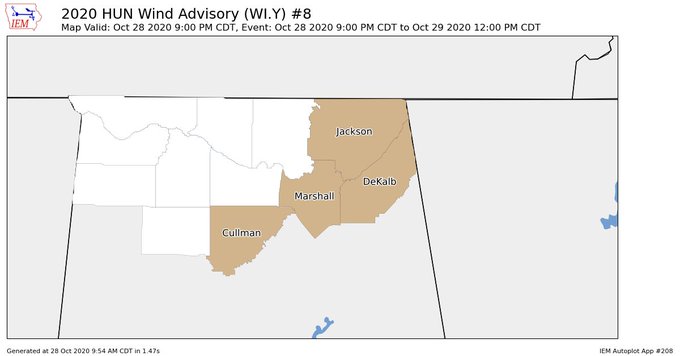
NWS Huntsville continues the Wind Advisory for Cullman, DeKalb, Jackson, and Marshall counties in North Alabama until 12:00 pm Thursday.
Category: Alabama's Weather, ALL POSTS, Severe Weather, Tropical
About the Author (Author Profile)
Scott Martin is an operational meteorologist, professional graphic artist, musician, husband, and father. Not only is Scott a member of the National Weather Association, but he is also the Central Alabama Chapter of the NWA president. Scott is also the co-founder of Racecast Weather, which provides forecasts for many racing series across the USA. He also supplies forecasts for the BassMaster Elite Series events including the BassMaster Classic.Subscribe
If you enjoyed this article, subscribe to receive more just like it.


