Just a Quick Check on Our Weather Just After 7:00 pm
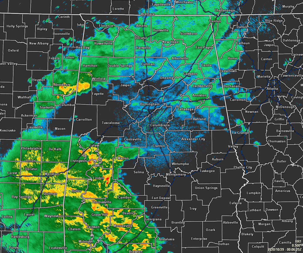
As of 7:06 pm, the outer rainbands of the main core of Hurricane Zeta have moved into the southwestern part of the state and into the southwestern counties of Central Alabama. At this point, the highest wind gust across those counties are less than 20 MPH at the moment, but those will be greatly increasing over the next few hours.
So far in Mobile county, the peak wind gust has been 55 MPH at the Mobile Regional Airport. Lesser peak gusts of 45 and 41 MPH have been recorded in Downtown Mobile and at Sonny Callahan Airport.
As the center of Zeta continues to speed northeastward across southeastern Mississippi and eventually into southwestern Alabama, peak wind gusts most likely will be higher, possibly as high as hurricane strength.
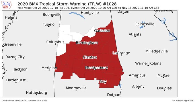
NWS Birmingham continues the Tropical Storm Warning for Etowah, Cherokee, Jefferson, St. Clair, Calhoun, Cleburne, Tuscaloosa, Shelby, Talladega, Clay, Randolph, Bibb, Sumter, Greene, Hale, Perry, Chilton, Coosa, Tallapoosa, Chambers, Marengo, Dallas, Autauga, Elmore, Lee, Lowndes, Montgomery, Macon, Russell, Pike, Bullock, and Barbour counties in Central Alabama until further notice.
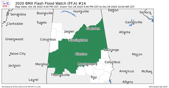
NWS Birmingham continues the Flash Flood Watch for Etowah, Cherokee, Jefferson, St. Clair, Calhoun, Cleburne, Tuscaloosa, Shelby, Talladega, Clay, Randolph, Bibb, Sumter, Greene, Hale, Perry, Chilton, Coosa, Tallapoosa, Marengo, Dallas, Autauga, and Elmore counties in Central Alabama until 10:00 am Thursday.
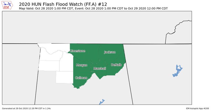
NWS Huntsville continues the Flash Flood Watch for Cullman, DeKalb, Jackson, Limestone, Madison, Marshall, Morgan counties in North Alabama until 12:00 pm Thursday.
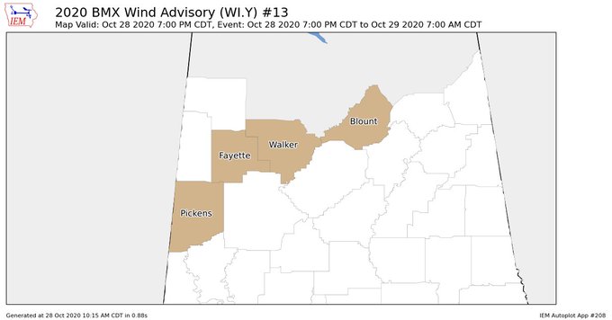
NWS Birmingham continues the Wind Advisory for Blount, Fayette, Pickens, and Walker counties in Central Alabama until 7:00 am Thursday.
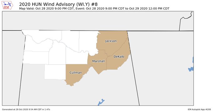
NWS Huntsville continues the Wind Advisory for Cullman, DeKalb, Jackson, and Marshall counties in North Alabama until 12:00 pm Thursday.
Category: Alabama's Weather, ALL POSTS, Severe Weather, Tropical
About the Author (Author Profile)
Scott Martin is an operational meteorologist, professional graphic artist, musician, husband, and father. Not only is Scott a member of the National Weather Association, but he is also the Central Alabama Chapter of the NWA president. Scott is also the co-founder of Racecast Weather, which provides forecasts for many racing series across the USA. He also supplies forecasts for the BassMaster Elite Series events including the BassMaster Classic.Subscribe
If you enjoyed this article, subscribe to receive more just like it.


