Freeze Watches for North and North Central Alabama for Sunday Night
A strong upper-level trough and dry cold front will be pushing into Alabama Sunday morning. It is in southeastern Iowa this evening and will reach I-59 before noon tomorrow.
It will push some low cloudiness that will form overnight away quickly, leaving mostly sunny skies in its wake. The main surge of cooler and drier air will arrive later Sunday afternoon on gusty northwesterly winds that will reach 20 mph at times during the afternoon and overnight hours.
Sunday’s highs will range from near 60F over Northwest Alabama, to the upper 60s in the I-59 Corridor, to the lower and middle 70s south.
The colder air will set the stage for a potential freeze across parts of North and North Central Alabama, with frost possible down into the I-20 Corridor.
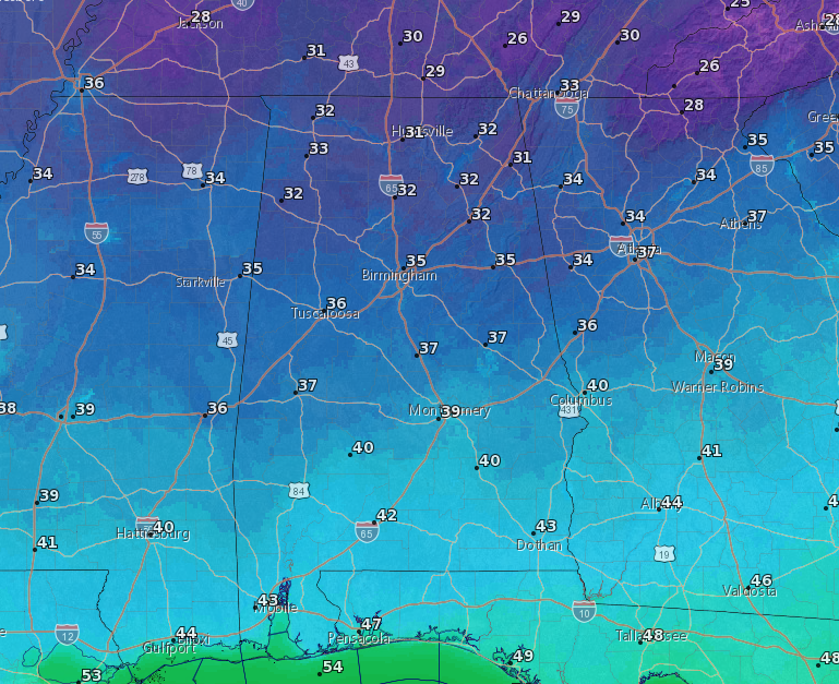
Lows Sunday night will range from 30-32F from parts of Marion, Winston, Cullman, Blount, Etowah, and Cherokee Counties northward. There could even be a few 20s in the normally colder locations of North Alabama.
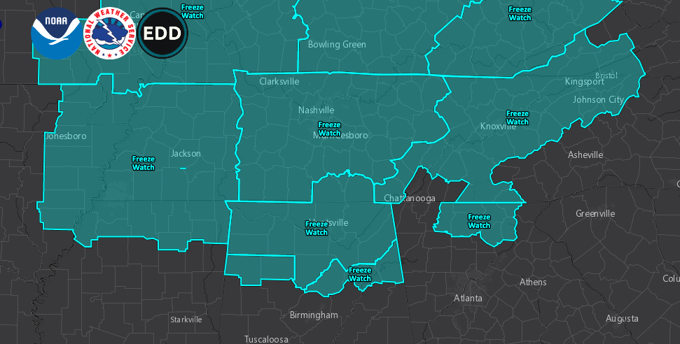
For this reason, NWS Offices in Birmingham and Huntsville have issued freeze watches for Sunday night. Those could be upgraded to freeze warnings in some portions of the watch areas later on Sunday.
Category: Alabama's Weather, ALL POSTS
About the Author (Author Profile)
Bill Murray is the President of The Weather Factory. He is the site's official weather historian and a weekend forecaster. He also anchors the site's severe weather coverage. Bill Murray is the proud holder of National Weather Association Digital Seal #0001 @wxhistorianSubscribe
If you enjoyed this article, subscribe to receive more just like it.


