Tropical Storm Eta Makes Landfall in Lower Matecumbe Key, Florida
Tropical Storm Eta Tropical Cyclone Update
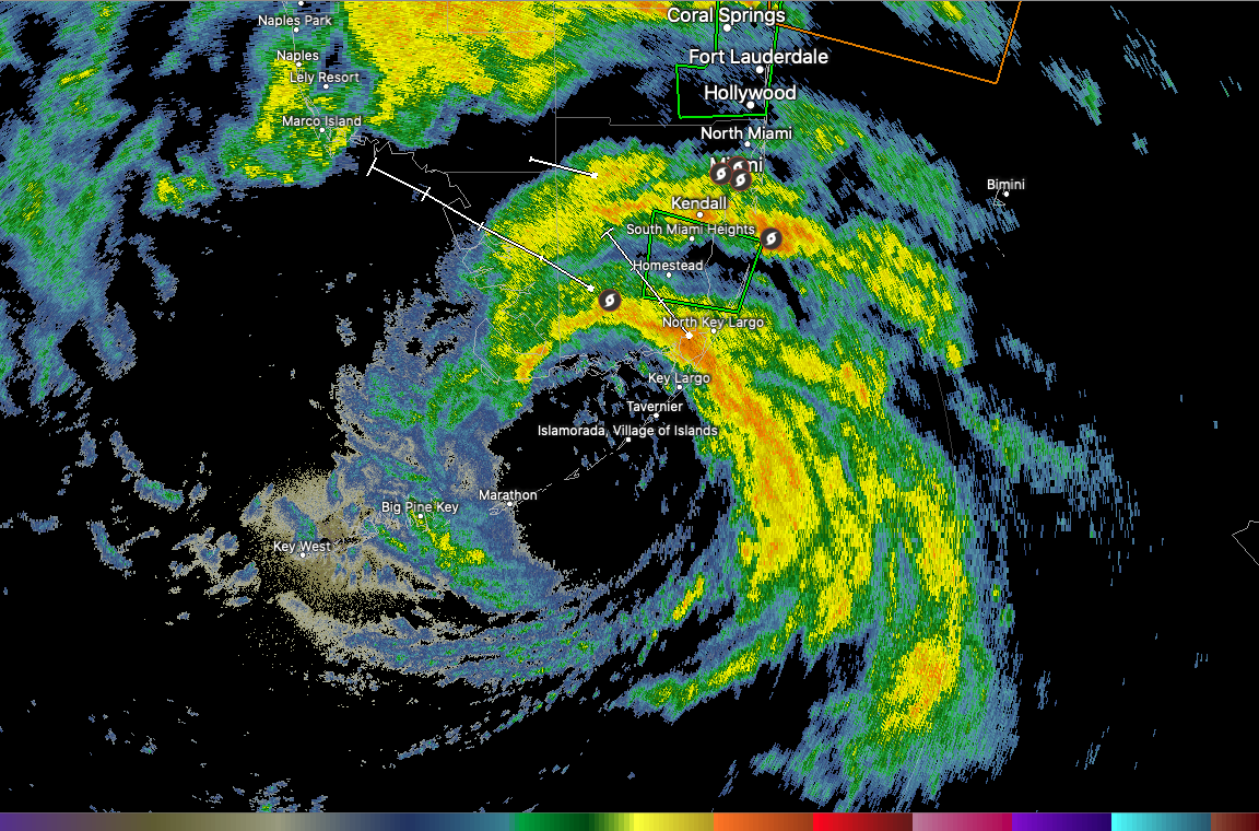
NWS National Hurricane Center Miami FL AL292020
1100 PM EST Sun Nov 08 2020
…ETA MAKES LANDFALL IN LOWER MATECUMBE KEY FLORIDA…
Doppler radar data indicate that Eta has made landfall on Lower
Matecumbe Key in the Florida Keys as a strong tropical storm with
maximum winds estimated to be near 65 mph (100 km/h).
A WeatherFlow station at Carysfort Reef Light in the Florida Keys
recently reported a sustained wind of 52 mph (84 km/h) with a gust
of 63 mph (101 km/h). Another Weatherflow station in Key Largo
recently reported a wind gust of 53 mph (85 km/h). A wind gust
of 47 mph (76 km/h) was measured at Homestead Air Force Base in
Homestead, Florida.
SUMMARY OF 1100 PM EST…0400 UTC…INFORMATION
———————————————-
LOCATION…24.9N 80.7W
ABOUT 30 MI…45 KM ENE OF MARATHON FLORIDA
ABOUT 70 MI…115 KM ENE OF KEY WEST FLORIDA
MAXIMUM SUSTAINED WINDS…65 MPH…100 KM/H
PRESENT MOVEMENT…WNW OR 300 DEGREES AT 14 MPH…22 KM/H
MINIMUM CENTRAL PRESSURE…991 MB…29.26 INCHES
$$
Forecaster Cangialosi/Blake
About the Author (Author Profile)
Bill Murray is the President of The Weather Factory. He is the site's official weather historian and a weekend forecaster. He also anchors the site's severe weather coverage. Bill Murray is the proud holder of National Weather Association Digital Seal #0001 @wxhistorianSubscribe
If you enjoyed this article, subscribe to receive more just like it.


