Tropical Depression 31 Forms Over the Central Caribbean Sea; Updates on Eta & Theta
TROPICAL DEPRESSION 31
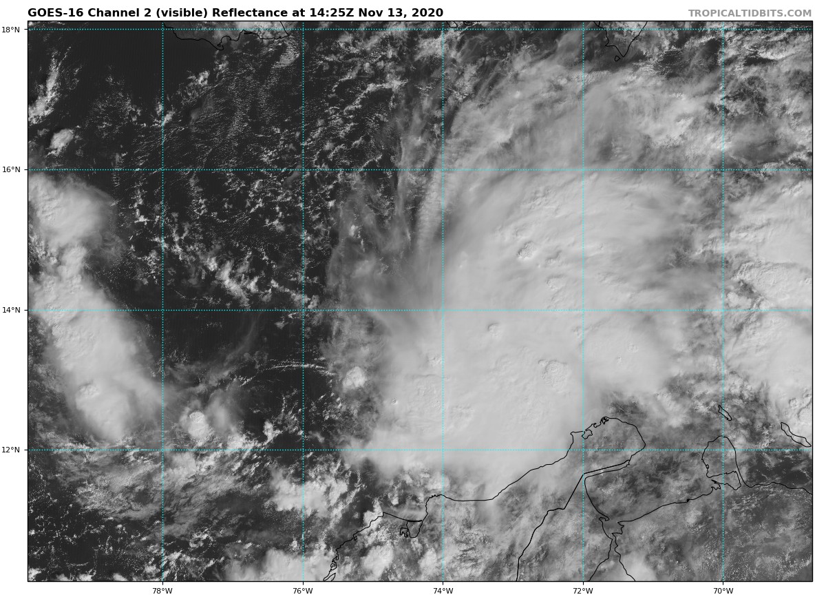
While the first advisory for Tropical Depression 31 will not be released until 9:00 am this morning, the National Hurricane Center has already announced its formation on its webpage. Here is the latest Tropical Weather Outlook on the disturbance:
Showers and thunderstorms associated with a broad area of low pressure over the central Caribbean Sea have increased and become better organized since yesterday. Environmental conditions are conducive for additional development, and a tropical storm is likely to form later today or tonight while the system moves slowly westward. Additional development of the system is likely over the weekend, and interests in Honduras and Nicaragua should closely monitor the progress of the disturbance.
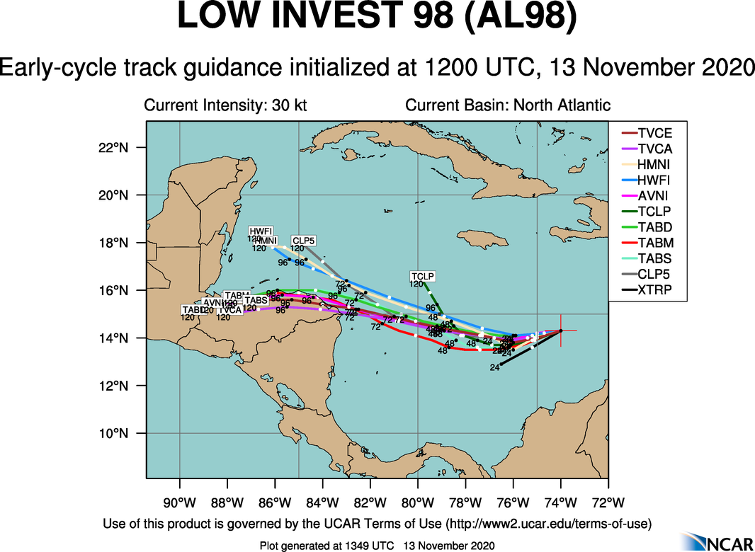
All members of the latest guidance shows that TD-31 will continue to move generally to the west to west-northwest over the next several days and make landfall somewhere from Honduras ad Nicaragua, to the Yucatán Peninsula.
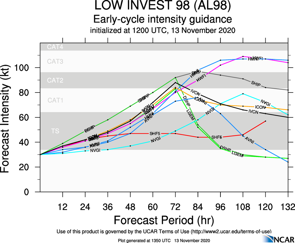
Unfortunately, this one has the look of becoming a hurricane and could potentially affect the same locations that were hit by Eta when it was a strong category 4 hurricane. At this point, guidance shows that TD-31 probably won’t get that strong, but category 3 strength will be possible. When it becomes a tropical storm, it will be called Iota.
ETA
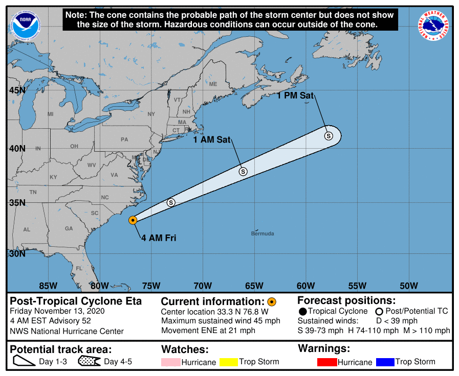
Eta has now transitioned into an extratropical low and is located just over 100 miles southeast of Wilmington Delaware. Winds as of 3:00 am this morning were at 45 miles per hour and movement was to the east-northeast at 21 MPH. This motion is expected to continue with an
increase in forward speed through Saturday. On the forecast track, Eta is expected to gradually pull away from the southeast U.S. coast today. Eta could intensify a little as a non-tropical cyclone during the next day or so before it becomes absorbed by a larger non-tropical cyclone on Saturday or Saturday night.
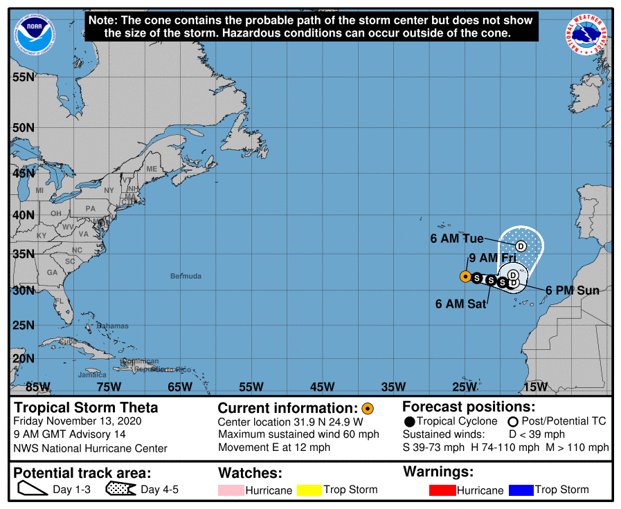
THETA
As of 3:00 am this morning, the center of Tropical Storm Theta was located around 445 miles south-southeast of The Azores. Theta is moving toward the east near 12 MPH. The cyclone should turn toward the east-southeast and slow its forward speed today. A continued slow east-southeastward motion is then expected through the weekend followed a turn sharply toward the north by early next week. Maximum sustained winds are near 60 MPH with higher gusts.
Little change in strength is forecast during the next 12 hours or so. Afterward, weakening is expected through the weekend, and Theta is expected to become a remnant low on Sunday and dissipate in 5 days.
About the Author (Author Profile)
Scott Martin is an operational meteorologist, professional graphic artist, musician, husband, and father. Not only is Scott a member of the National Weather Association, but he is also the Central Alabama Chapter of the NWA president. Scott is also the co-founder of Racecast Weather, which provides forecasts for many racing series across the USA. He also supplies forecasts for the BassMaster Elite Series events including the BassMaster Classic.Subscribe
If you enjoyed this article, subscribe to receive more just like it.


