Still Monitoring the Severe Weather Threat for Alabama
At this hour, our surface low is over northeastern Texas and northwestern Arkansas.
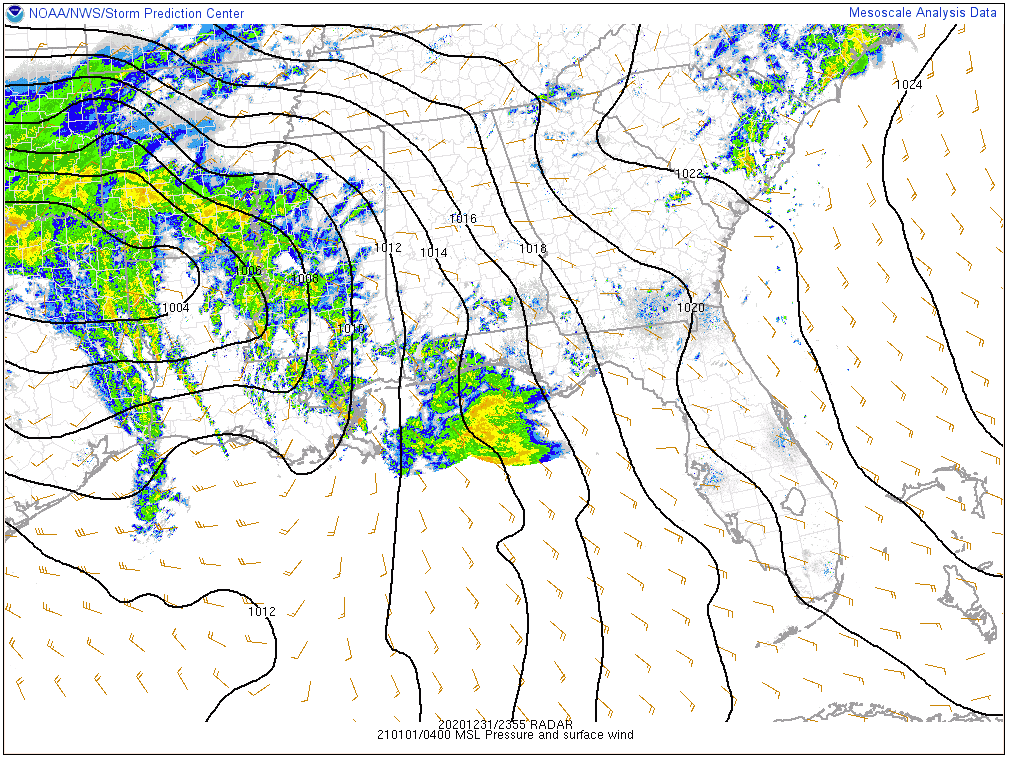
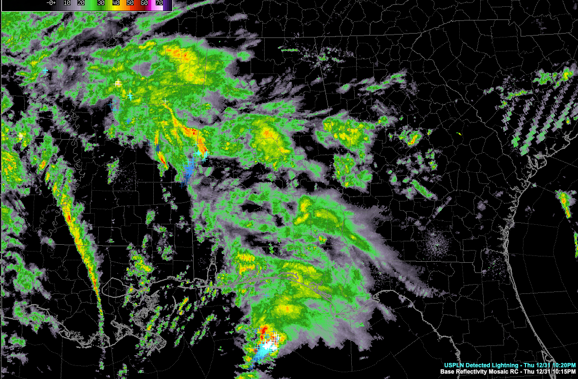
Storms have weakened as they pushed north northeast across Mississippi. Some of them are now into West Alabama’s Sumter and Pickens Counties, but the lightning output is fairly meager and they pose no threat of being severe at this time.
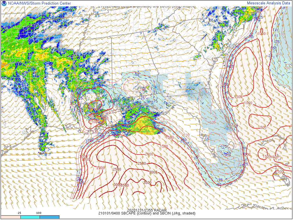
There is decent surface-based CAPE over southern Mississippi and it is expected to lift northeastward overnight.
There is certainly plenty of wind shear over the southern two-thirds of Alabama thanks to an encroaching 850 mb jet.
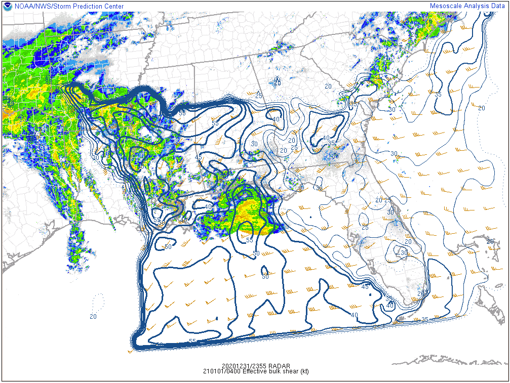
This combination of high shear and some surface-based CAPE will work into West Alabama later tonight. Any stronger updrafts that can maintain themselves later tonight will have the potential to produce tornadoes and damaging winds.
The entire system will continue pushing eastward overnight and early Friday morning. The threat will end from the west start around 6 a.m. and ending in the east around noon.
We will continue to monitor the situation and will keep you posted.
Category: Alabama's Weather, ALL POSTS, Severe Weather
About the Author (Author Profile)
Bill Murray is the President of The Weather Factory. He is the site's official weather historian and a weekend forecaster. He also anchors the site's severe weather coverage. Bill Murray is the proud holder of National Weather Association Digital Seal #0001 @wxhistorianSubscribe
If you enjoyed this article, subscribe to receive more just like it.


