Some Rain & Storms Moving In; Tornado Watch Coming Shortly
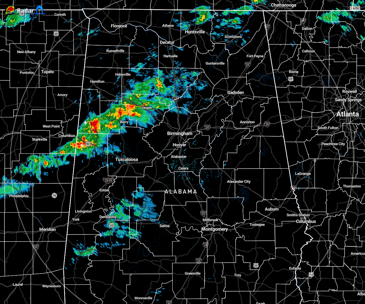
Radar check at 5:35 pm shows a batch of rain with a few claps of thunder embedded moving northeastward across the west-central portions of North/Central Alabama. The good news is that these are well below severe limits, but we’ll have to watch further developing storms later this evening and tonight as conditions become a little more favorable for severe storms.
NWS Birmingham just posted that they are currently working with the SPC on a tornado watch that will be coming out shortly. More than likely, it will be for the northwestern counties of the area.
NWS Huntsville just stated on NWS Chat that the watch would include all of their counties. The expected expiration time would be 1:00 am.
There are no severe weather watches or warnings off to our west at the moment, but this will be where we will have to watch for storm development over the next several hours.
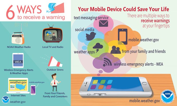
From NWS Birmingham: It’s been a little while since we’ve had some severe weather. With severe weather possible tonight, it’s important that you have multiple ways to receive warnings. Dust off/test your weather radio and weather alert apps before bed tonight & make sure phone alerts aren’t silenced.
Category: Alabama's Weather, ALL POSTS, Severe Weather
About the Author (Author Profile)
Scott Martin is an operational meteorologist, professional graphic artist, musician, husband, and father. Not only is Scott a member of the National Weather Association, but he is also the Central Alabama Chapter of the NWA president. Scott is also the co-founder of Racecast Weather, which provides forecasts for many racing series across the USA. He also supplies forecasts for the BassMaster Elite Series events including the BassMaster Classic.Subscribe
If you enjoyed this article, subscribe to receive more just like it.


