A Quick Check on Our Weather at 1:40 am
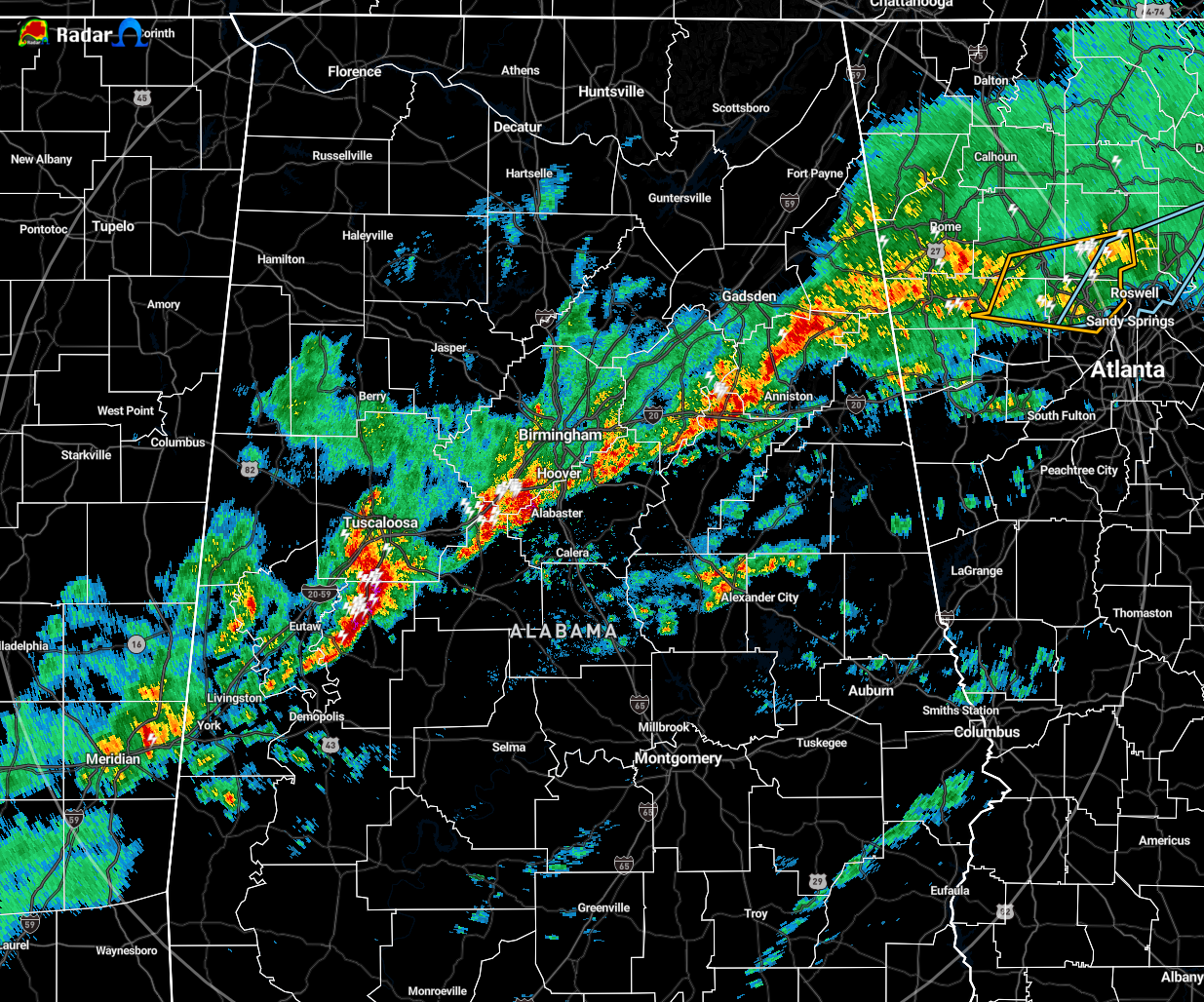
A line of rain and storms continues to slowly move eastward through Central Alabama while the individual cells within the line rapidly move northeast. That line roughly stretches down the I-20/59 corridor southwest of Birmingham and just south of the I-59 corridor east and northeast of the Magic City.
No severe storm warnings are in effect at this time in Central Alabama.
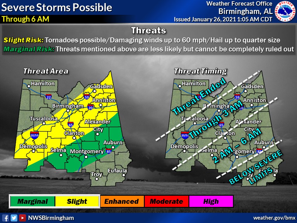
The latest update from NWS Birmingham shows a Slight Risk for severe storms continues for locations south of a line from Geiger to Gardendale to Sardis City down to a line from Sweet Water to Clanton to Wedowee. South of that, a Marginal Risk continues down to the I-85 corridor.
The threat window continues until roughly 6:00 am this morning.
Tornadoes, damaging winds up to 60 MPH, and quarter-size hail will remain possible over the slight risk locations. Those threats will be possible but less likely for the marginal risk locations.
For those in the North Alabama counties, the severe weather threat is over, that is why there is no graphic shown for those counties.
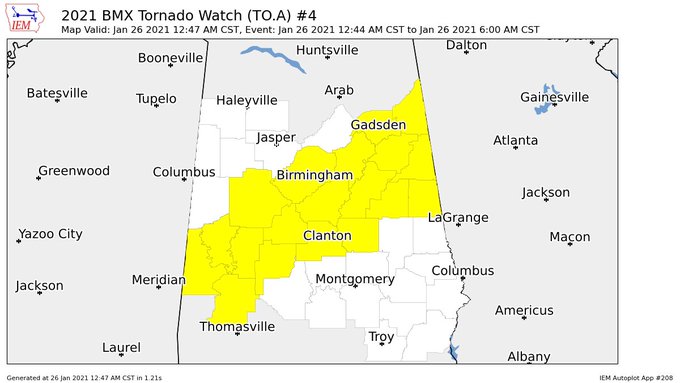
A Tornado Watch continues for portions of Central Alabama until 6:00 am. Those counties include: Cherokee, Etowah, Cleburne, Calhoun, St. Clair, Jefferson, Randolph, Clay, Talladega, Shelby, Tuscaloosa, Coosa, Chilton, Bibb, Greene, Hale, Perry, Sumter, and Marengo.
Category: Alabama's Weather, ALL POSTS, Severe Weather
About the Author (Author Profile)
Scott Martin is an operational meteorologist, professional graphic artist, musician, husband, and father. Not only is Scott a member of the National Weather Association, but he is also the Central Alabama Chapter of the NWA president. Scott is also the co-founder of Racecast Weather, which provides forecasts for many racing series across the USA. He also supplies forecasts for the BassMaster Elite Series events including the BassMaster Classic.Subscribe
If you enjoyed this article, subscribe to receive more just like it.


