A Late Morning Look at the Winter Storm Situation for Alabama
A Winter Weather Advisory has been issued for Lauderdale, Colbert, Franklin, Lawrence, Limestone, Madison, Morgan, and Cullman counties in North Alabama until 6 p.m. for any light freezing rain or sleet that moves across the area this afternoon. Light sleet could reach Northwest Alabama by 2-3 p.m. this afternoon.
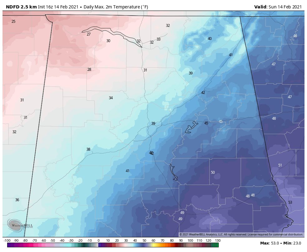
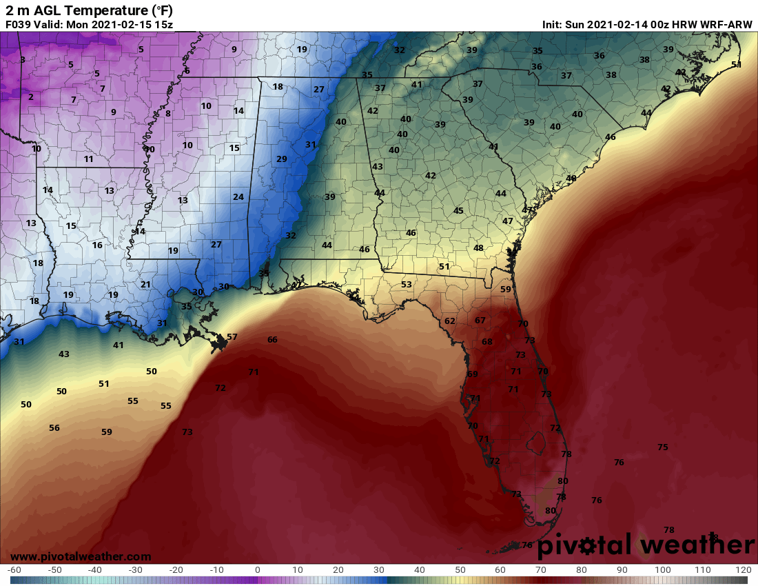
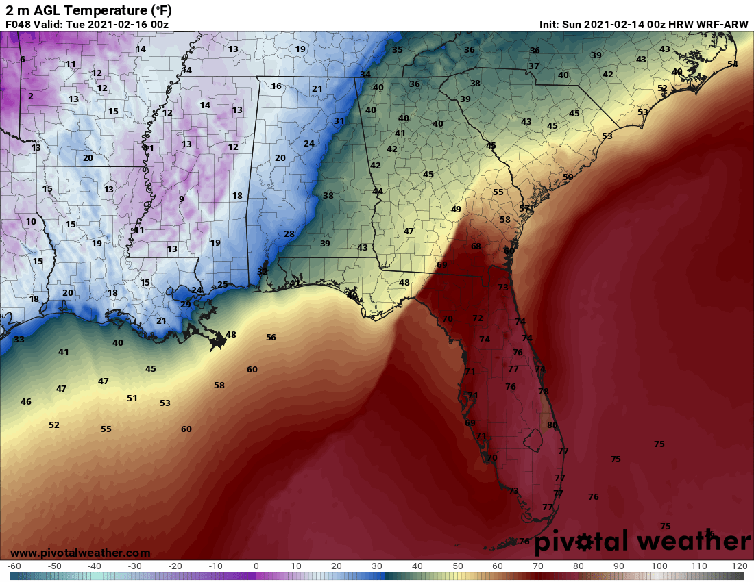
Temperatures across Northwest and North Alabama are below freezing and aren’t expected to go much above freezing if at all today.
Here is a projection of what precipitation might look like at 3pm:
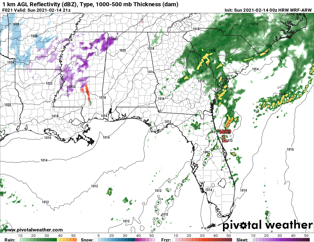
The red is freezing rain, the purple sleet, blue snow, and green/yellow liquid rain.
Here are expected highs this afternoon:
WINTER WEATHER ADVISORY FOR NORTH ALABAMA THIS AFTERNOON
A Winter Weather Advisory has been issued for Lauderdale, Colbert, Franklin, Lawrence, Limestone, Madison, Morgan, and Cullman counties in North Alabama until 6 p.m. for any light freezing rain or sleet that moves across the area this afternoon.
WINTER STORM WARNINGS FOR NORTH AND WEST ALABAMA
Winter storm warnings go into effect at…
…6 p.m. tonight for Lauderdale, Colbert, Franklin, Lawrence, Limestone, Madison, Morgan, Colbert, Marshall, Jackson, DeKalb
…6 a.m. Monday for Hale and Marengo Counties
…9 a.m. Monday for Fayette, Walker, Pickens, Tuscaloosa, Sumter, and Greene Counties
WINTER STORM WATCH FOR CENTRAL ALABAMA
…Blount, Jefferson, Shelby, Perry, and Bibb counties starting 9 a.m. Monday through Midnight Monday night.
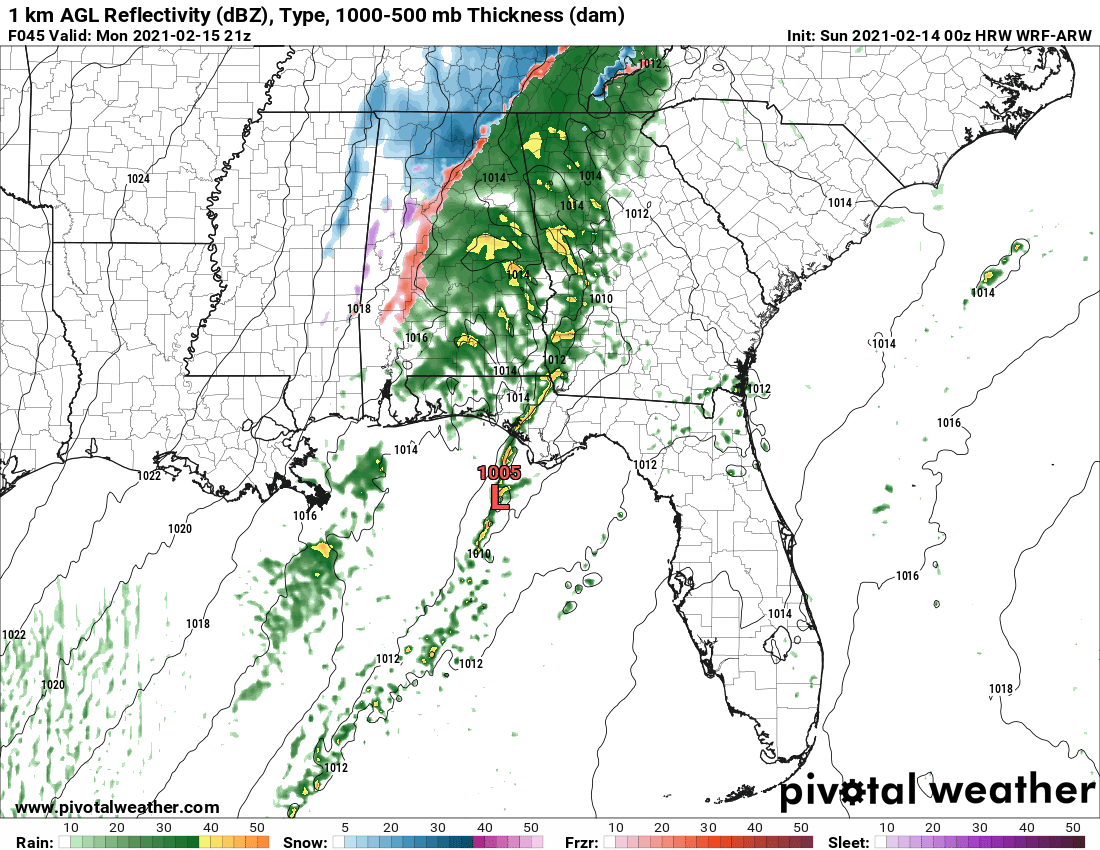
Here is a projection for 7 pm:

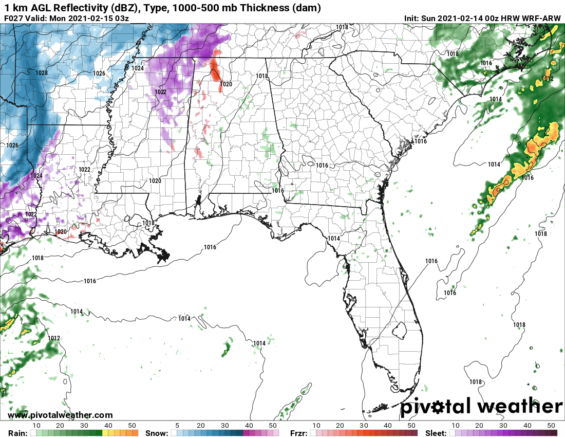
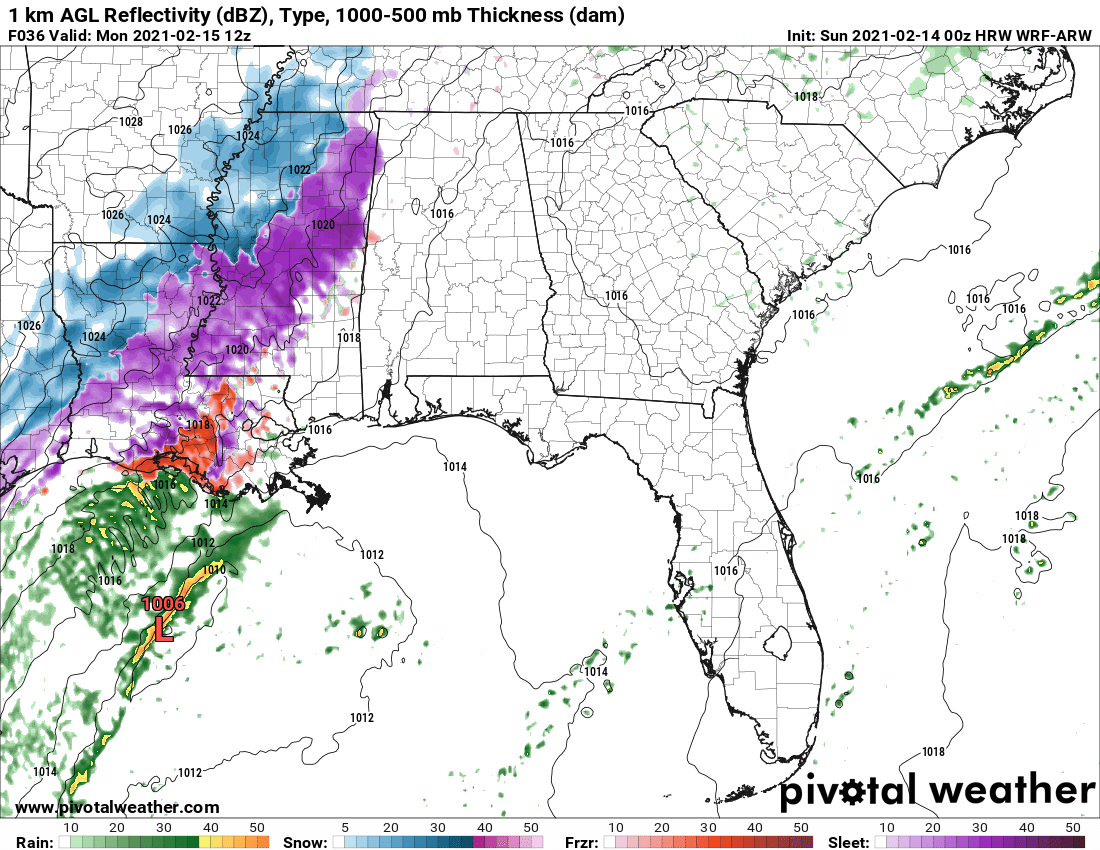
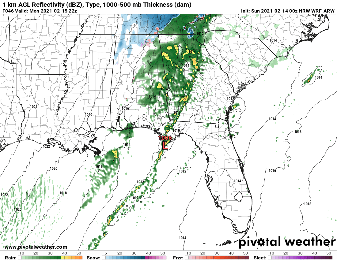
By 9 p.m., the precipitation should be at its maximum for tonight:
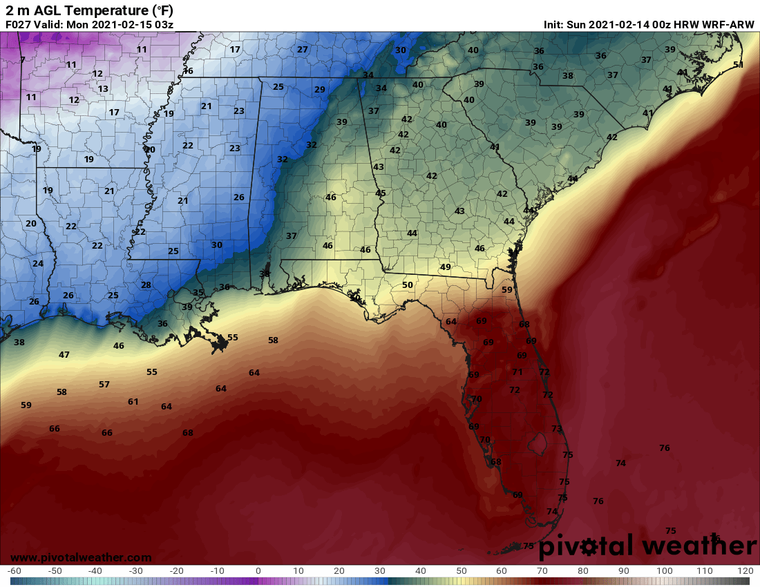
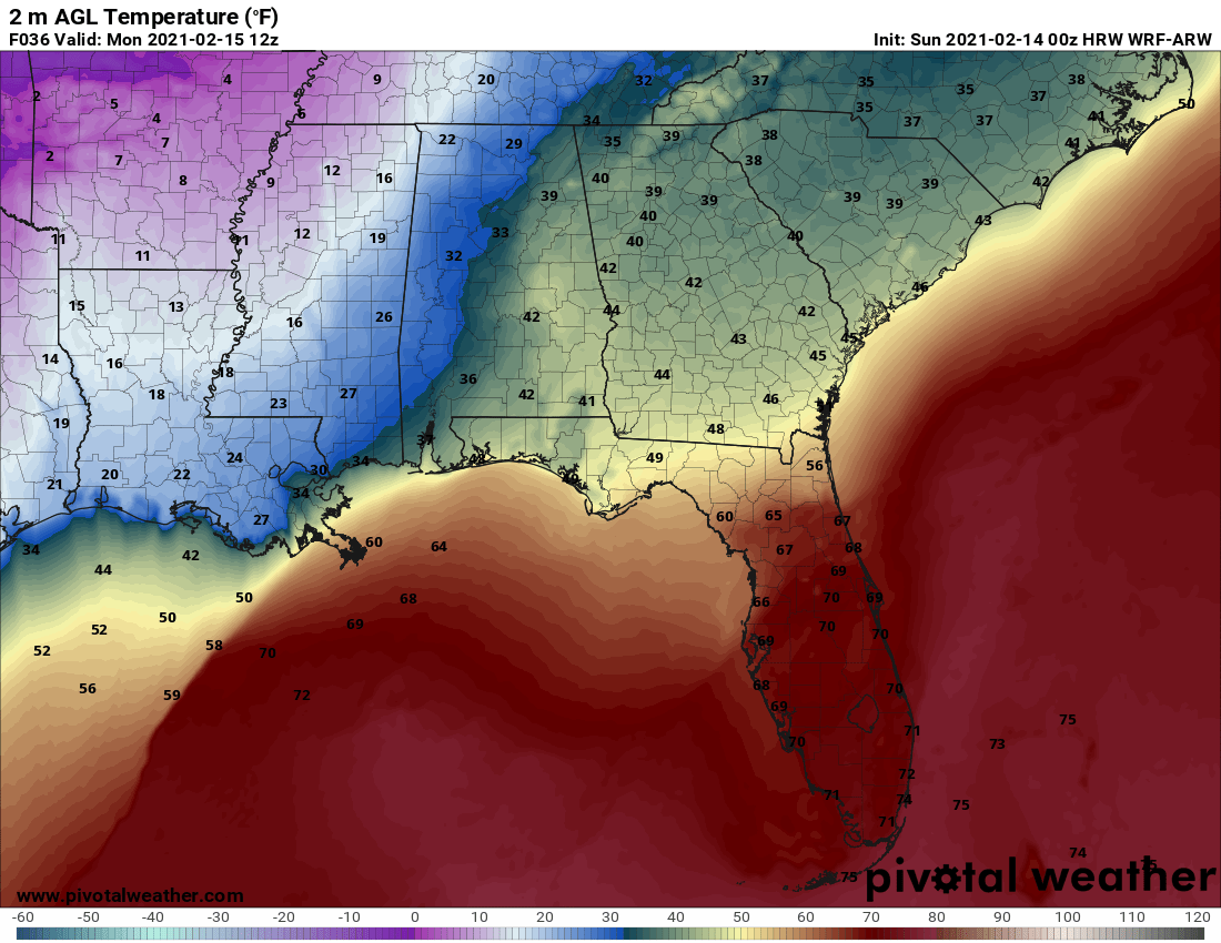
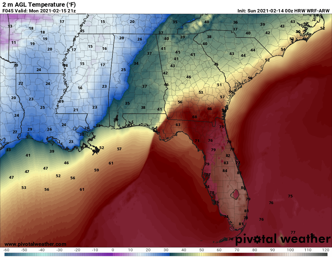
Temperatures should look like this at that point:
Areas that are at or below freezing will be our concern of course. Light freezing rain and sleet should continue through the evening, with most of the precipitation exiting into Tennessee by just after midnight, although there could be light freezing rain through the rest of the night over Northwest Alabama. Some light accumulations will occur causing problems on roads, especially bridges and overpasses. By 6 a.m., accumulations of freezing rain could look like this:
By then, more precipitation will be building to the west. By 6 a.m., this larger area of snow, sleet, and some freezing rain will be reaching West Alabama:
Temperatures should look like this:
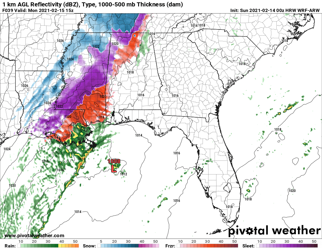
By 9 a.m. sleet, freezing rain, and rain will be falling across WEst, North, and North Central Alabama:
With temperatures like this:
Temperatures should warm just above freezing in the Birmingham area by mid-afternoon, but if they don’t, bigger problems could ensue, hence the winter storm watch.
The precipitation should begin moving out by late afternoon to early evening.
Temperatures will plunge behind the precip:
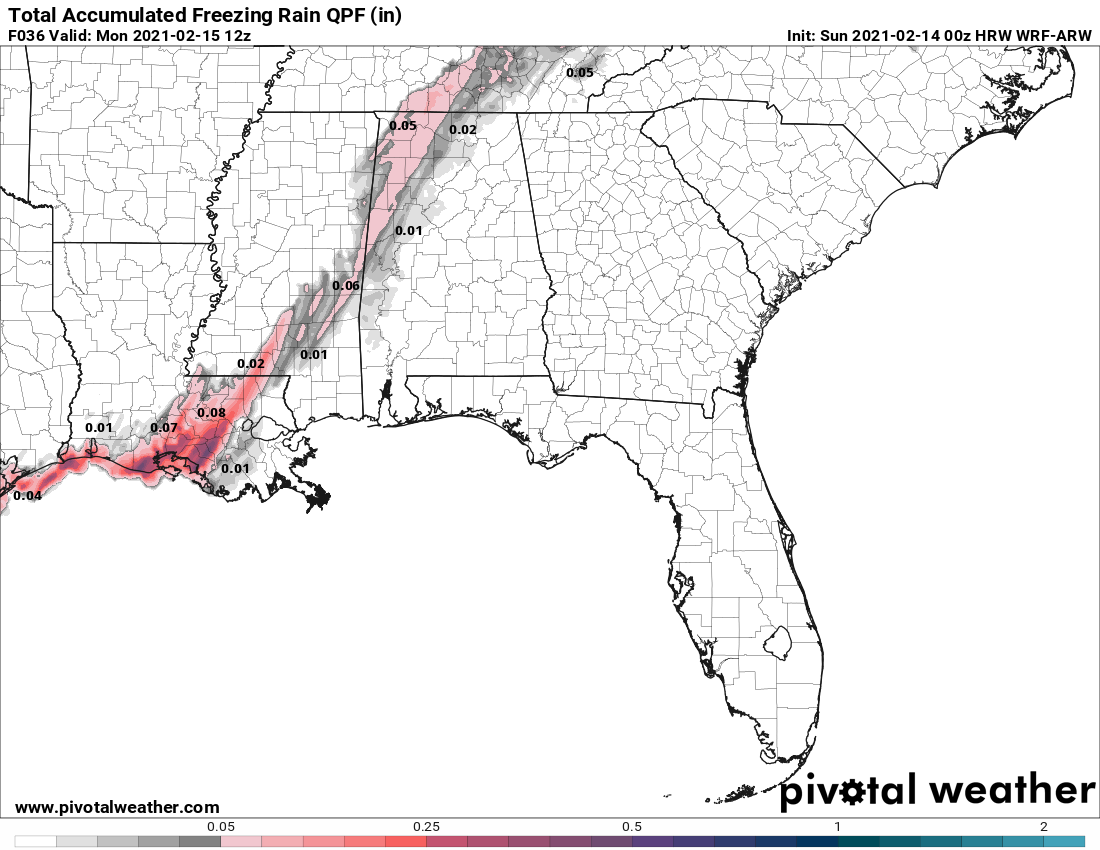
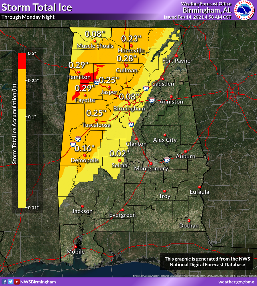
Here are expected ice accumulations for Alabama:
All of this is nice, deterministic model data, but we know it won’t look just like this. So if you are in a watch, warning, or advisory county, be prepared. And if you aren’t continue to monitor the latest weather information in case things change.
Category: Alabama's Weather, ALL POSTS, Winter Weather
About the Author (Author Profile)
Bill Murray is the President of The Weather Factory. He is the site's official weather historian and a weekend forecaster. He also anchors the site's severe weather coverage. Bill Murray is the proud holder of National Weather Association Digital Seal #0001 @wxhistorianSubscribe
If you enjoyed this article, subscribe to receive more just like it.


