Flood Watches Posted for North and West-Central Alabama
It has been wet across parts of Central and West Alabama over the past seven days.
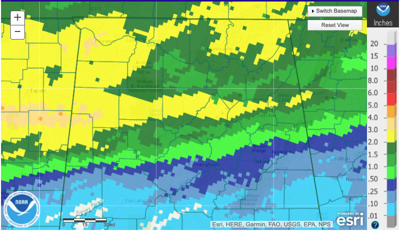
Widespread 1-3 inch amounts have fallen across the northern third of the state with some amounts in excess of 3 inches across parts of Marion, Lamar, Colbert, and Lauderdale Counties.
Our next weather system will bring another 1-2 inches of rain through tomorrow evening northwest of a line from Sulligent in Lamar County to Jasper to Cullman to Fort Payne. There could be isolated amounts to 3 inches.
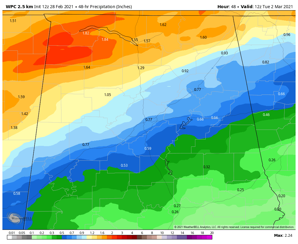
This rainfall could cause flooding of low-lying areas with some flash flooding in areas that see heavier rainfall. Rises will be observed on areas creeks and rivers as well.
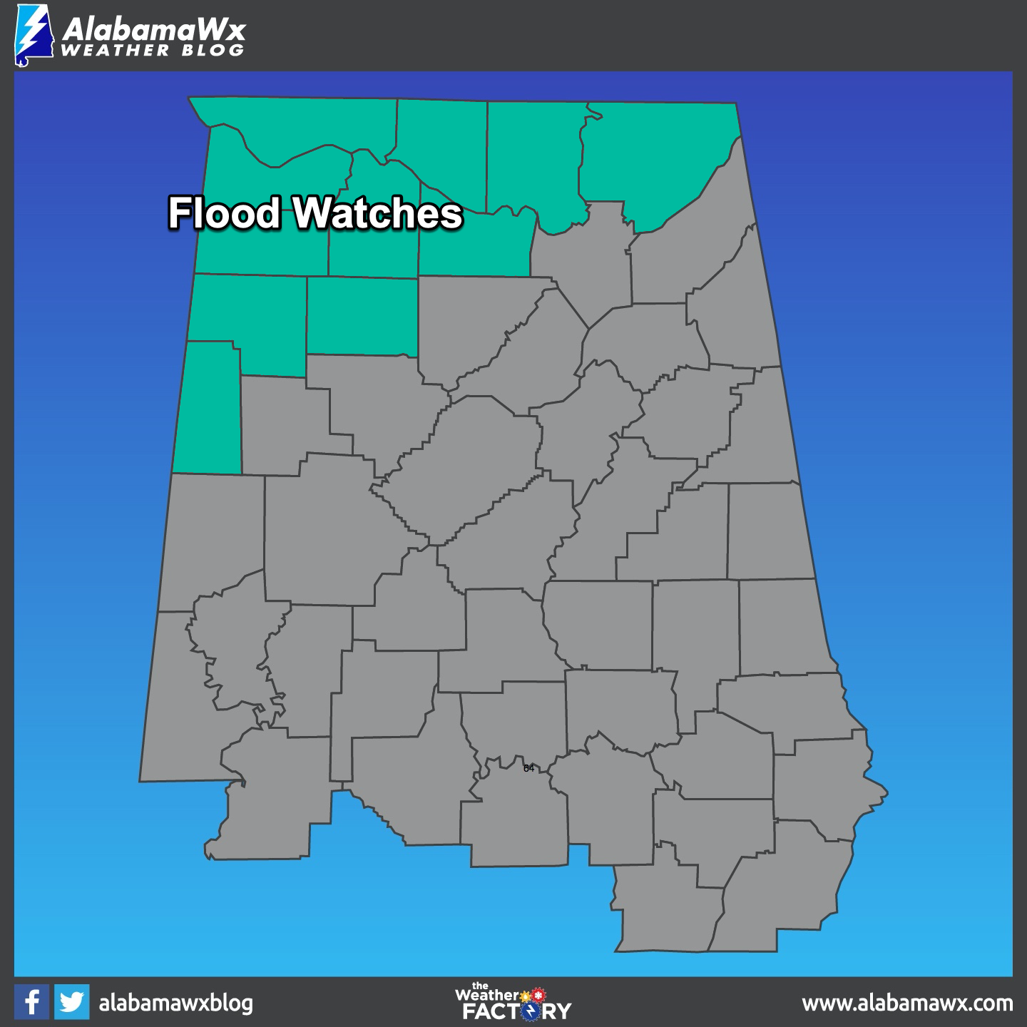
The NWS in Birmingham has issued a Flood Watch that goes into effect at 6 p.m. tonight and lasts until 6 a.m.m tomorrow morning for Lamar, Marion, and Winston Counties. The NWS in Huntsville has issued a Flash Flood Watch that starts at 9 p.m. tonight and goes until noon on Monday for Colbert, Franklin, Jackson, Lauderdale, Lawrence, Limestone, Madison, and Morgan Counties.
Be alert to heavy rainfall that occurs in your areas and be extra cautious driving if flooding begins. Remember our mantra: Turn Around, Don’t Drown!
Category: Alabama's Weather, ALL POSTS, Severe Weather
About the Author (Author Profile)
Bill Murray is the President of The Weather Factory. He is the site's official weather historian and a weekend forecaster. He also anchors the site's severe weather coverage. Bill Murray is the proud holder of National Weather Association Digital Seal #0001 @wxhistorianSubscribe
If you enjoyed this article, subscribe to receive more just like it.


