A Brief Early Afternoon Check on Our Weather
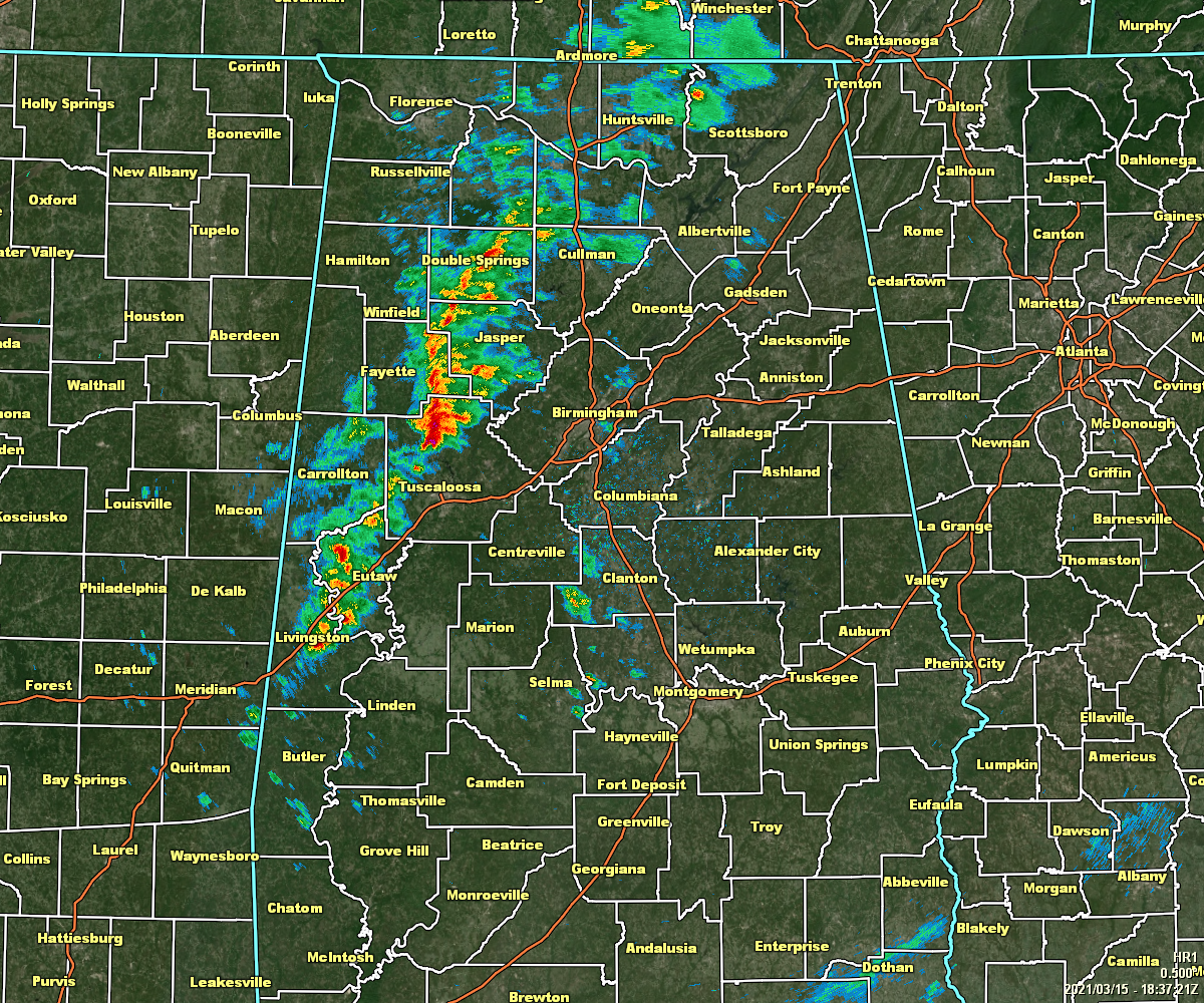
As of 1:37 pm, we have a ragged line of showers and thunderstorms moving slowly across the western parts of North/Central Alabama, mainly stretching from Huntsville to Carbon Hill to Livingston. None of the embedded cells are particularly strong at the moment, and none look concerning on radar at the moment. The heaviest rainfall is occurring from Carbon Hill southward through Berry and into northern parts of Tuscaloosa County.
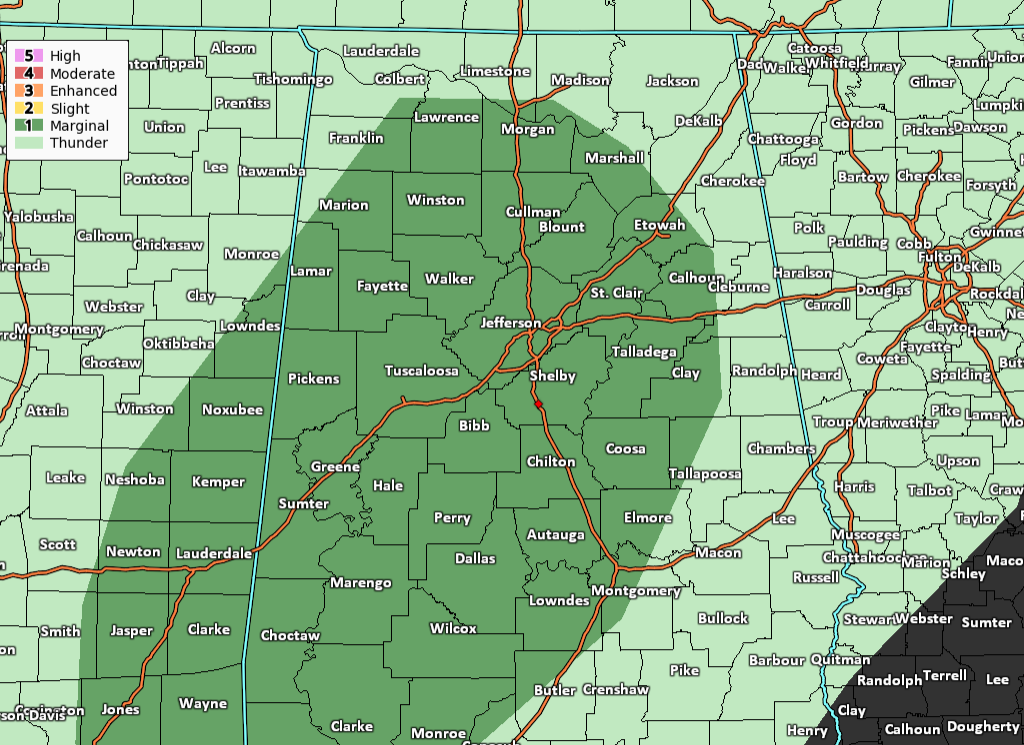
The Storm Prediction Center continues a Level 1 Marginal Risk for much of Central Alabama and the extreme south-central parts of North Alabama through the remainder of your Monday and into the pre-dawn hours of Tuesday. The main threats will be for the potential of isolated damaging wind gusts up to 60 MPH and hail up to quarter size (1-inch) in diameter. There is a non-zero threat of a brief spin-up tornado or two, but the odds are really low at this juncture.
I still see no reason to change the forecast from my previous update this morning. We do have just enough ingredients in place for a storm or two to potentially become strong to severe for a short period of time. The main window for the potential of any strong to severe storms across the risk area will be from now through 10 pm, mainly locations north of a line from Demopolis to Clanton to Roanoke.
Category: Alabama's Weather, ALL POSTS, Severe Weather
About the Author (Author Profile)
Scott Martin is an operational meteorologist, professional graphic artist, musician, husband, and father. Not only is Scott a member of the National Weather Association, but he is also the Central Alabama Chapter of the NWA president. Scott is also the co-founder of Racecast Weather, which provides forecasts for many racing series across the USA. He also supplies forecasts for the BassMaster Elite Series events including the BassMaster Classic.Subscribe
If you enjoyed this article, subscribe to receive more just like it.


