

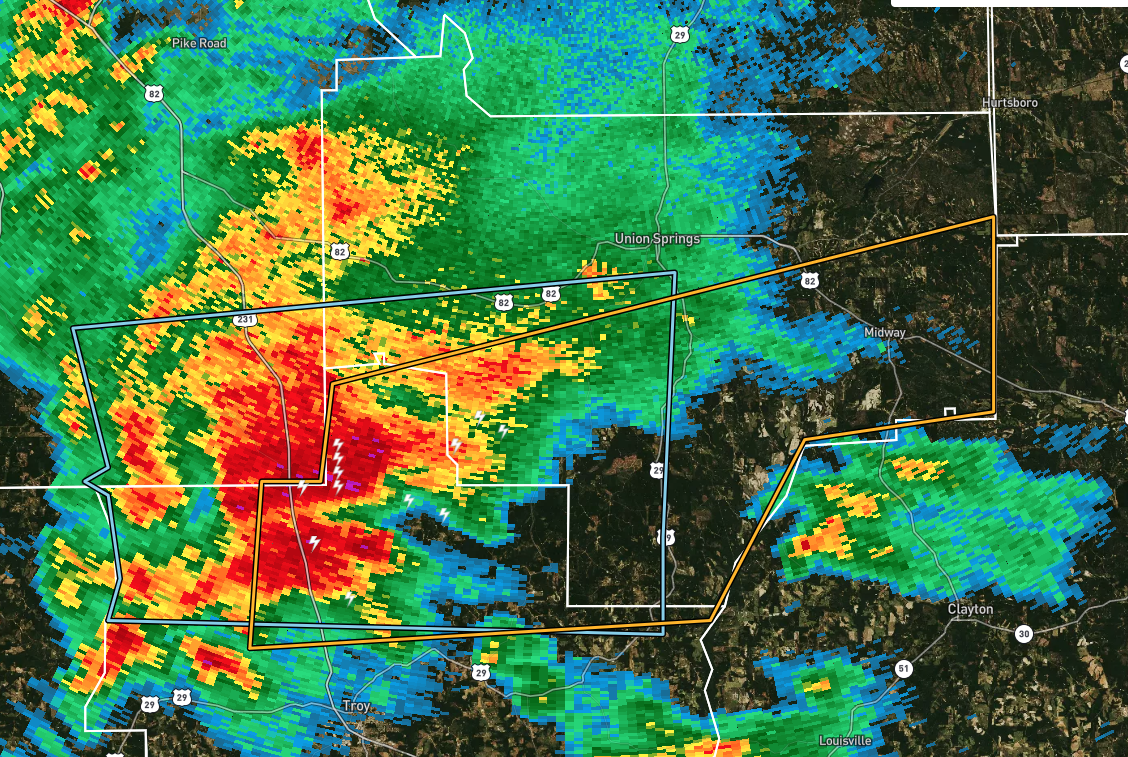
EXPIRED Severe Thunderstorm Warning for Pike & Bullock Co. Until 3:00 pm
The National Weather Service in Birmingham has issued a
* Severe Thunderstorm Warning for…
Northeastern Pike County in southeastern Alabama…
Southern Bullock County in southeastern Alabama…
* Until 300 PM CDT.
* At 224 PM CDT, a severe thunderstorm was located near Troy
Municipal Airport, or 8 miles north of Troy, moving east at 55 mph.
HAZARD…60 mph wind gusts and penny size hail.
SOURCE…Radar indicated.
IMPACT…Expect damage to roofs, siding, and trees.
* Locations impacted include…
Troy, Midway, Pickett, Aberfoil, Beans Crossroads, Linwood, Troy
Municipal Airport, Tanyard, Orion, Perote, Josie, China Grove,
Sandfield and Three Notch.
PRECAUTIONARY/PREPAREDNESS ACTIONS…
For your protection move to an interior room on the lowest floor of a
building.
Category: Alabama's Weather, ALL POSTS, Severe Weather
About the Author (Author Profile)
Scott Martin is an operational meteorologist, professional graphic artist, musician, husband, and father. Not only is Scott a member of the National Weather Association, but he is also the Central Alabama Chapter of the NWA president. Scott is also the co-founder of Racecast Weather, which provides forecasts for many racing series across the USA. He also supplies forecasts for the BassMaster Elite Series events including the BassMaster Classic.Subscribe
If you enjoyed this article, subscribe to receive more just like it.


