

Tornado Warning for Autauga, Chilton, & Elmore Co. Until 2:15 pm
The National Weather Service in Birmingham has issued a
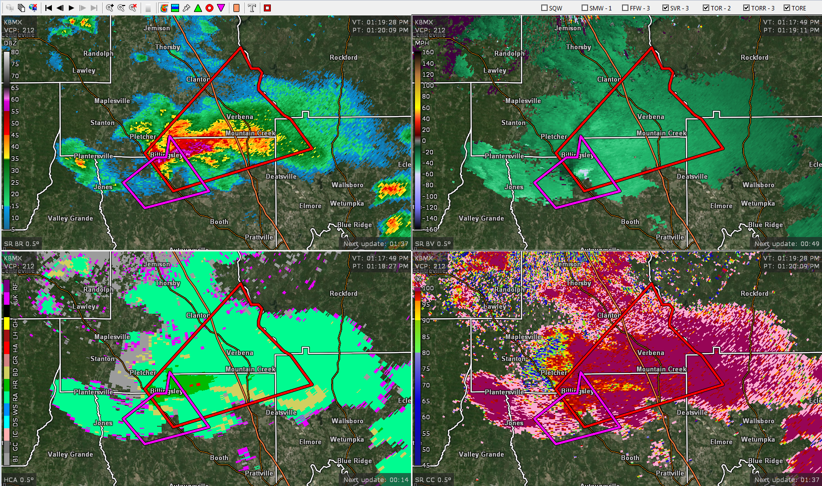
* Tornado Warning for…
Northeastern Autauga County in central Alabama…
Northwestern Elmore County in east central Alabama…
Southeastern Chilton County in central Alabama…
* Until 215 PM CDT.
* At 118 PM CDT, a severe thunderstorm capable of producing a tornado
was located over Billingsley, or 14 miles south of Clanton, moving
northeast at 30 mph.
HAZARD…Tornado and quarter size hail.
SOURCE…Radar indicated rotation.
IMPACT…Flying debris will be dangerous to those caught without
shelter. Mobile homes will be damaged or destroyed.
Damage to roofs, windows, and vehicles will occur. Tree
damage is likely.
* Locations impacted include…
Clanton, Billingsley, Marbury, Higgins Ferry Park, Verbena,
Mitchell Lake, Jordan Lake, Mitchell Dam, Cooper and New Prospect.
PRECAUTIONARY/PREPAREDNESS ACTIONS…
TAKE COVER NOW! Move to a basement or an interior room on the lowest
floor of a sturdy building. Avoid windows. If you are outdoors, in a
mobile home, or in a vehicle, move to the closest substantial shelter
and protect yourself from flying debris.
Category: Alabama's Weather, ALL POSTS, Severe Weather
About the Author (Author Profile)
Scott Martin is an operational meteorologist, professional graphic artist, musician, husband, and father. Not only is Scott a member of the National Weather Association, but he is also the Central Alabama Chapter of the NWA president. Scott is also the co-founder of Racecast Weather, which provides forecasts for many racing series across the USA. He also supplies forecasts for the BassMaster Elite Series events including the BassMaster Classic.Subscribe
If you enjoyed this article, subscribe to receive more just like it.


