New Tornado Warning for Autauga County; Another Continues for Dallas County
This potential tornado is passing just north of Burnsville. It will pass near James, and eventually near Billingsley, and eventually into extreme southern Chilton County near Verbena.
Another tornadic cell is passing over US-80 west of Selma. There is a new warning for Dallas and Perry for that storm.
Clanton could be affected by either storm.
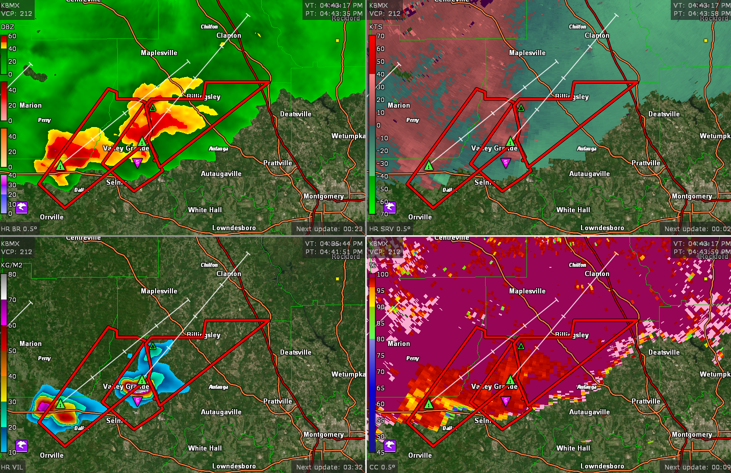
The second storm produced a tornado earlier near Safford.
THE NATIONAL WEATHER SERVICE IN BIRMINGHAM HAS ISSUED A
* TORNADO WARNING FOR…
NORTHWESTERN AUTAUGA COUNTY IN CENTRAL ALABAMA…
* UNTIL 530 PM CDT.
* AT 440 PM CDT, A SEVERE THUNDERSTORM CAPABLE OF PRODUCING A TORNADO
WAS LOCATED OVER BURNSVILLE, OR NEAR VALLEY GRANDE, MOVING
NORTHEAST AT 40 MPH.
HAZARD…TORNADO.
SOURCE…RADAR INDICATED ROTATION.
IMPACT…FLYING DEBRIS WILL BE DANGEROUS TO THOSE CAUGHT WITHOUT
SHELTER. MOBILE HOMES WILL BE DAMAGED OR DESTROYED.
DAMAGE TO ROOFS, WINDOWS, AND VEHICLES WILL OCCUR. TREE
DAMAGE IS LIKELY.
* LOCATIONS IMPACTED INCLUDE…
BILLINGSLEY AND DAWSON MILL.
Category: Alabama's Weather, ALL POSTS, Severe Weather
About the Author (Author Profile)
Bill Murray is the President of The Weather Factory. He is the site's official weather historian and a weekend forecaster. He also anchors the site's severe weather coverage. Bill Murray is the proud holder of National Weather Association Digital Seal #0001 @wxhistorianSubscribe
If you enjoyed this article, subscribe to receive more just like it.


