CANCELED Tornado Warning for Parts of Autauga, Chilton, and Elmore Counties until 915 pm
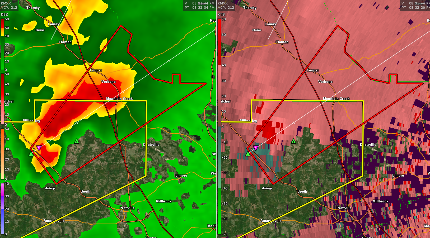
This tornado will pass near Verbena and Mountain Creek. It will eventually move into Coosa County passing near Rockford.
This storm is still able to tap the better instability to the south. It continues to move into better low level wind shear.
The National Weather Service in Birmingham has issued a
* Tornado Warning for…
Northeastern Autauga County in central Alabama…
Northwestern Elmore County in east central Alabama…
Southeastern Chilton County in central Alabama…
* Until 915 PM CDT.
* At 832 PM CDT, a severe thunderstorm capable of producing a tornado
was located over Vida Junction, or 15 miles northwest of
Prattville, moving northeast at 30 mph.
HAZARD…Tornado and half dollar size hail.
SOURCE…Radar indicated rotation.
IMPACT…Flying debris will be dangerous to those caught without
shelter. Mobile homes will be damaged or destroyed.
Damage to roofs, windows, and vehicles will occur. Tree
damage is likely.
* Locations impacted include…
Marbury, Vida Junction, Welona, Higgins Ferry Park, Verbena, Titus,
Mitchell Lake, Mitchell Dam, Cooper and New Prospect.
Category: Alabama's Weather, ALL POSTS, Severe Weather
About the Author (Author Profile)
Bill Murray is the President of The Weather Factory. He is the site's official weather historian and a weekend forecaster. He also anchors the site's severe weather coverage. Bill Murray is the proud holder of National Weather Association Digital Seal #0001 @wxhistorianSubscribe
If you enjoyed this article, subscribe to receive more just like it.


