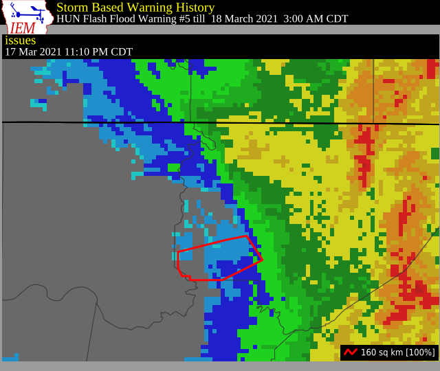
Flash Flood Warning for Jackson & Marshall Co. Until 3:00 am
The National Weather Service in Huntsville has issued a
* Flash Flood Warning for…
West Central Jackson County in northeastern Alabama…
Northern Marshall County in northeastern Alabama…
* Until 300 AM CDT.
* At 1110 PM CDT, Doppler radar indicated thunderstorms producing
heavy rain across the warned area. Between 3 and 6 inches of rain
have fallen. Flash flooding is ongoing or expected to begin
shortly.
HAZARD…Life threatening flash flooding. Thunderstorms
producing flash flooding.
SOURCE…Doppler radar.
IMPACT…Life threatening flash flooding of creeks and streams,
urban areas, highways, streets and underpasses.
* Some locations that will experience flash flooding include…
Woodville, Paint Rock and Lim Rock.
Runoff from previous rainfall has produced flash flooding in and
north of the Woodville area, particularly near the intersection of
CR and CR 30. In this location water almost up to the top of
mailboxes was reported by emergency management.
PRECAUTIONARY/PREPAREDNESS ACTIONS…
Turn around, don’t drown when encountering flooded roads. Most flood
deaths occur in vehicles.
Category: Alabama's Weather, ALL POSTS, Severe Weather
About the Author (Author Profile)
Scott Martin is an operational meteorologist, professional graphic artist, musician, husband, and father. Not only is Scott a member of the National Weather Association, but he is also the Central Alabama Chapter of the NWA president. Scott is also the co-founder of Racecast Weather, which provides forecasts for many racing series across the USA. He also supplies forecasts for the BassMaster Elite Series events including the BassMaster Classic.Subscribe
If you enjoyed this article, subscribe to receive more just like it.


