

The Tornado Watch for the Remaining Two Counties in Central Alabama Has Expired
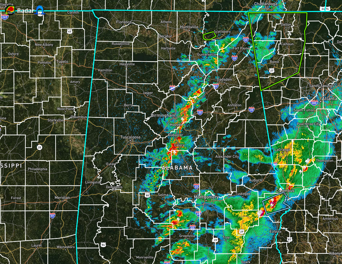
We have reached 3:00 am in Central Alabama, and we still have a few storms associated with the main line moving across the extreme southeastern portions of the area. The strongest cell was located over portions of Russell County, but it is staying below severe limits.
A second line of showers and storms continue to move eastward behind that first line, and is currently stretching from Henager to Springville to Montevallo to Orville. While some parts of this line may be noisy, there is no threat of severe weather associated with it.
NWS Birmingham is allowing the Tornado Watch to expire for Pike and Barbour counties as the threat of severe weather has passed those locations. No county in North/Central Alabama remains in a Tornado Watch.
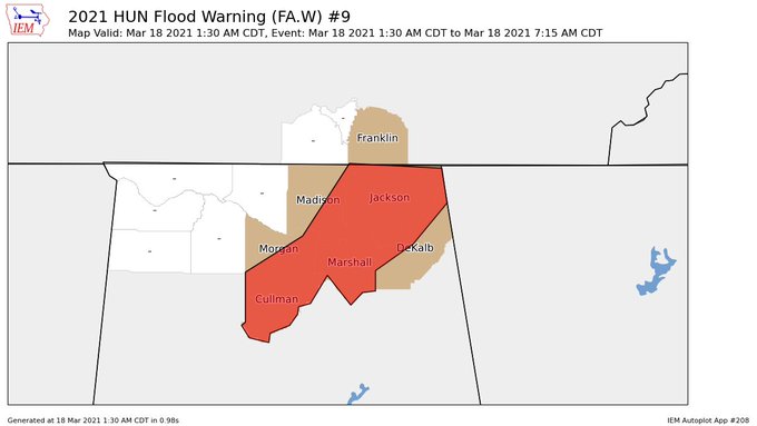
A Flood Warning continues in effect until 7:15 am for Cullman, DeKalb, Jackson, Madison, Marshall, and Morgan counties in North Alabama as runoff from the previous rainfall is producing significant and widespread flooding
issues. Particularly hard hit were locations near and north of highway 278 in Cullman County, Hampton Cove, Gurley, Woodville, and the Eva areas.
I am signing off for the night… um, well… morning. I wish for you a good sleep for the remainder of the dark hours before sunrise.
Category: Alabama's Weather, ALL POSTS, Severe Weather
About the Author (Author Profile)
Scott Martin is an operational meteorologist, professional graphic artist, musician, husband, and father. Not only is Scott a member of the National Weather Association, but he is also the Central Alabama Chapter of the NWA president. Scott is also the co-founder of Racecast Weather, which provides forecasts for many racing series across the USA. He also supplies forecasts for the BassMaster Elite Series events including the BassMaster Classic.Subscribe
If you enjoyed this article, subscribe to receive more just like it.


