A Brief Update on Our Weather Situation as of 8:30 am
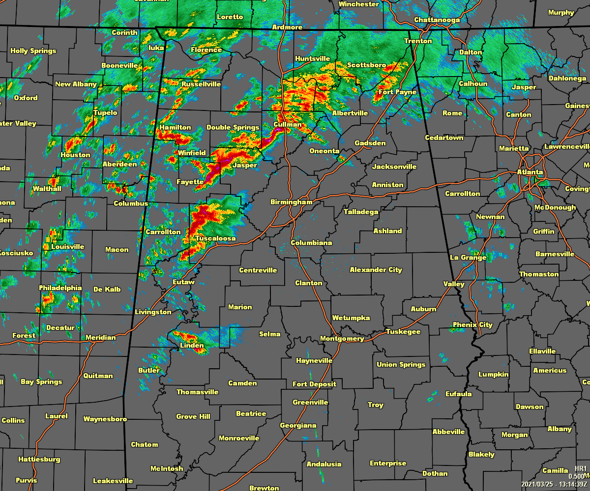
At 8:15 am, we are already starting to see cells starting to become separated and scattered from the main rain and thunderstorm activity that moved through this morning. The good news at this point is that none of this action is severe. The storms over Tuscaloosa County and portions of Winston, Walker, and Fayette counties are putting down heavy rainfall along with a decent bit of lightning.
As soon as I typed that, a Severe Thunderstorm Warning was issued for parts of Cullman and Morgan counties until 8:45 am.
For now, these storms are working off of elevated instability as the latest update from the SPC’s Mesoscale Analysis shows that the surface-based instability remains low across nearly all of North/Central Alabama. Instability is already starting to quickly rise in the southwestern parts of the area, and that will eventually work its way north and northeastward. We already have the necessary wind shear and helicity in place over the western half of the area, so once that instability works in a couple of hours, we may see an uptick in warnings being issued.
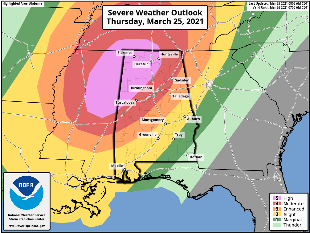
The 8 am updated SPC graphic continues to have the northwestern parts of North/Central Alabama in a Level 5 out of 5 High Risk for severe storms, which includes the cities of Florence, Russellville, Athens, Decatur, Hartselle, Cullman, Huntsville, Hamilton, Double Springs, Winfield, Fayette, and Carrollton. A Level 4 out of 5 Moderate Risk continues just east of that and includes the cities of Guntersville, Scottsboro, and Rainsville, Gadsden, Birmingham, Hoover, Tuscaloosa, and Demopolis.
These locations will have the greater risk of strong tornadoes this afternoon through this evening as the ingredients for severe weather will be much higher. Damaging winds up to 80 MPH and golf ball size hail will also be possible in these locations. The main timing continues to be from 11 am this morning through 11 pm tonight.
A Level 3 out of 5 Enhanced Risk is up east of that, which includes the cities of Anniston, Talladega, Alexander City, Clanton, and Selma. A Level 2 out of 5 Slight Risk is up east of that, which includes the cities of Auburn, Montgomery, and Troy. And east of that, a Level 1 out of 5 Marginal Risk is up for the extreme southeastern parts of the area that includes the cities of Phenix City and Eufaula.
Tornadoes, damaging winds up to 60-70 MPH, and hail up to quarter size will be possible in these risk locations. The main timing continues to be from 6 pm tonight through midnight.
Category: Alabama's Weather, ALL POSTS, Severe Weather
About the Author (Author Profile)
Scott Martin is an operational meteorologist, professional graphic artist, musician, husband, and father. Not only is Scott a member of the National Weather Association, but he is also the Central Alabama Chapter of the NWA president. Scott is also the co-founder of Racecast Weather, which provides forecasts for many racing series across the USA. He also supplies forecasts for the BassMaster Elite Series events including the BassMaster Classic.Subscribe
If you enjoyed this article, subscribe to receive more just like it.


