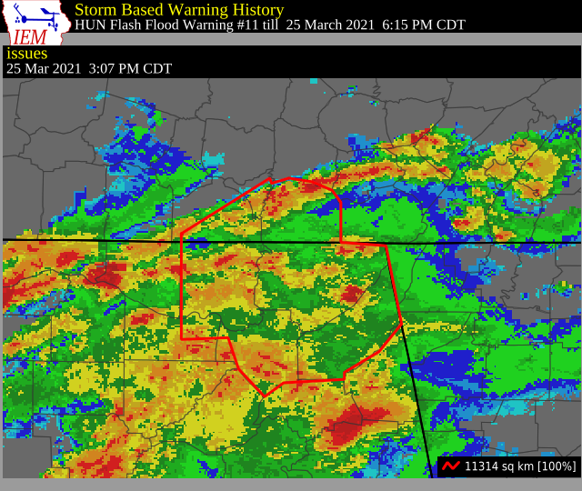
Flash Flood Warning for Cullman, Madison, Morgan, Dekalb, Jackson, & Marshall Co. Until 6:15 pm
The National Weather Service in Huntsville has issued a
* Flash Flood Warning for…
Northeastern Cullman County in north central Alabama…
Madison County in north central Alabama…
East Central Morgan County in north central Alabama…
DeKalb County in northeastern Alabama…
Jackson County in northeastern Alabama…
Marshall County in northeastern Alabama…
Franklin TN County in middle Tennessee…
Southern Lincoln County in middle Tennessee…
Southeastern Moore County in middle Tennessee…
* Until 615 PM CDT.
* At 307 PM CDT, Doppler radar indicated thunderstorms producing
heavy rain in Marshall County, and also including portions of
Madison, Jackson, Dekalb Counties in Alabama, and portions of
Lincoln, Moore, and Franklin Counties in Southern Middle
Tennessee. In addition to rainfall totals of 2 to 3 inches of
rainfall earlier today, another 1 to 2 inches of rainfall is
possible in the next hour. Flash Flooding will begin shortly.
HAZARD…Flash flooding caused by thunderstorms.
SOURCE…Doppler radar.
IMPACT…Flooding of small creeks and streams, urban areas,
highways, streets and underpasses as well as other
drainage and low lying areas.
* Some locations that will experience flash flooding include…
Huntsville, Madison, Albertville, Scottsboro, Fort Payne, Boaz,
Winchester, Guntersville, Arab, Fayetteville, Rainsville,
Bridgeport, Moores Mill, Meridianville, Redstone Arsenal,
Lynchburg, Hazel Green, Decherd, Henagar and Estill Springs.
PRECAUTIONARY/PREPAREDNESS ACTIONS…
Turn around, don’t drown when encountering flooded roads. Most flood
deaths occur in vehicles.
Category: Alabama's Weather, ALL POSTS, Severe Weather
About the Author (Author Profile)
Scott Martin is an operational meteorologist, professional graphic artist, musician, husband, and father. Not only is Scott a member of the National Weather Association, but he is also the Central Alabama Chapter of the NWA president. Scott is also the co-founder of Racecast Weather, which provides forecasts for many racing series across the USA. He also supplies forecasts for the BassMaster Elite Series events including the BassMaster Classic.Subscribe
If you enjoyed this article, subscribe to receive more just like it.


