Alabama Weather Update at 4:30 p.m.
A very dangerous situation continues across Alabama this afternoon.
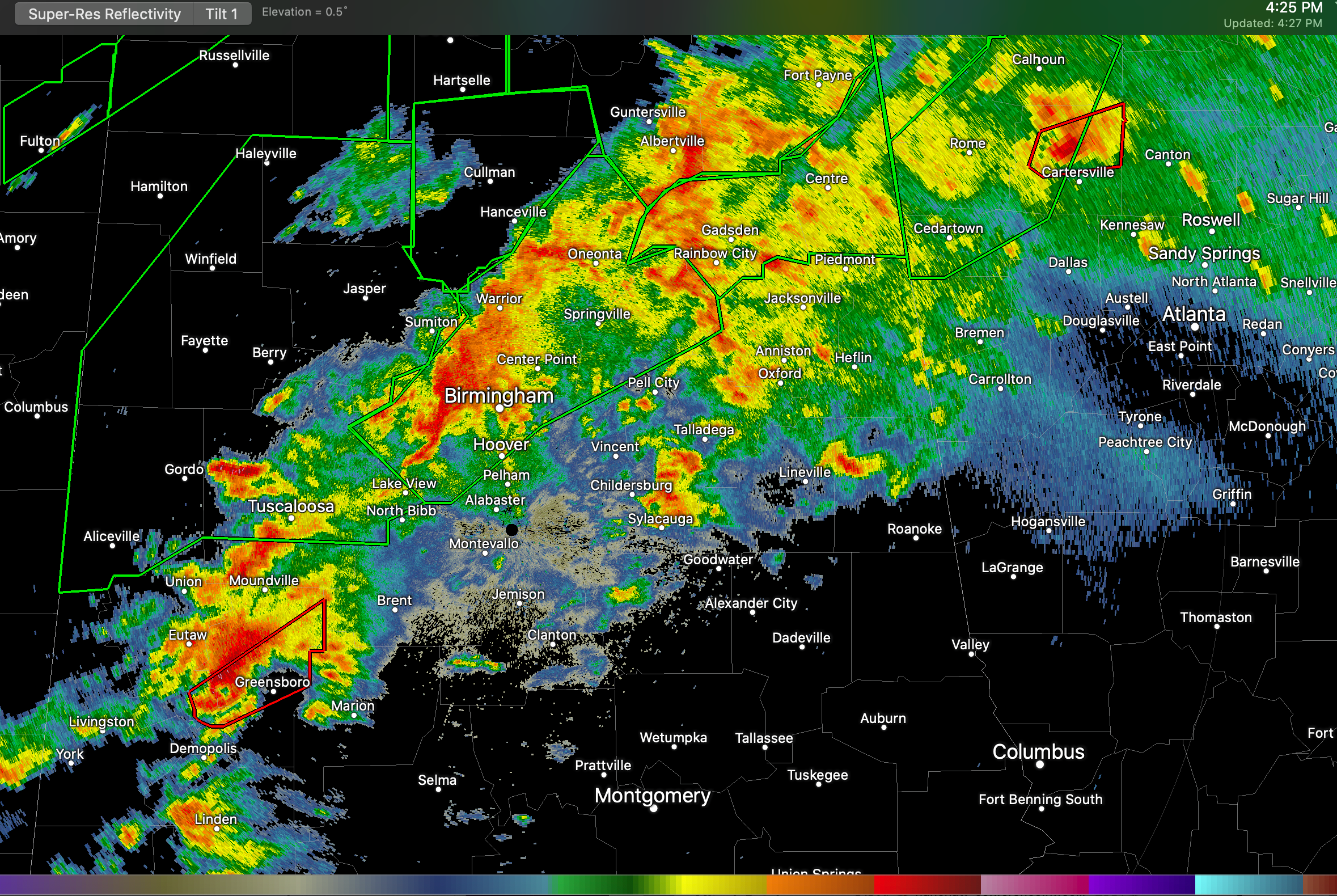
One long-lived supercell storm has produced tornado damage from Bibb County across Shelby, St. Clair, Calhoun, and Cherokee Counties. There are reports of fatalities in Calhoun County near Ohatchee.
The airmass feeding into these storms is warm, humid, and unstable. There is plenty of bulk wind shear, as well as directional shear for more tornadoes.
Instability values are between 1,500-2,500 joules/kg. Bulk shear is between 60-70 knots, which is off the charts for organized storms. 0-1km helicity is between 300-400 m2/s2.
A tornado warning remains in effect for Greene and Hale Counties. A violent circulation is near Forkland at this time. There are strong indications of a Bounded Weak Echo Region indicating a really strong updraft. Be in safe shelter now in areas between Greensboro and Akron.
Category: Alabama's Weather, ALL POSTS, Severe Weather
About the Author (Author Profile)
Bill Murray is the President of The Weather Factory. He is the site's official weather historian and a weekend forecaster. He also anchors the site's severe weather coverage. Bill Murray is the proud holder of National Weather Association Digital Seal #0001 @wxhistorianSubscribe
If you enjoyed this article, subscribe to receive more just like it.


