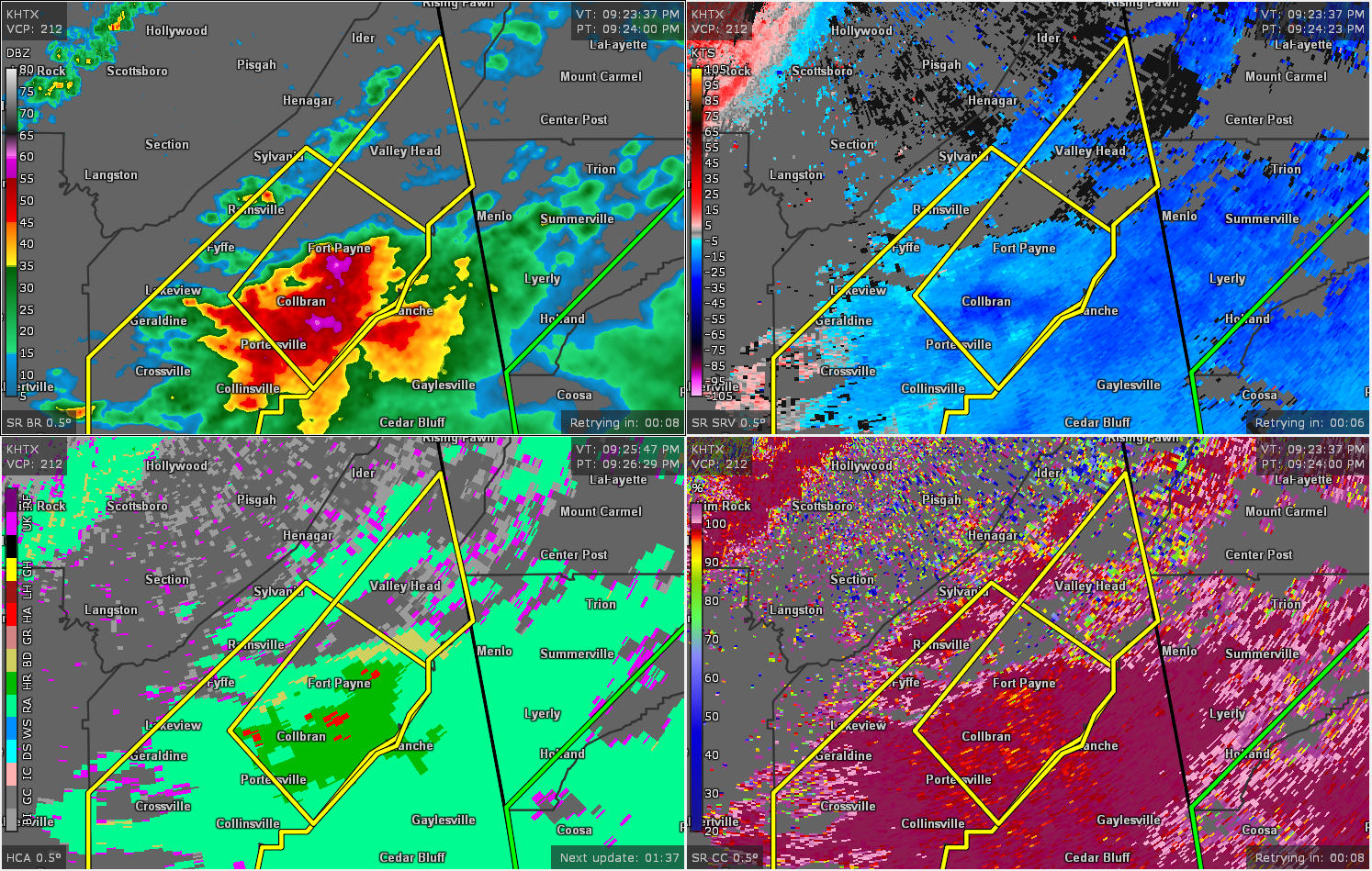
Severe Thunderstorm Warning for DeKalb Co. Until 9:45 pm
The National Weather Service in Huntsville Alabama has issued a
* Severe Thunderstorm Warning for…
Southeastern DeKalb County in northeastern Alabama…
* Until 945 PM CDT.
* At 926 PM CDT, a severe thunderstorm was located over Fort Payne,
moving northeast at 80 mph.
HAZARD…60 mph wind gusts and quarter size hail.
SOURCE…Public.
IMPACT…Hail damage to vehicles is expected. Expect wind damage
to roofs, siding, and trees.
* Locations impacted include…
Fort Payne, Rainsville, Valley Head, Hammondville, Mentone, Pine
Ridge, Dog Town, Collbran, Sulpher Springs and Little River Canyon
NP.
PRECAUTIONARY/PREPAREDNESS ACTIONS…
A Tornado Watch remains in effect until 100 AM CDT for northeastern
Alabama.
Prepare immediately for large hail and deadly cloud to ground
lightning. Seek shelter inside a well-built structure. Stay away from
windows.
Category: Alabama's Weather, ALL POSTS, Severe Weather
About the Author (Author Profile)
Scott Martin is an operational meteorologist, professional graphic artist, musician, husband, and father. Not only is Scott a member of the National Weather Association, but he is also the Central Alabama Chapter of the NWA president. Scott is also the co-founder of Racecast Weather, which provides forecasts for many racing series across the USA. He also supplies forecasts for the BassMaster Elite Series events including the BassMaster Classic.Subscribe
If you enjoyed this article, subscribe to receive more just like it.


