

EXPIRED Severe Thunderstorm Warning for Pickens & Fayette Co. Until 6:45 pm
The National Weather Service in Birmingham has issued a
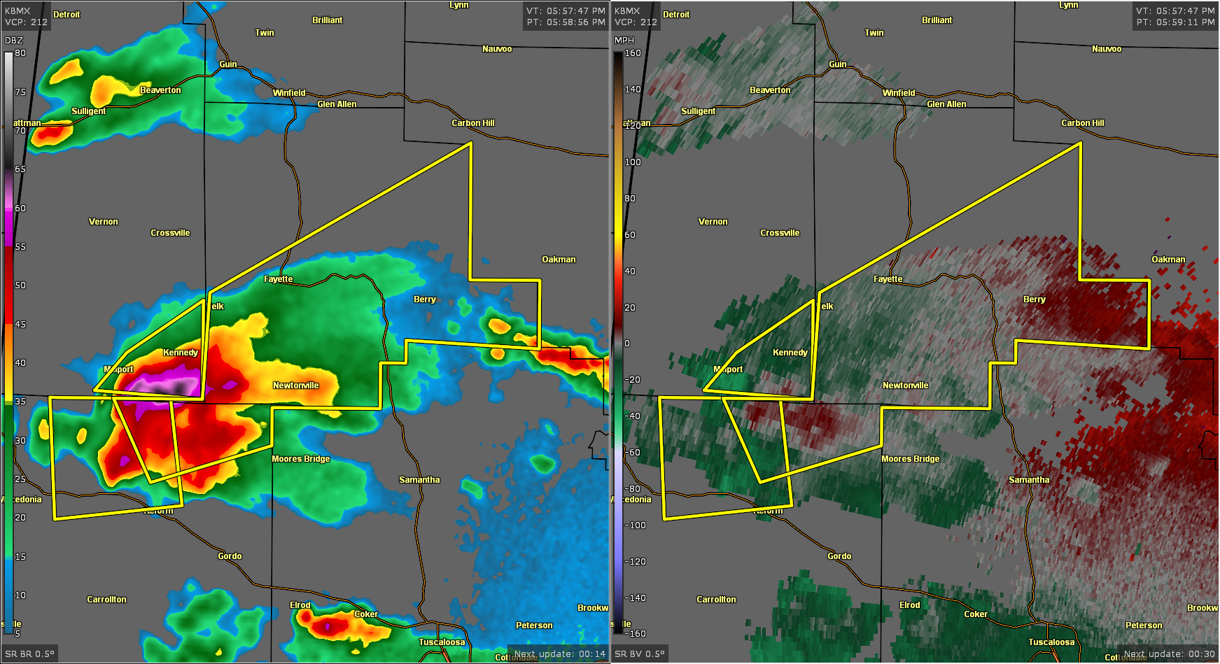
* Severe Thunderstorm Warning for…
Northeastern Pickens County in west central Alabama…
Fayette County in west central Alabama…
* Until 645 PM CDT.
* At 559 PM CDT, a severe thunderstorm was located over Kennedy, or
near Millport, moving northeast at 40 mph.
HAZARD…60 mph wind gusts and quarter size hail.
SOURCE…Radar indicated.
IMPACT…Hail damage to vehicles is expected. Expect wind damage
to roofs, siding, and trees.
* Locations impacted include…
Fayette, Berry, Belk, Ashcraft Corner, Bankston, Boley Springs,
Bevill State College Fayette, Stone Wall, Fowlers Crossroads,
Richard Arthur Field and Fayette County Public Lake.
PRECAUTIONARY/PREPAREDNESS ACTIONS…
For your protection move to an interior room on the lowest floor of a
building.
Category: Alabama's Weather, ALL POSTS, Severe Weather
About the Author (Author Profile)
Scott Martin is an operational meteorologist, professional graphic artist, musician, husband, and father. Not only is Scott a member of the National Weather Association, but he is also the Central Alabama Chapter of the NWA president. Scott is also the co-founder of Racecast Weather, which provides forecasts for many racing series across the USA. He also supplies forecasts for the BassMaster Elite Series events including the BassMaster Classic.Subscribe
If you enjoyed this article, subscribe to receive more just like it.


