

CANCELED Severe Thunderstorm Warning for Jackson Co. Until 7:15 pm
The National Weather Service in Huntsville Alabama has issued a
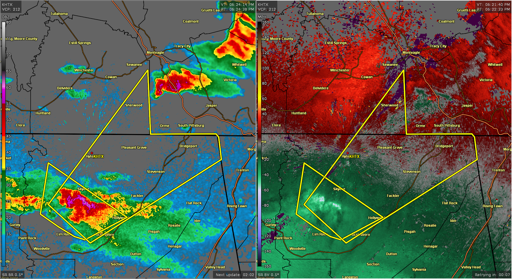
* Severe Thunderstorm Warning for…
Northern Jackson County in northeastern Alabama…
Southeastern Franklin County in Middle Tennessee…
* Until 715 PM CDT.
* At 623 PM CDT, a severe thunderstorm was located near Skyline, or 7
miles northwest of Scottsboro, moving northeast at 50 mph.
HAZARD…Golf ball size hail and 60 mph wind gusts.
SOURCE…Radar indicated.
IMPACT…People and animals outdoors will be injured. Expect hail
damage to roofs, siding, windows, and vehicles. Expect
wind damage to roofs, siding, and trees.
* Locations impacted include…
Scottsboro, Bridgeport, Stevenson, Hollywood, Skyline, Anderson,
Pleasant Groves, Hytop, Bass and Martintown.
PRECAUTIONARY/PREPAREDNESS ACTIONS…
A Tornado Watch remains in effect until 900 PM CDT for north central
and northeastern Alabama…and Middle Tennessee.
For your protection move to an interior room on the lowest floor of a
building.
Category: Alabama's Weather, ALL POSTS, Severe Weather
About the Author (Author Profile)
Scott Martin is an operational meteorologist, professional graphic artist, musician, husband, and father. Not only is Scott a member of the National Weather Association, but he is also the Central Alabama Chapter of the NWA president. Scott is also the co-founder of Racecast Weather, which provides forecasts for many racing series across the USA. He also supplies forecasts for the BassMaster Elite Series events including the BassMaster Classic.Subscribe
If you enjoyed this article, subscribe to receive more just like it.


