PDS Tornado Warning Southwest of Shreveport
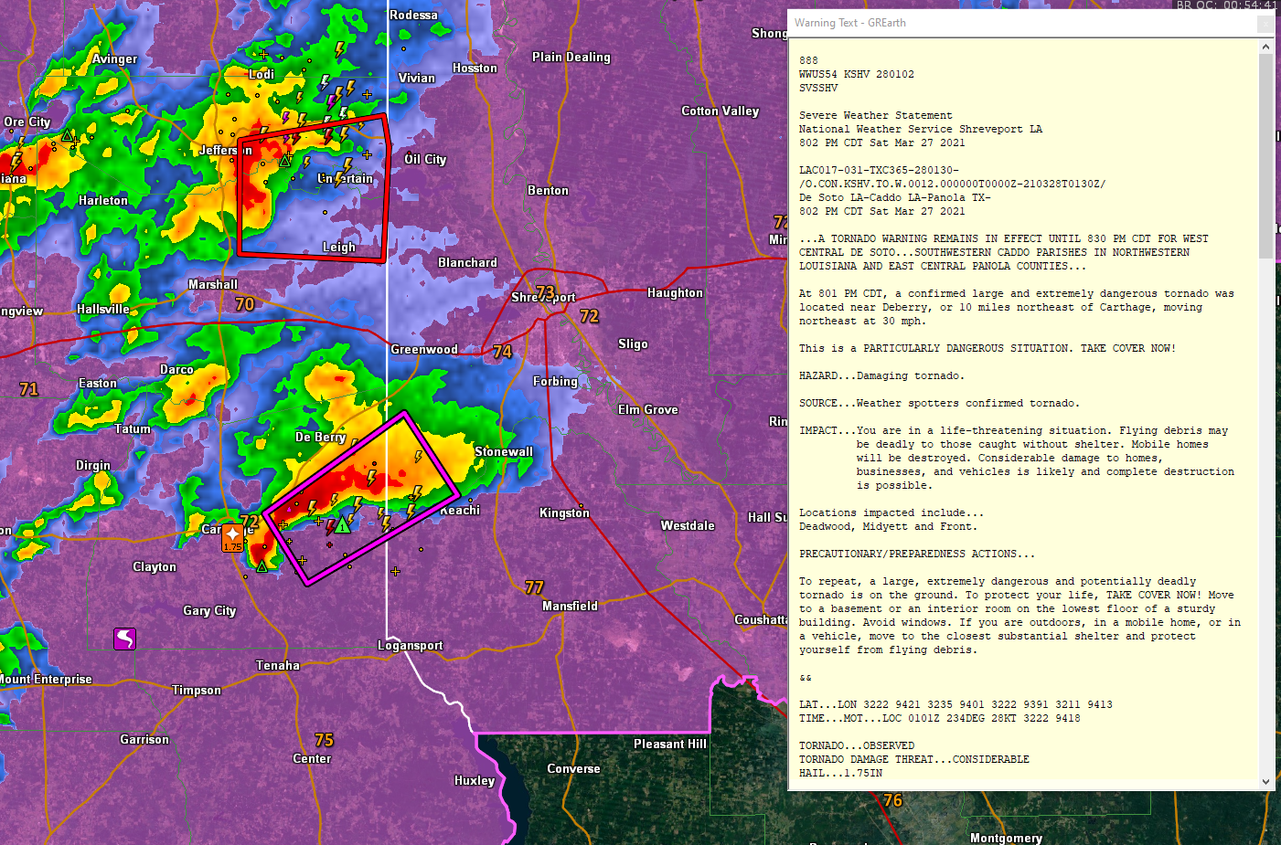
Spotters confirm a large and dangerous tornado moving into areas southwest of Shreveport at this hour. This same storm produced a tornado near Gary City in Panola County, Texas.
Tornado watches still cover a large part of southern Tennessee, northern Mississippi. southeastern Arkansas, northwestern Louisiana, and northeastern Texas. Strong storms continue tonight from western and Middle Tennessee into Arkansas, Northeast Texas, and Northwest Louisiana. These storms will congeal into a squall line later tonight ahead of a cold front that will be pushing quickly southeastward overnight.
Strong to severe storms will reach Northwest Alabama after midnight, probably around 2 a.m.. This squall line will reach I-59 around 6-7 a.m. It should be weakening as it pushes southeast, but with the recent history of over-performance by storm systems this spring, we need to monitor things carefully.
Here is the new SPC Day One Outlook that is in effect through the overnight hours:
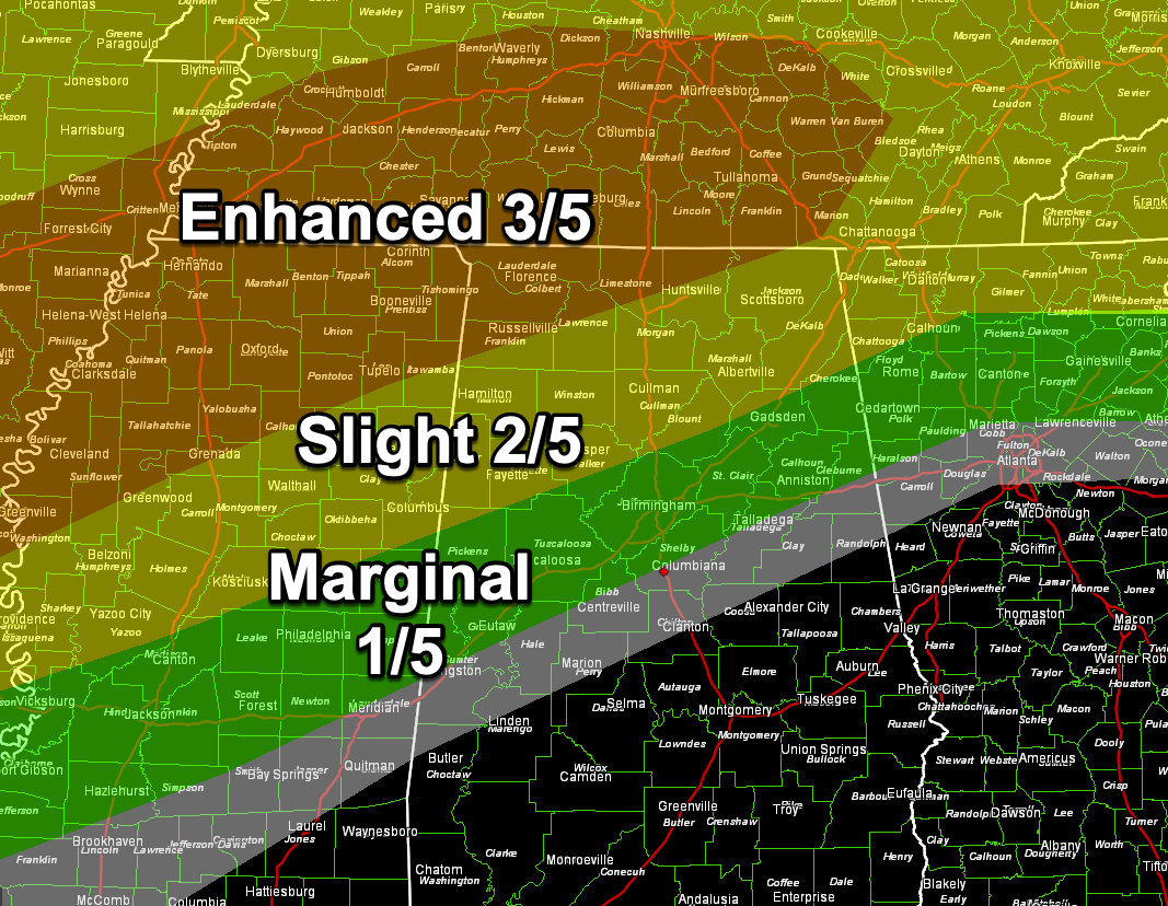
The greatest threat of severe weather is over Northwest Alabama, but there is a risk overnight down to the I-20 Corridor.
There is a marginal risk (1/5) for much of the state for Sunday as the line of storms reintensifies during the late morning and afternoon.
Category: Alabama's Weather, ALL POSTS, Severe Weather
About the Author (Author Profile)
Bill Murray is the President of The Weather Factory. He is the site's official weather historian and a weekend forecaster. He also anchors the site's severe weather coverage. Bill Murray is the proud holder of National Weather Association Digital Seal #0001 @wxhistorianSubscribe
If you enjoyed this article, subscribe to receive more just like it.


