Severe Weather Threat Continues…Storms Will Likely Intensify Overnight
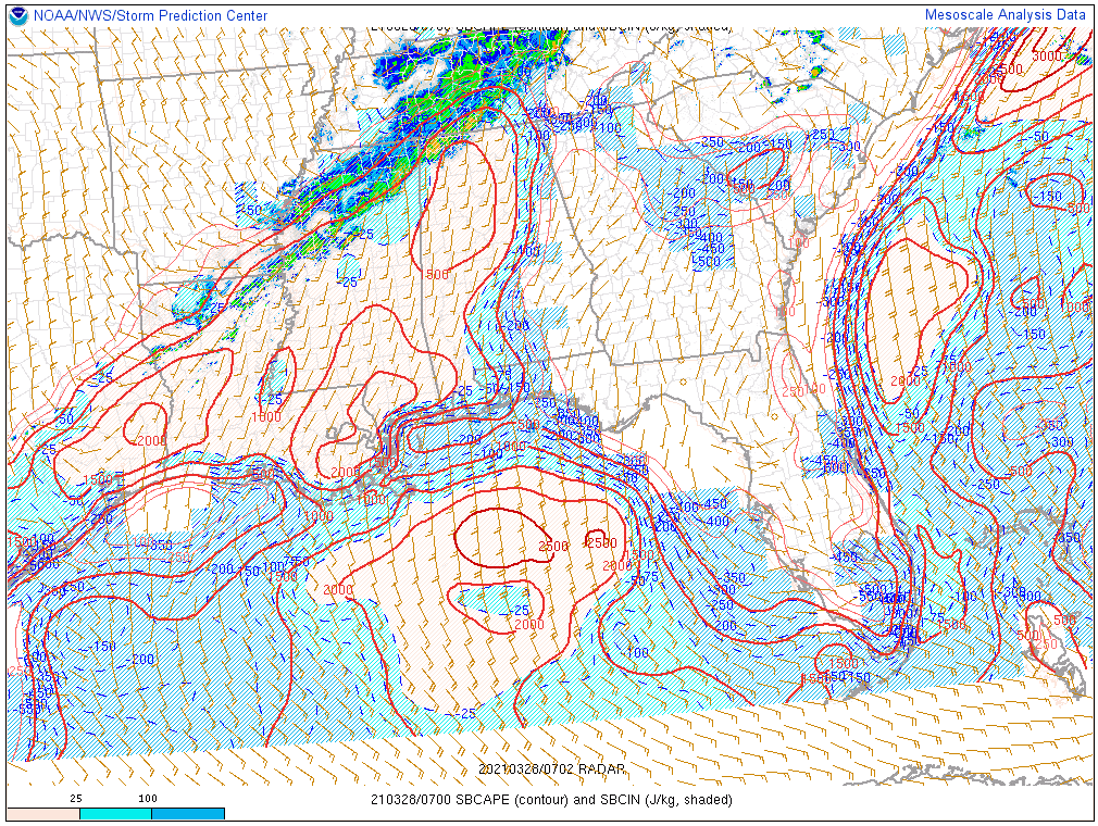
A warm and unstable airmass continues across much of North and North Central Alabama. Temperatures are still in the 70s even at this hour. Dewpoints are in the middle and upper 60s. CAPE values are still above 1,500 joules/kg over the northwestern quarter of Alabama.
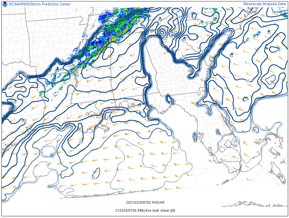
Winds have been increasing at about 5,000 feet, leading to very strong speed shear and enhancing the threat for damaging winds:
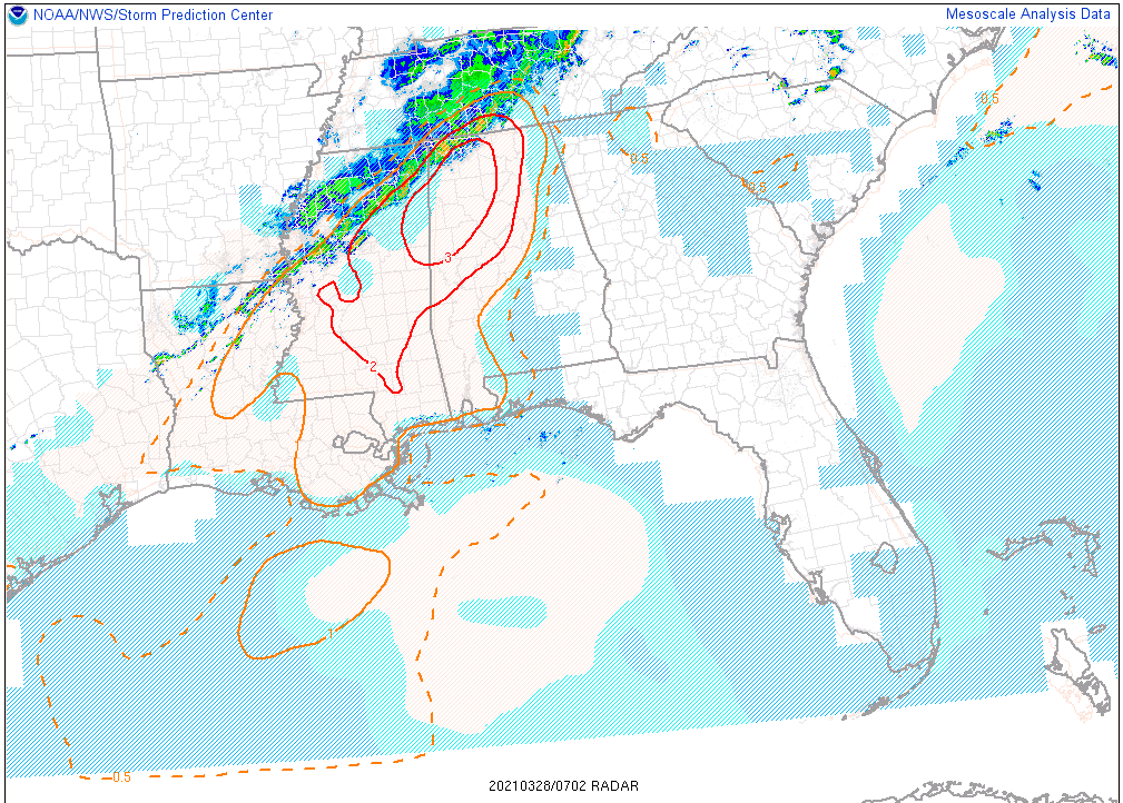
The significant tornado parameter is fairly high over Northwest Alabama, highlighting the threat of a few isolated tornadoes:
A tornado watch remains in effect until 6 a.m. CDT for the counties in magenta.
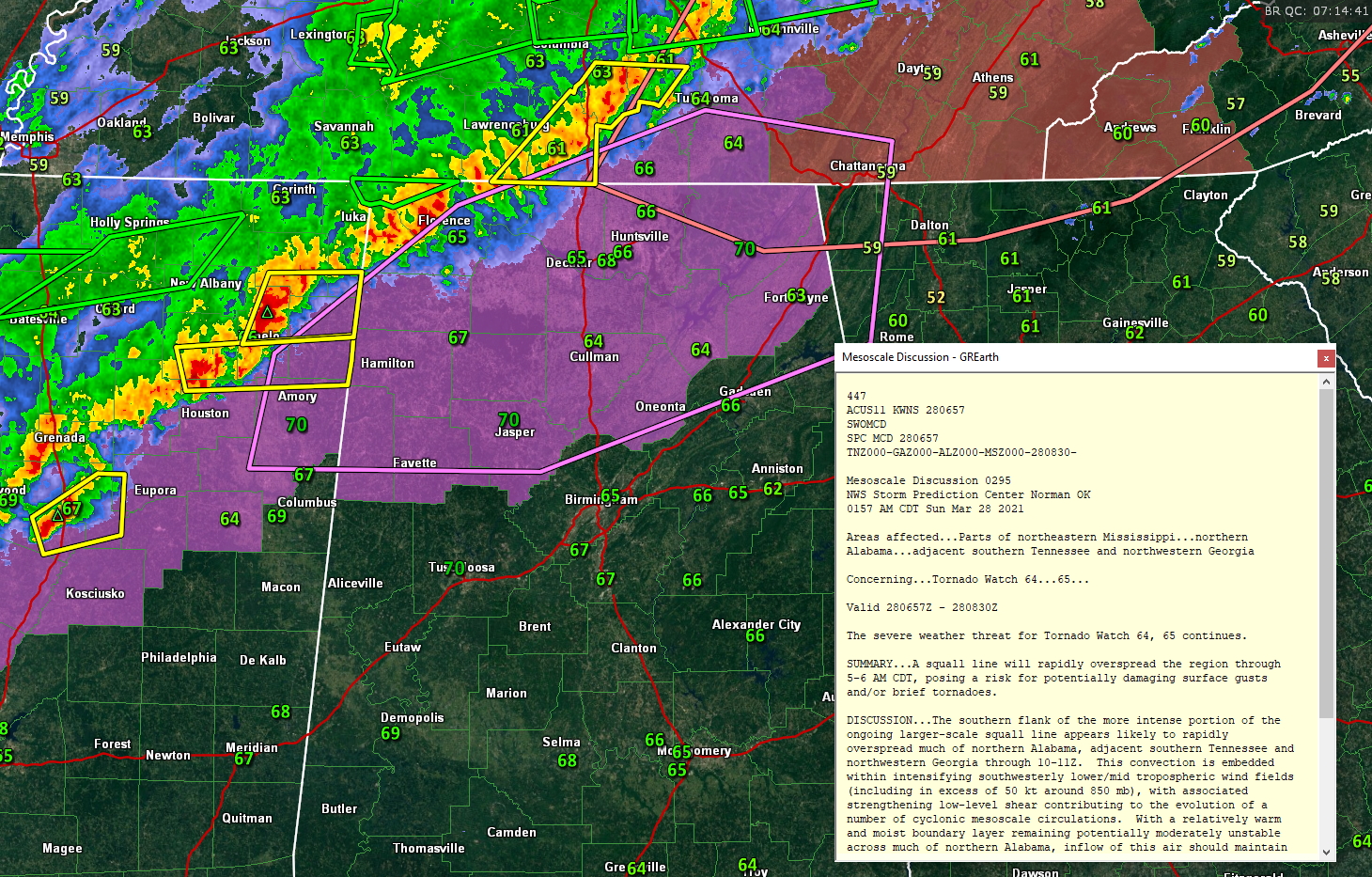
A dangerous storm is near Tupelo, Mississippi. It will move into this increasing shear and could produce widespread damaging winds or a tornado over Northwest Alabama, especially Franklin County. There have been reports of roof damage, downed trees, and power outages across Pontotoc County in the wake of this storm.
A flash flood warning has just been issued for parts of Lauderdale County in Northwest Alabama. Extremely heavy rain will accompany the storms as they progress across North and North Central Alabama tonight.
Stay tuned for frequent updates.
Category: Alabama's Weather, ALL POSTS, Severe Weather
About the Author (Author Profile)
Bill Murray is the President of The Weather Factory. He is the site's official weather historian and a weekend forecaster. He also anchors the site's severe weather coverage. Bill Murray is the proud holder of National Weather Association Digital Seal #0001 @wxhistorianSubscribe
If you enjoyed this article, subscribe to receive more just like it.


