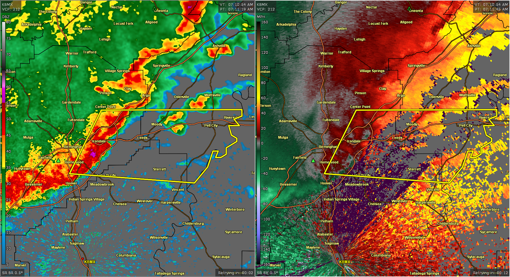
Severe Thunderstorm Warning for Parts of Jefferson, Shelby, & St. Clair Co. Until 7:45 am
The National Weather Service in Birmingham has issued a
* Severe Thunderstorm Warning for…
Northeastern Shelby County in central Alabama…
East central Jefferson County in central Alabama…
Southwestern St. Clair County in central Alabama…
* Until 745 AM CDT.
* At 713 AM CDT, a severe thunderstorm was located over Barber
Motorsports Park, or near Leeds, moving east at 60 mph.
HAZARD…60 mph wind gusts.
SOURCE…Radar indicated.
IMPACT…Expect damage to roofs, siding, and trees.
* Locations impacted include…
Eastern Birmingham, Vestavia Hills, Homewood, Mountain Brook,
Trussville, Pell City, Irondale, Leeds, Moody, Center Point,
Vincent, Shops of Grand River, Bald Rock, Vandiver, Barber
Motorsports Park, Greystone, Samford University, Cahaba Heights,
Logan Martin Lake and Alton.
PRECAUTIONARY/PREPAREDNESS ACTIONS…
For your protection move to an interior room on the lowest floor of a
building.
Large hail and damaging winds and continuous cloud to ground
lightning is occurring with this storm. Move indoors immediately.
Lightning is one of nature’s leading killers. Remember, if you can
hear thunder, you are close enough to be struck by lightning.
Torrential rainfall is occurring with this storm, and may lead to
flash flooding. Do not drive your vehicle through flooded roadways.
Category: Alabama's Weather, ALL POSTS, Severe Weather
About the Author (Author Profile)
Scott Martin is an operational meteorologist, professional graphic artist, musician, husband, and father. Not only is Scott a member of the National Weather Association, but he is also the Central Alabama Chapter of the NWA president. Scott is also the co-founder of Racecast Weather, which provides forecasts for many racing series across the USA. He also supplies forecasts for the BassMaster Elite Series events including the BassMaster Classic.Subscribe
If you enjoyed this article, subscribe to receive more just like it.


