Slight Risk Increased in Area, Northwest Alabama No Longer in Severe Storm Risk
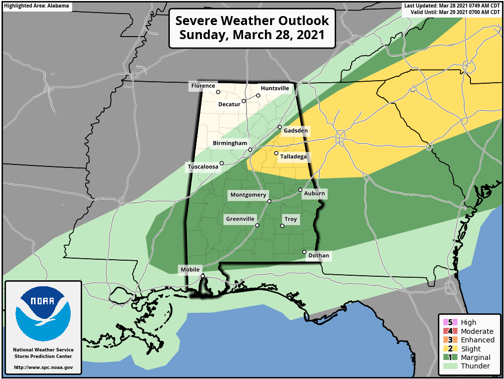
The latest update from the Storm Prediction Center is out and there has been an increase in area to the Slight Risk for severe storms (level 2 of 5). The Slight Risk now includes locations inside a line from Cedar Bluff to Pelham to Montevallo to Dadeville to Valley.
The rest of Central Alabama roughly south of the I-59 corridor remains in a Marginal Risk for severe storms (level 1 of 5) for several more hours.
For locations in North/Central Alabama north and west of I-59, the threat of severe weather has come to an end.
Here is the latest Day 1 Severe Weather Outlook from the SPC:
A semi-broken/quasi-linear cluster of storms may continue to pose an isolated severe risk this morning from central/eastern Alabama into western/northern Georgia and western South Carolina. These storms may tend to outpace the more appreciable moistening/destabilization from the southwest, while low-level winds will otherwise continue to veer over time. Isolated wind damage will remain possible early today, and potentially remain possible this afternoon into other parts of Georgia/South Carolina pending downstream destabilization and the disposition of the early day convective line.
Category: Alabama's Weather, ALL POSTS, Severe Weather
About the Author (Author Profile)
Scott Martin is an operational meteorologist, professional graphic artist, musician, husband, and father. Not only is Scott a member of the National Weather Association, but he is also the Central Alabama Chapter of the NWA president. Scott is also the co-founder of Racecast Weather, which provides forecasts for many racing series across the USA. He also supplies forecasts for the BassMaster Elite Series events including the BassMaster Classic.Subscribe
If you enjoyed this article, subscribe to receive more just like it.


