A Quick Early Afternoon Check on Our Severe Weather Threat
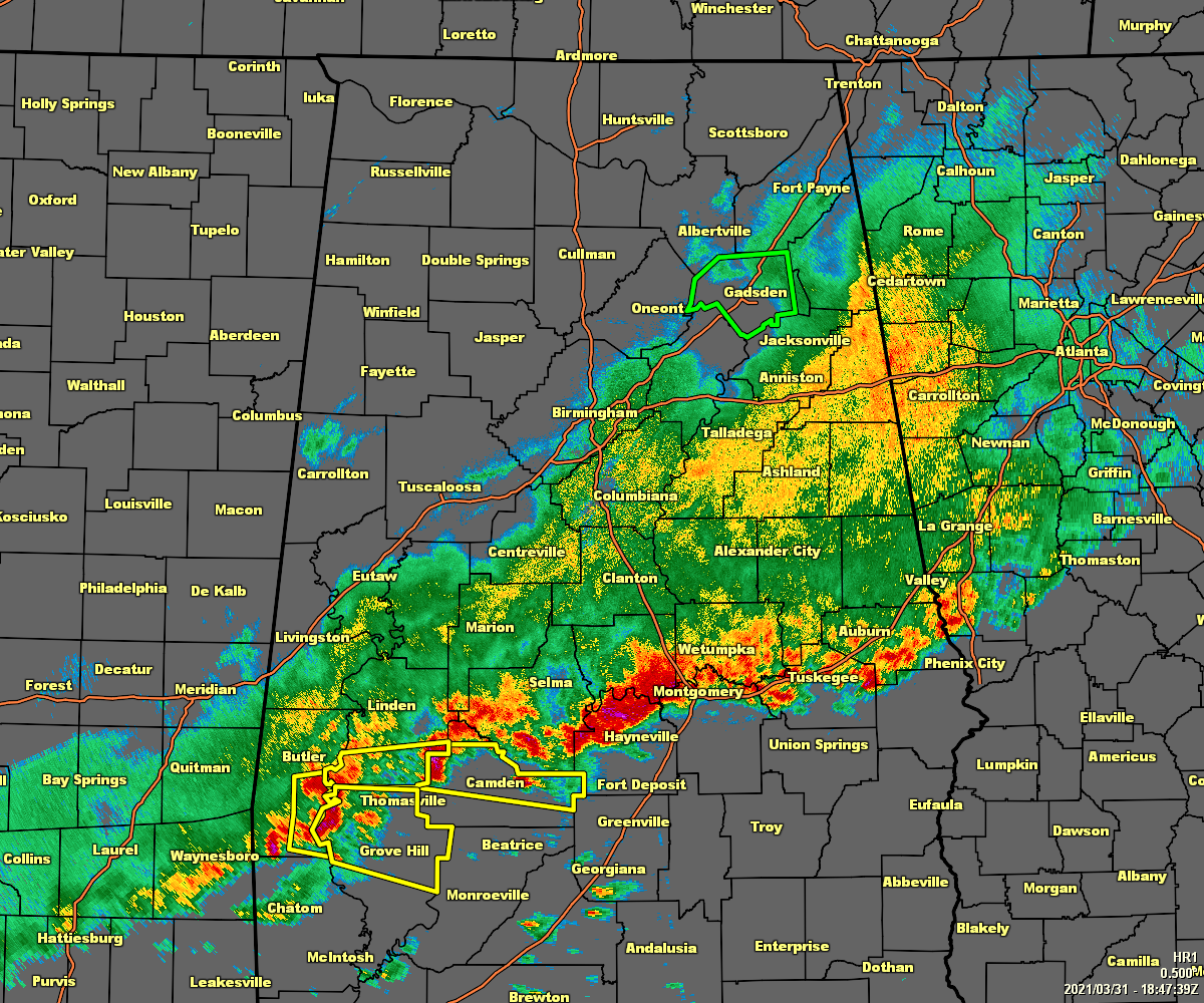
At 1:47 pm, the line of storms stretches from just north of Phenix City and Auburn to Montgomery and Hayneville, to Orrville and Dixons Mill. The stronger part of the line is currently over Northern Lowndes Co. and moving into the extreme southern parts of Marengo County. The Rest of the storms are staying well-behaved at the moment.
• A threat of damaging winds and quarter size hail continues for locations along and out ahead of the front and the line of storms.
• Instability values out ahead of the line quickly rise into the 500-2,000 J/kg range from north to south.
• Shear values are lower ahead of the front, but just enough to warrant a threat of stronger to severe storms. Shear actually climbs behind the front, but with no instability, there is no threat of storms reforming.
• Helicity values are also much higher behind the line of storms due to the shift in winds. Out ahead of the line, there is enough helicity for stronger to severe storms, but only enough for a brief spin-up tornado threat.
• A few counties are about to be removed from the Severe Thunderstorm Watch.
• STP values are below 1.0 at this point.
• There are still plenty of flooding issues. Turn around, don’t drown!
Category: Alabama's Weather, ALL POSTS, Severe Weather
About the Author (Author Profile)
Scott Martin is an operational meteorologist, professional graphic artist, musician, husband, and father. Not only is Scott a member of the National Weather Association, but he is also the Central Alabama Chapter of the NWA president. Scott is also the co-founder of Racecast Weather, which provides forecasts for many racing series across the USA. He also supplies forecasts for the BassMaster Elite Series events including the BassMaster Classic.Subscribe
If you enjoyed this article, subscribe to receive more just like it.


