Strong to Severe Storms Possible from Late Friday Morning Through Early Saturday Afternoon
We’ll have two rounds of storms throughout your Friday and into the first half of Saturday as a very unsettled weather pattern continues to stay in place over North/Central Alabama. The first round will be scattered in nature and may become severe with damaging winds and large hail up to half dollar size. The second round will be in the form of a strong squall line with all modes of severe weather possible, including a few tornadoes.
The First Round
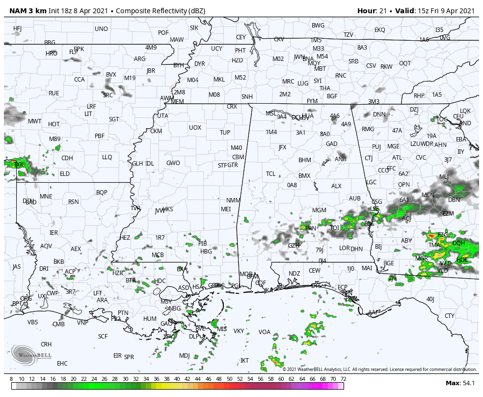
We’ll have the potential of a few scattered showers and maybe a thunderstorm developing during the early to mid-morning hours before the air becomes highly unstable during the late morning through the afternoon and evening hours. Wind profiles and lapse rates, along with the high instability, will be favorable for storms to become severe with strong winds and large hail. While a tornado cannot be completely ruled out, odds for one will be very, very low. With these storms being scattered, not everyone across the area will see activity during this first round, but rain chances will be around 40-60% from north to south across North/Central Alabama. Afternoon highs will be in the mid-70s to the lower 80s. The main window for the potential of strong to severe storms will be from 10 am Friday until 12 am Saturday.
The Second Round
A line of strong storms will form along a shortwave off to our west and will begin to move into the west and northwestern portions of our area during the pre-dawn hours on Saturday and progress through the entire area, with the stronger storms exiting the area by the early afternoon hours. Even though these storms will move through the area during a time when our atmosphere is expected to be the most stable, we’ll continue to have decent instability over the area and the shortwave will bring its own instability as well. Ingredients will be in place for the potential of a few tornadoes, damaging winds up to 70 mph, and large hail up to quarter size in diameter. The main time frame for this round of storms will be on Saturday from 3 am to 1 pm.
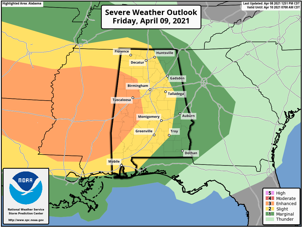
A level 3/5 Enhanced Risk for severe storms is up on Friday for the western portions of the area, which includes Hamilton, Vernon, Fayette, Carrollton, Tuscaloosa, Livingston, Eutaw, Greensboro, Selma, and Linden.
A level 2/5 Slight Risk is up for much of the rest of North/Central Alabama, which includes Florence, Huntsville, Decatur, Cullman, Birmingham, Montgomery, Talladega, and Troy.
A level 1/5 Marginal Risk is up for the remainder of North Central Alabama, which includes Scottsboro, Fort Payne, Gadsden, Anniston, Heflin, Wedowee, Auburn, Phenix City, and Clayton.
This outlook is valid from 7 am Friday to 7 am Saturday.
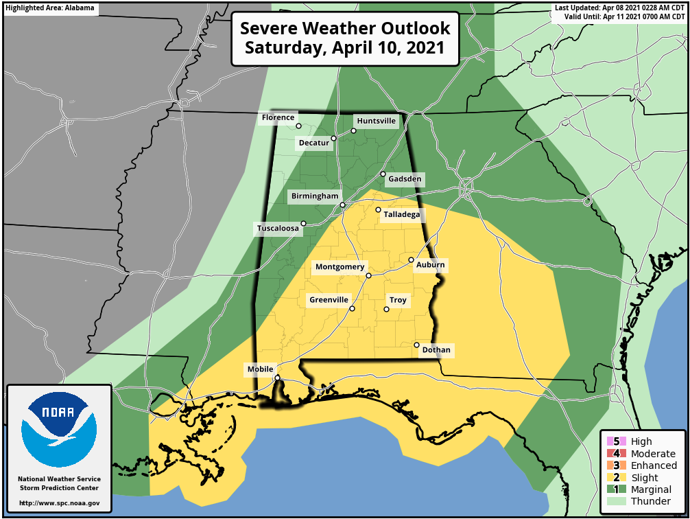
A level 2/5 Slight Risk is up on Saturday for much of the southern, east-central, and eastern parts of Central Alabama, which includes Anniston, Talladega, Clanton, Alexander City, Selma, Montgomery, Auburn, Troy, and Eufaula.
A level 1/5 Marginal Risk is up for most of the remainder of North Central Alabama, which includes Birmingham, Tuscaloosa, Demopolis, Athens, Decatur, Hartselle, Cullman, Huntsville, Guntersville, Scottsboro, and Rainsville.
This outlook is valid from 7 am Saturday to 7 am Sunday; however, the threat for severe storms will end for you as soon as the line of storms moves out of your location. The threat will be completely out of the area by 1 pm Saturday afternoon.
Be sure to have your trusty sources of weather alerts handy throughout the entire day on Friday, and keep them with you until the early afternoon hours on Saturday. Have your safety plans, your place of safety, and your safety kits ready to go just in case you go under a warning. We’ll be with you throughout the entire event.
Category: Alabama's Weather, ALL POSTS, Severe Weather
About the Author (Author Profile)
Scott Martin is an operational meteorologist, professional graphic artist, musician, husband, and father. Not only is Scott a member of the National Weather Association, but he is also the Central Alabama Chapter of the NWA president. Scott is also the co-founder of Racecast Weather, which provides forecasts for many racing series across the USA. He also supplies forecasts for the BassMaster Elite Series events including the BassMaster Classic.Subscribe
If you enjoyed this article, subscribe to receive more just like it.


