

A Brief Check on Our Weather Situation Just Before 8:30 pm
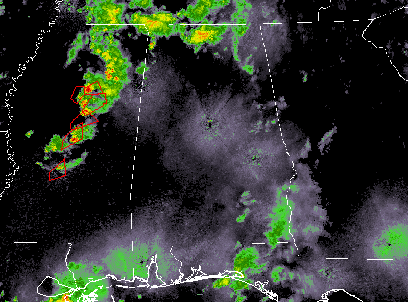
So far earlier this afternoon and into the early evening hours, we may have had a couple of tornadoes briefly touch down over portions of the western and southwestern parts of Central Alabama.
At this point, there are 4 observed tornado warnings and one radar indicated tornado warning in effect for the line of supercells that are moving across portions of Central Mississippi. Those cells will eventually move into the western portions of Central Alabama later tonight.
We’ll continue to have a severe threat over the northwestern parts of Central Alabama and into the western parts of North Alabama as instability will continue to increase as a warm front continues to move northward through the area. Helicity and shear will continue to be high enough that there will be the potential for a brief tornado or two. The tornado watch for the remaining counties will be allowed to go to full term and maybe even be extended later in time.
The latest thoughts from NWS Birmingham have the potential for a redevelopment zone with the potential of strong to severe storms over the southeastern parts of the area (south of I-20 and east of I-65).
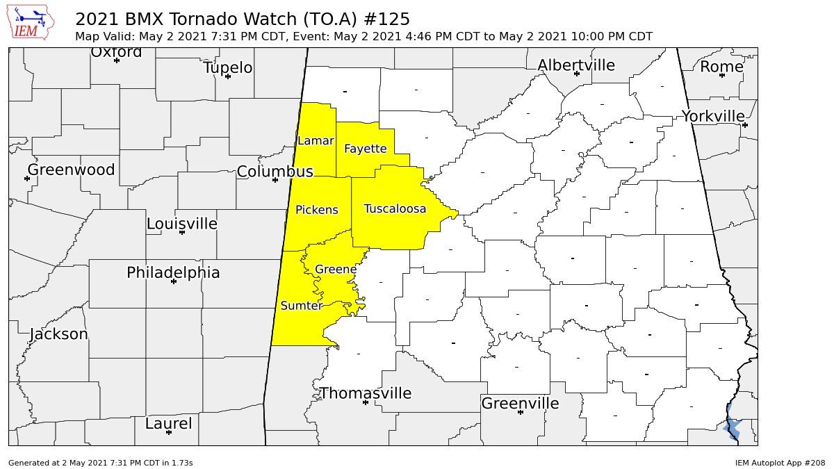
NWS Birmingham continues the Tornado Watch until 10 pm (for now) for Fayette, Greene, Lamar, Pickens, Sumter, and Tuscaloosa counties.
Category: Alabama's Weather, ALL POSTS, Severe Weather
About the Author (Author Profile)
Scott Martin is an operational meteorologist, professional graphic artist, musician, husband, and father. Not only is Scott a member of the National Weather Association, but he is also the Central Alabama Chapter of the NWA president. Scott is also the co-founder of Racecast Weather, which provides forecasts for many racing series across the USA. He also supplies forecasts for the BassMaster Elite Series events including the BassMaster Classic.Subscribe
If you enjoyed this article, subscribe to receive more just like it.


