

Tornado Watch Issued for Portions of the Area Until 4:00 pm
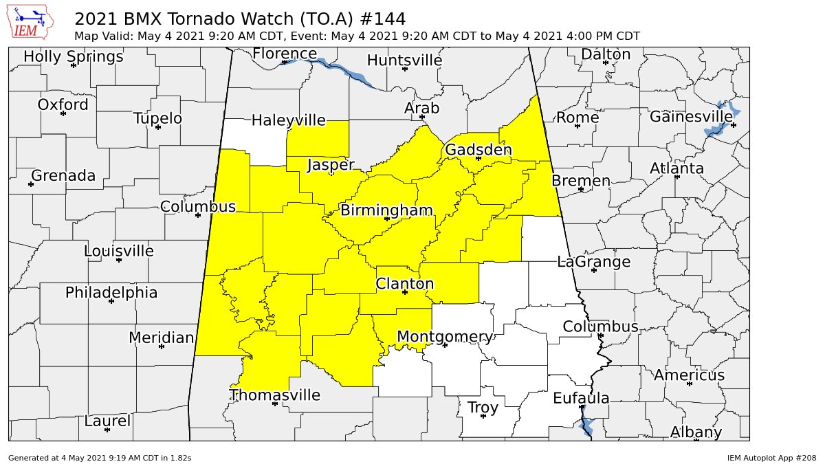
The Storm Prediction Center and NWS Birmingham have issued a Tornado Watch effective immediately until 4:00 pm for the following counties in Central Alabama: Autauga, Bibb, Blount, Calhoun, Cherokee, Chilton, Clay, Cleburne, Coosa, Dallas, Etowah, Fayette, Greene, Hale, Jefferson, Lamar, Marengo, Perry, Pickens, Shelby, St. Clair, Sumter, Talladega, Tuscaloosa, Walker, Winston.
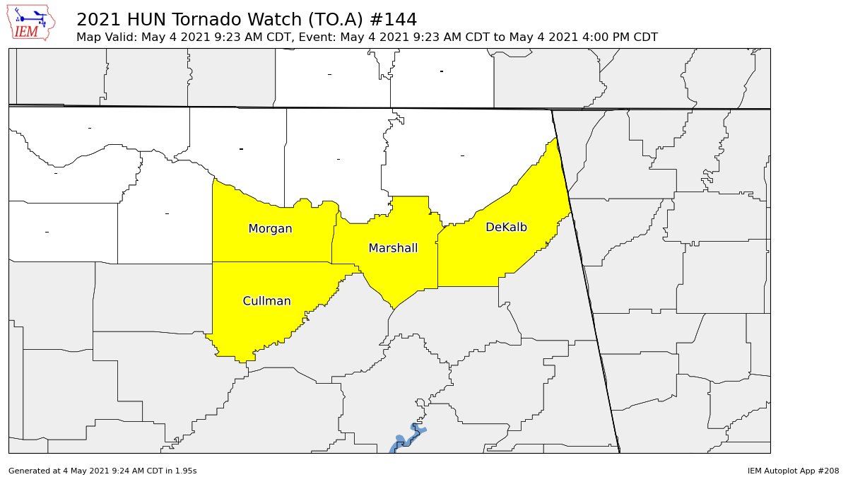
The Storm Prediction Center and NWS Huntsville have issued a Tornado Watch effective immediately until 4:00 pm for the following counties in North Alabama: Cullman, DeKalb, Marshall, Morgan.
The NWS Storm Prediction Center has issued a
* Tornado Watch for portions of
Alabama
Central Mississippi
* Effective this Tuesday morning and afternoon from 920 AM until
400 PM CDT.
* Primary threats include…
A few tornadoes possible
Widespread damaging winds likely with isolated significant gusts
to 75 mph possible
Isolated very large hail events to 2 inches in diameter possible
SUMMARY…A discrete supercell over central Mississippi may persist
this morning with additional discrete supercells possible into
west-central and southwest Alabama. Otherwise, an intensifying
squall line is expected to evolve east across northern and central
Alabama with damaging winds and a few tornadoes as the primary
hazards.
PRECAUTIONARY/PREPAREDNESS ACTIONS…
REMEMBER…A Tornado Watch means conditions are favorable for
tornadoes and severe thunderstorms in and close to the watch
area. Persons in these areas should be on the lookout for
threatening weather conditions and listen for later statements
and possible warnings.
Category: Alabama's Weather, ALL POSTS, Severe Weather
About the Author (Author Profile)
Scott Martin is an operational meteorologist, professional graphic artist, musician, husband, and father. Not only is Scott a member of the National Weather Association, but he is also the Central Alabama Chapter of the NWA president. Scott is also the co-founder of Racecast Weather, which provides forecasts for many racing series across the USA. He also supplies forecasts for the BassMaster Elite Series events including the BassMaster Classic.Subscribe
If you enjoyed this article, subscribe to receive more just like it.


