Flash Flood Warning for Parts of DeKalb, Marshall Co. Until 2:00 pm
The National Weather Service in Huntsville has issued a
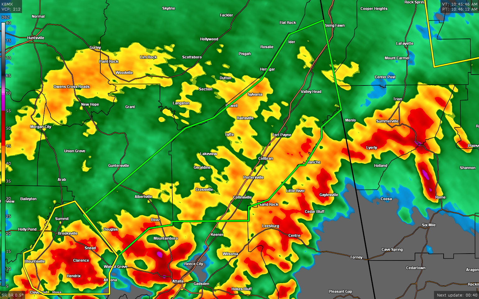
* Flash Flood Warning for…
DeKalb County in northeastern Alabama…
Southeastern Marshall County in northeastern Alabama…
* Until 200 PM CDT.
* At 1047 AM CDT, Doppler radar indicated thunderstorms producing
heavy rain across portions of Marshall and Dekalb Counties.
Between 1 and 3 inches of rain have fallen. Flash flooding is
ongoing or expected to begin shortly.
HAZARD…Flash flooding caused by thunderstorms.
SOURCE…Doppler radar.
IMPACT…Flooding of small creeks and streams, urban areas,
highways, streets and underpasses as well as other
drainage and low lying areas.
* Some locations that will experience flash flooding include…
Albertville, Fort Payne, Boaz, Guntersville, Rainsville, Henagar,
Crossville, Sylvania, Fyffe, Powell, Geraldine, Ider, Douglas,
Valley Head, Hammondville, Mentone, Pine Ridge, Lakeview, Peeks
Corner and Guest.
PRECAUTIONARY/PREPAREDNESS ACTIONS…
Turn around, don’t drown when encountering flooded roads. Most flood
deaths occur in vehicles.
In hilly terrain there are hundreds of low water crossings which are
potentially dangerous in heavy rain. Do not attempt to cross flooded
roads. Find an alternate route.
Category: Alabama's Weather, ALL POSTS, Severe Weather
About the Author (Author Profile)
Scott Martin is an operational meteorologist, professional graphic artist, musician, husband, and father. Not only is Scott a member of the National Weather Association, but he is also the Central Alabama Chapter of the NWA president. Scott is also the co-founder of Racecast Weather, which provides forecasts for many racing series across the USA. He also supplies forecasts for the BassMaster Elite Series events including the BassMaster Classic.Subscribe
If you enjoyed this article, subscribe to receive more just like it.


