

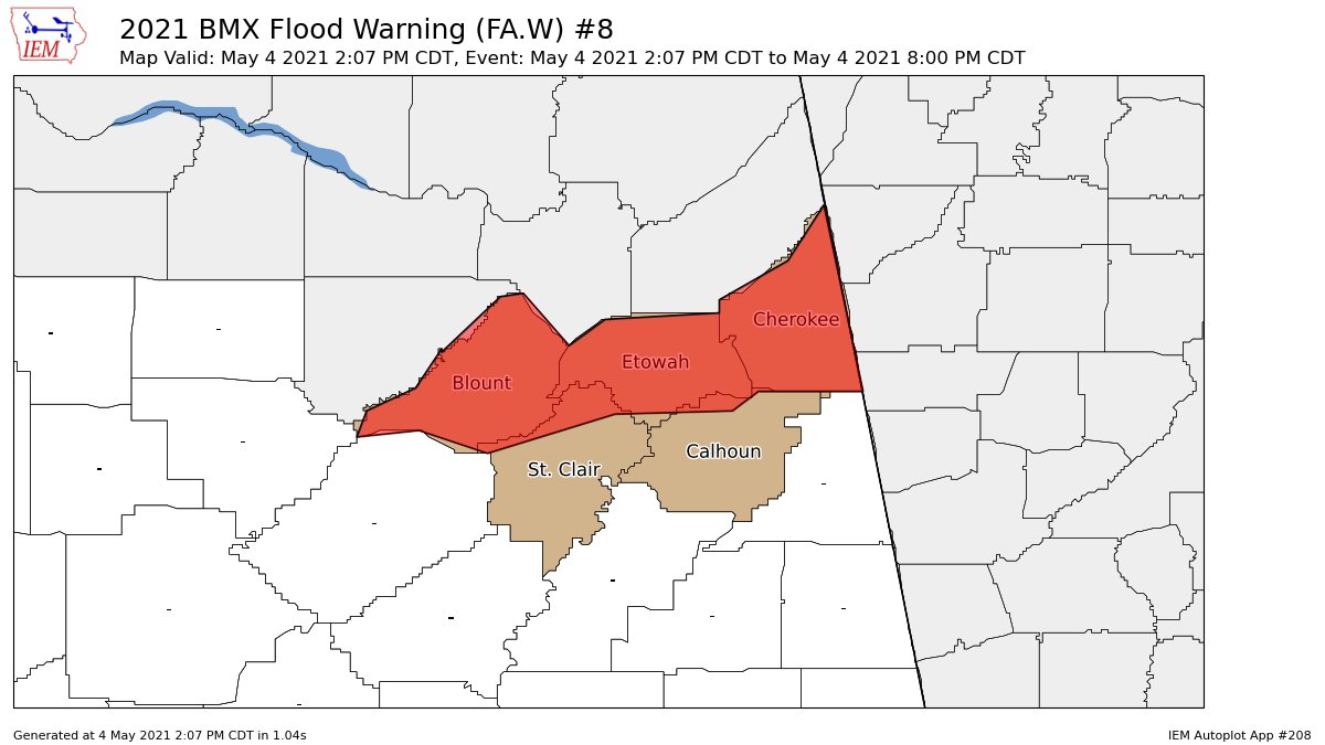
Areal Flood Warning for Parts of Blount, St. Clair, Calhoun, Cherokee, Etowah Co. Until 8:00 pm
The National Weather Service in Birmingham has issued a
* Flood Warning for…
Blount County in central Alabama…
Northeastern St. Clair County in central Alabama…
Northwestern Calhoun County in east central Alabama…
Cherokee County in northeastern Alabama…
Etowah County in northeastern Alabama…
* Until 800 PM CDT.
* At 207 PM CDT, Doppler radar indicated heavy rain due to
thunderstorms. Flooding is already occurring across the warned
area. Between 1 and 3 inches of rain have fallen.
Some locations that will experience flooding include…
Gadsden, Rainbow City, Oneonta, Attalla, Piedmont, Hokes Bluff,
Springville, Centre, Cedar Bluff, Blountsville, Cleveland, Centre
Municipal Airport, Little River Canyon National Preserve, Forney,
Dallas, Glencoe, Warrior, Ashville, Sardis City and Locust Fork.
Additional rainfall amounts of 1 to 2 inches are possible in the
warned area.
PRECAUTIONARY/PREPAREDNESS ACTIONS…
In hilly terrain there are hundreds of low water crossings which are
potentially dangerous in heavy rain. Do not attempt to cross flooded
roads. Find an alternate route.
Turn around, don’t drown when encountering flooded roads. Most flood
deaths occur in vehicles.
Category: Alabama's Weather, ALL POSTS, Severe Weather
About the Author (Author Profile)
Scott Martin is an operational meteorologist, professional graphic artist, musician, husband, and father. Not only is Scott a member of the National Weather Association, but he is also the Central Alabama Chapter of the NWA president. Scott is also the co-founder of Racecast Weather, which provides forecasts for many racing series across the USA. He also supplies forecasts for the BassMaster Elite Series events including the BassMaster Classic.Subscribe
If you enjoyed this article, subscribe to receive more just like it.


