Very Nice at Midday; Heat Starts Building on Sunday
Mother Nature Turns Up the Thermostat
The forecast for today and the next six days really does not show any relief for the heat that will start to build underneath what we call the “death ridge.” Enjoy this weekend as it will be the last one we’ll see for a little while where some locations will stay in the 80s. Here is what we got for this forecast period.
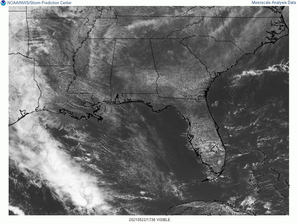
We have a few high and wispy clouds over the western parts of the area while the rest of Central Alabama has fair-weather clouds dotting the skies. Temperatures as of 12 pm were in the upper 70s to the lower 80s with Birmingham sitting at 82 degrees, tied with several others for the warmer spots. Calera was the cool spot at 78 degrees. Skies will continue to be mostly sunny with highs reaching the mid-80s to right around 90 degrees. Sunday’s weather will be very similar, but heating up into the upper 80s to the lower 90s.
No change to the forecast for the work week ahead with the exception of even warmer temperatures as the ridge strengthens. The forecast will be very similar for each day through Thursday as skies will be mostly sunny with no rain expected. Monday’s highs will be in the lower to mid-90s, ranging from the lower to the upper 90s on Tuesday, lower to mid-90s on Wednesday, and right back to the lower to upper 90s on Thursday.
The pattern across the country flattens out for the most part on Friday with the exception of a trough over the northeast, which may bring a wave of moisture into the northern half of the area late on Friday afternoon. For now, it looks like much of the area will stay dry, but a few isolated to scattered showers and storms may be possible. The heat won’t back down any as highs will be in the lower 90s in the north to the upper 90s in the south.
Update on the Tropics
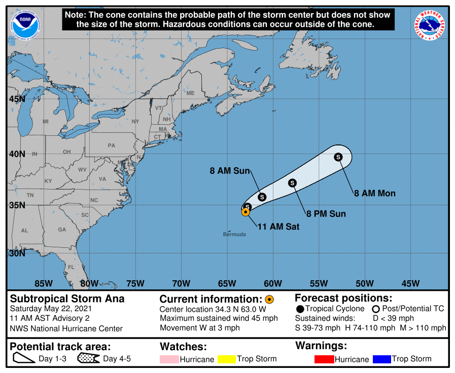
Satellite imagery and radar data from Bermuda indicate that the central convection associated with Ana has changed little in organization during the past several hours, with a complex of small bands near the center at this time. The storm is expected to turn northeastward with little change in strength over the next 12 hours or so. After Ana recurves, a combination of increasing shear, dry air, and decreasing sea surface temperatures should cause the storm to gradually weaken tonight and Sunday. The large-scale models agree upon Ana opening up into a trough of low pressure in 36-48 hours, and the official forecast shows this happening just after 48 hours. The remnant trough will likely be absorbed by a cold front associated with the mid-latitude cyclone shortly thereafter.
Category: Alabama's Weather, ALL POSTS, Tropical
About the Author (Author Profile)
Scott Martin is an operational meteorologist, professional graphic artist, musician, husband, and father. Not only is Scott a member of the National Weather Association, but he is also the Central Alabama Chapter of the NWA president. Scott is also the co-founder of Racecast Weather, which provides forecasts for many racing series across the USA. He also supplies forecasts for the BassMaster Elite Series events including the BassMaster Classic.Subscribe
If you enjoyed this article, subscribe to receive more just like it.


