Warming Up Just Before Midday; Showers & Storms Possible Tonight
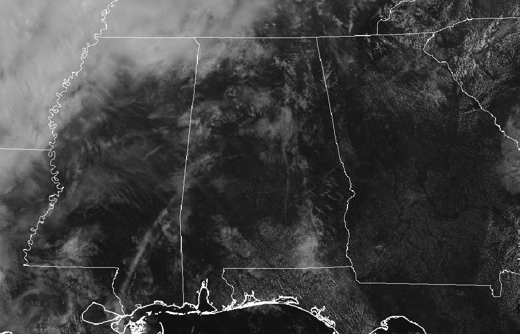
Today is the start of Meteorological Summer for Central Alabama and will begin to feel like it later this afternoon. For now, we have some high clouds moving in from the west but we will stay dry for the rest of the daylight hours. As of the 10 am roundup, temperatures were in the 70s across the area with Eufaula and Montgomery leading the way at 79 degrees. Several locations were tied at 74 as the cool spots. Birmingham was sitting at 75 degrees.
We’ll continue to have a few high clouds across Central Alabama for the rest of the daylight hours, but later this evening and through the overnight hours, clouds will begin to increase from the west with showers and a few thunderstorms becoming possible. Locations along and west of a line from Selma to Clanton to Anniston could see some rain while the higher chances will be west of the I-59 corridor. Today’s highs will get up into the lower 80s to right at or just below 90 degrees. Tonight’s lows will be in the 60s.
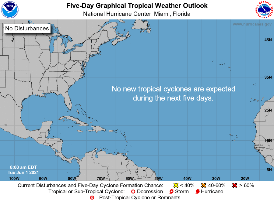
Today is the start to the 2021 Atlantic Hurricane Season, and the good news is that the tropics are relatively quiet at this point. No new tropical systems are expected to form over the tropical Atlantic Ocean, the Caribbean Sea, or the Gulf of Mexico within the next 5 days.
Category: Alabama's Weather, ALL POSTS, Severe Weather, Tropical
About the Author (Author Profile)
Scott Martin is an operational meteorologist, professional graphic artist, musician, husband, and father. Not only is Scott a member of the National Weather Association, but he is also the Central Alabama Chapter of the NWA president. Scott is also the co-founder of Racecast Weather, which provides forecasts for many racing series across the USA. He also supplies forecasts for the BassMaster Elite Series events including the BassMaster Classic.Subscribe
If you enjoyed this article, subscribe to receive more just like it.


