Flash Flood Warning for Tuscaloosa County Until 4 p.m.
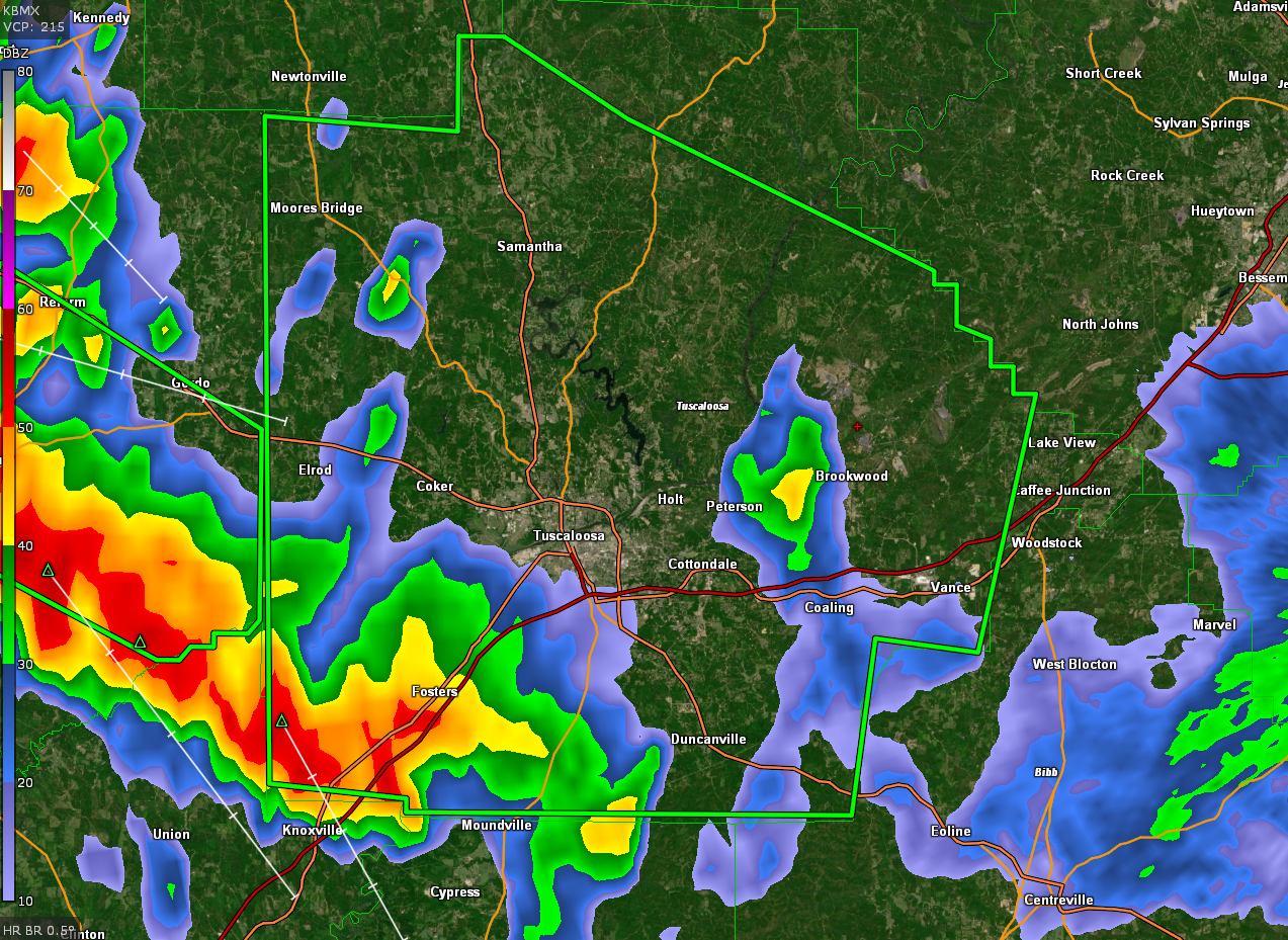
The National Weather Service in Birmingham has issued a
* Flash Flood Warning for…
Tuscaloosa County in west central Alabama…
* Until 400 PM CDT.
* At 1247 PM CDT, Doppler radar indicated thunderstorms producing
heavy rain across the warned area. Flash flooding is ongoing or
expected to begin shortly.
HAZARD…Flash flooding caused by thunderstorms.
SOURCE…Radar.
IMPACT…Flash flooding of small creeks and streams, urban
areas, highways, streets and underpasses as well as
other poor drainage and low-lying areas.
* Some locations that will experience flash flooding include…
Tuscaloosa, Northport, Holt, Moundville, Brookwood, Coaling,
Vance, Coker, Bryant Denny Stadium, Tuscaloosa Amphitheater,
University Mall, Tuscaloosa Regional Airport, McFarland Mall,
Deerlick Creek Campgrounds, Lake Lurleen State Park, Binion Creek
Landing, Shelton State Community College, Samantha, Lake Wildwood
and Bankhead Lock And Dam.
Category: Alabama's Weather, ALL POSTS, Severe Weather
About the Author (Author Profile)
Bill Murray is the President of The Weather Factory. He is the site's official weather historian and a weekend forecaster. He also anchors the site's severe weather coverage. Bill Murray is the proud holder of National Weather Association Digital Seal #0001 @wxhistorianSubscribe
If you enjoyed this article, subscribe to receive more just like it.


