Monitoring the Severe Weather Threat for Tonight
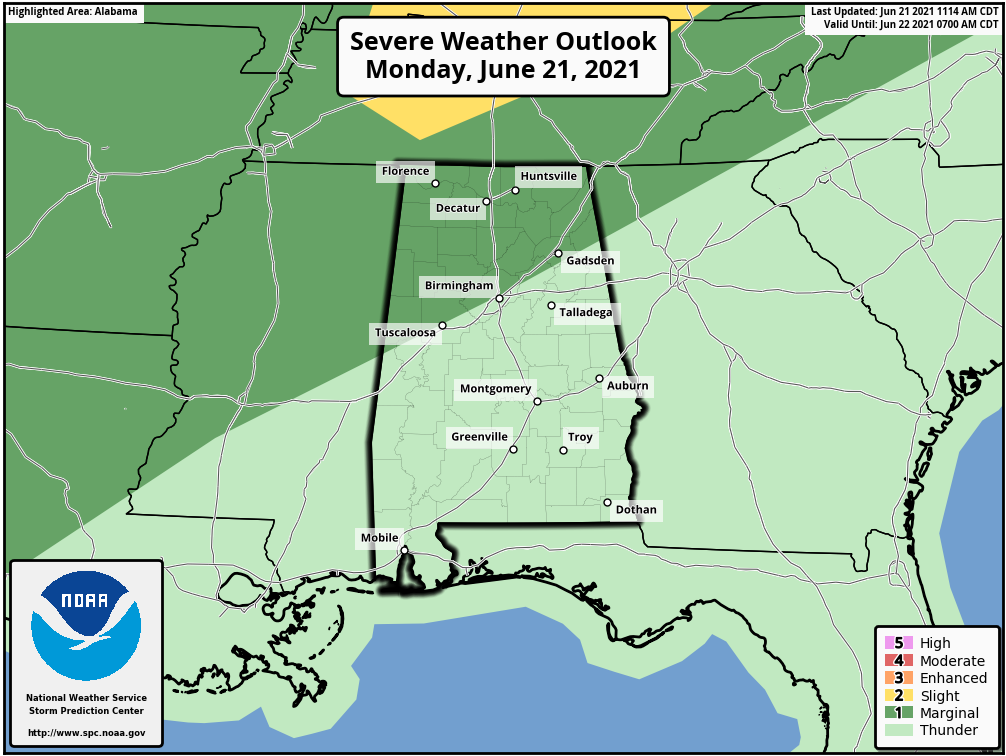
The new Day One Severe Weather Outlook from the Storm Prediction center is out, and it is basically unchanged for Alabama. There outlook a Marginal Risk (level 1 out of 5) down to near I-59 for a line of storms that will be pushing into the state around 7 p.m. this evening and reaching I-59 after midnight.
Ahead of it, there will be fairly numerous showers and storms this afternoon in the warm, moist atmosphere left behind by Claudette.
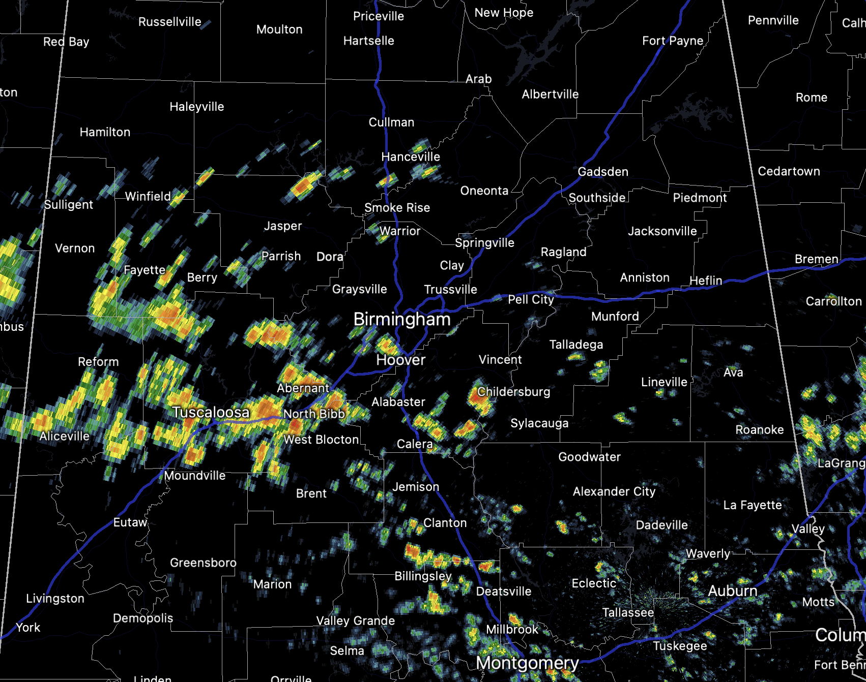
Radar is already picking up on that, with numerous cells to the west of Birmingham. You can see the strong storms ahead of the cold front over northeastern Arkansas into the northwest corner of Tennessee.
The storms will cause brief heavy rains and lightning as well as gusty winds.
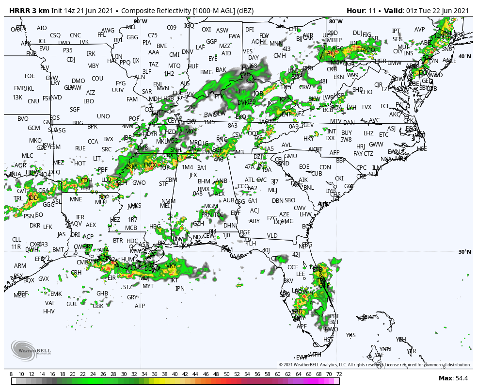
The main line of storms will reach Northwest Alabama around 6-7 p.m. tonight:
They will be approaching the Tuscaloosa/Birmingham/Gadsden areas by 1 a.m.
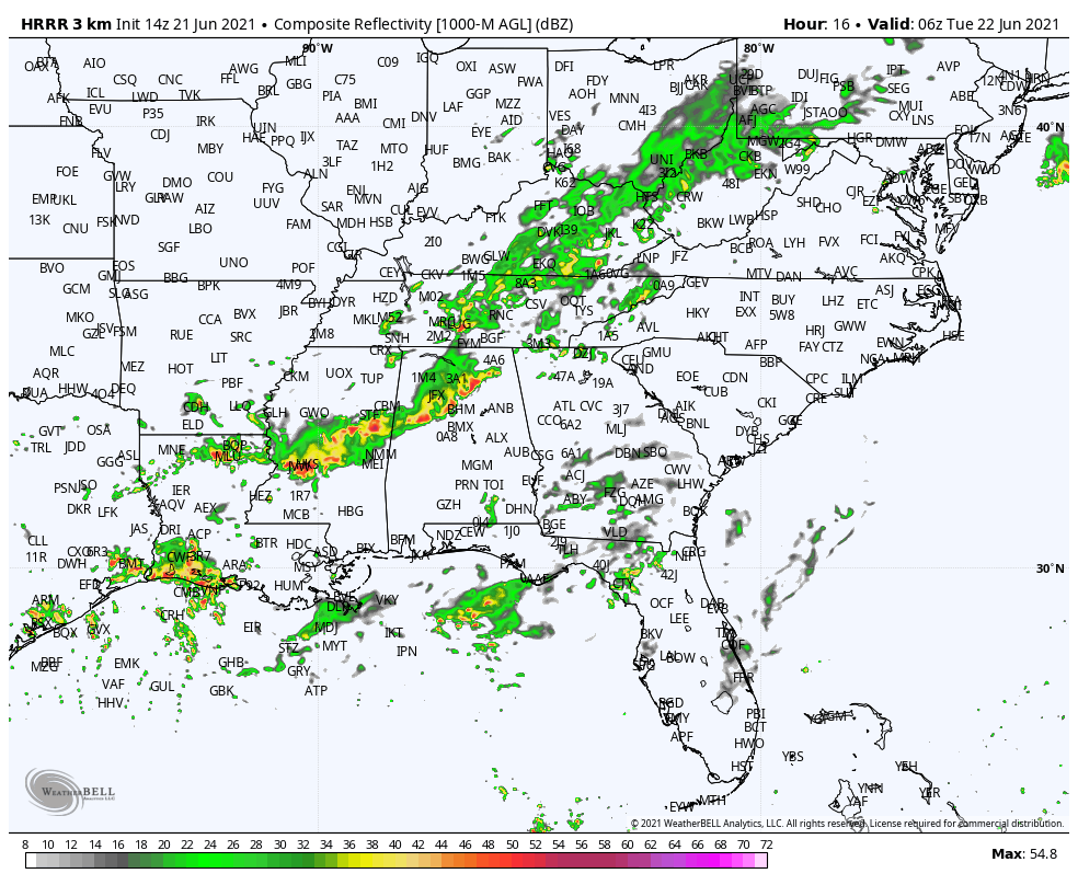
While they should be weakening by that time, they still could produce damaging wind and heavy rain. Make sure you have a way to receive warnings overnight that will wake you in case a severe thunderstorm warning is issued. And be in a safe place if one is issued for your location. It just takes a tree falling on your home to cause serious injuries or fatalities as we saw tragically in Tuscaloosa County Saturday evening
Category: ALL POSTS
About the Author (Author Profile)
Bill Murray is the President of The Weather Factory. He is the site's official weather historian and a weekend forecaster. He also anchors the site's severe weather coverage. Bill Murray is the proud holder of National Weather Association Digital Seal #0001 @wxhistorianSubscribe
If you enjoyed this article, subscribe to receive more just like it.


