

Sunday Noon Update: Scattered Showers Forming over East Alabama, Temps Warming Through the 80s
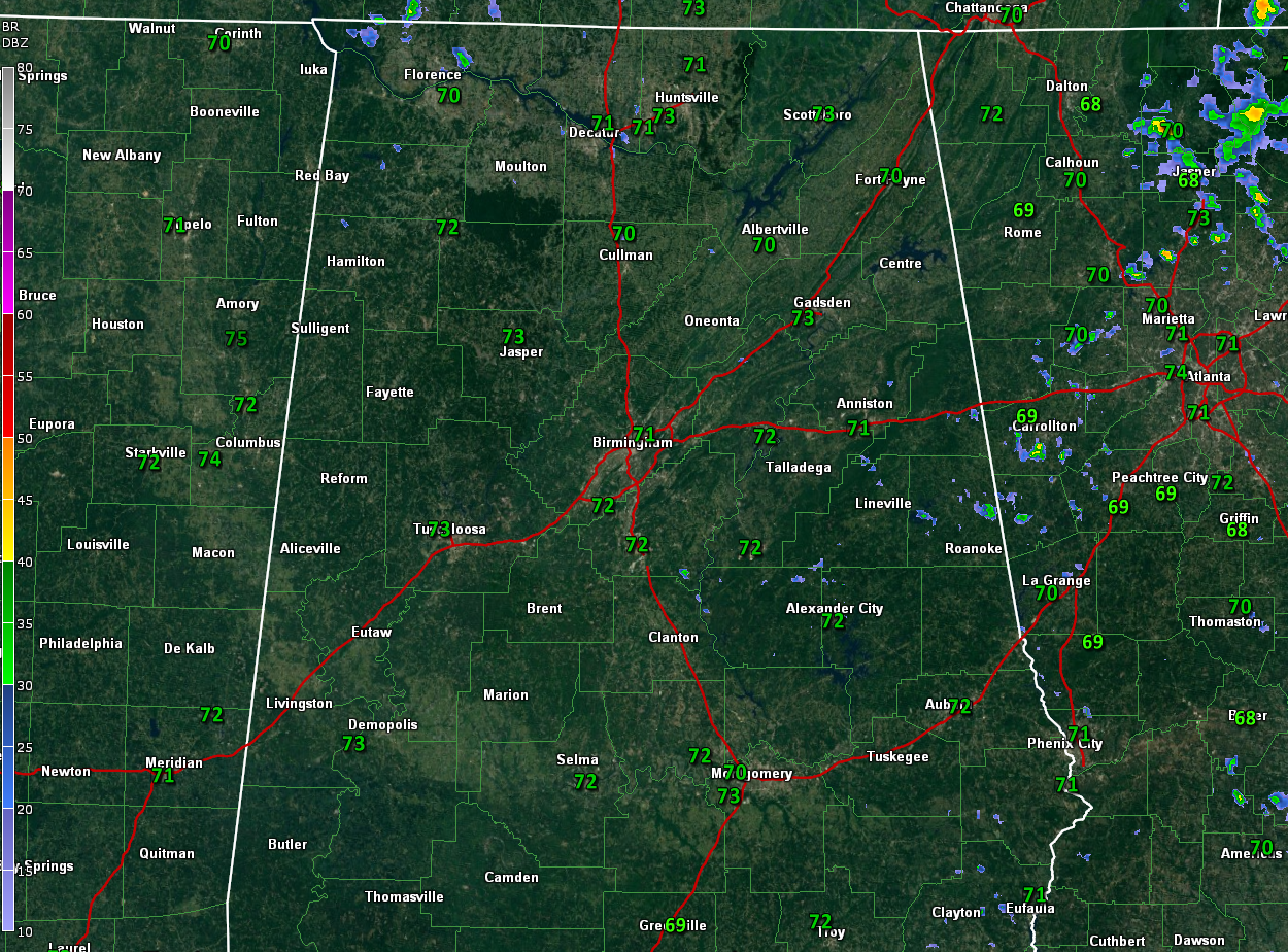
Sunday morning has been beautiful across Alabama. Temperatures bottomed out in the upper 60s in the cooler spots this morning, including Pell City and Gadsden (68F), and a nice 65F at Oneonta. Most folks were in the lower 70s, including Anniston (71F), Birmingham (73F), and Tuscaloosa (74F). Skies are partly cloudy and temperatures are warming through the 80s.
A nice upper-level high-pressure system is just off the Mid-Atlantic coast, east of Virginia, riding into North Alabama. At the surface, the high center is southeast of Newfoundland. The ridge from this high is being pinched by a low east of the Georgia coast. Alabama is in the east-southeasterly flow on the far end of this ridge. The NHC is tracking that low, but it has a tough row to hoe, trying to fight through the high pressure at the surface and aloft. They give it a 20% chance of developing into something tropical before it reaches the coast Monday night. It will rotate up into Alabama toward midweek, increasing our shower and thunderstorm chances.
A bit of subtle upper-level energy has aided in the development of showers over East Central Alabama this morning. Those showers will continue working west northwest in the deep flow. The chance you will see rain this afternoon is still pretty small, less than 30 percent. Skies are partly cloudy, to occasionally cloudy with the humid air in place, but there will be a good supply of sunshine today. Highs will warm into the upper 80s to near 90F. Any showers will die out early this evening and you can expect a calm, humid night, with lows near 70F.
Showers may be more isolated as we are in-between areas of rising air. But showers and storms may reappear as early as Monday night as the low approaching the Georgia coast spreads its influence into Alabama. Tuesday looks a little wetter with a better chance of showers and storms. Wednesday and Thursday will feature widely scattered showers and storms, mainly during the afternoon and evening hours. Temperatures will gradually ratchet down from near 90F on Monday into the lower 80s by the end of the week. Overnight lows will be in the upper 60s to near 70F.
Category: Alabama's Weather, ALL POSTS
About the Author (Author Profile)
Bill Murray is the President of The Weather Factory. He is the site's official weather historian and a weekend forecaster. He also anchors the site's severe weather coverage. Bill Murray is the proud holder of National Weather Association Digital Seal #0001 @wxhistorianSubscribe
If you enjoyed this article, subscribe to receive more just like it.


