Noon Update: Showers and Storms Increasing
Skies have cleared enough for sunshine to pop out across much of Central Alabama, pushing temperatures into the 80s. Highs will be in the middle and upper 80s.
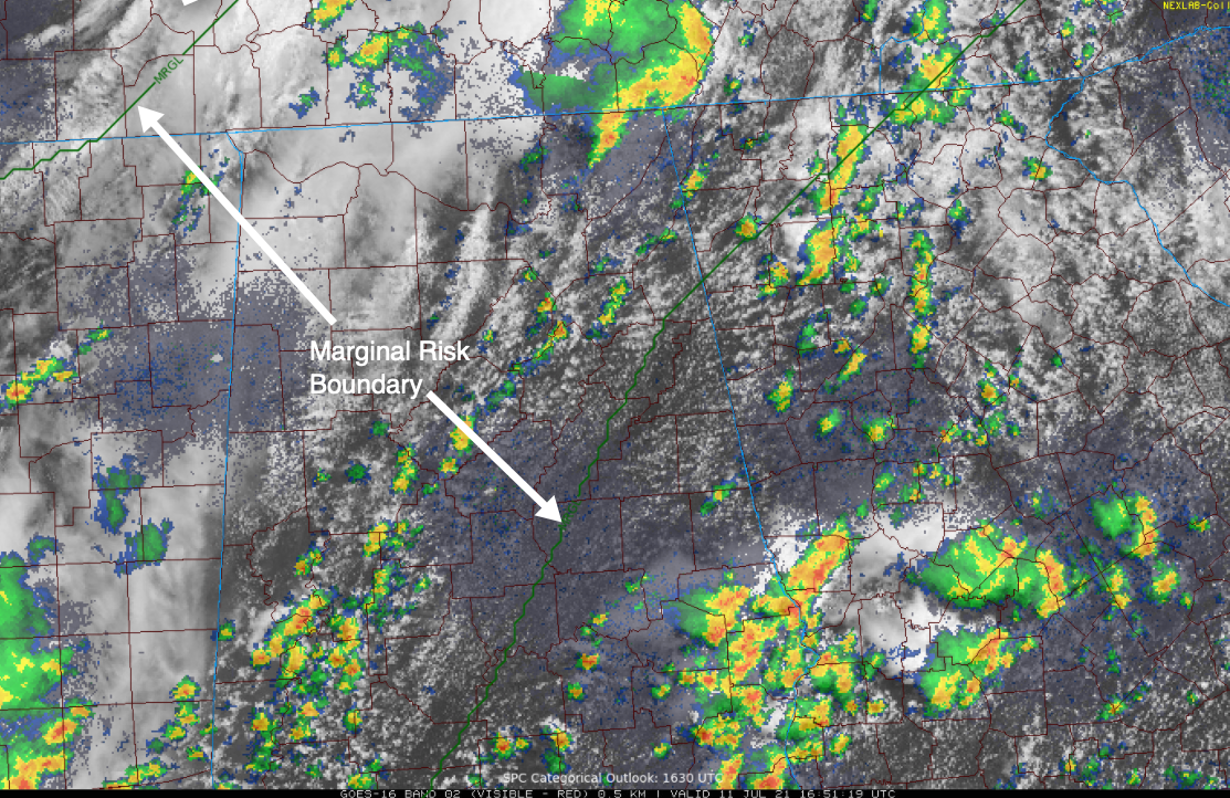
A weak surface low is near St. Louis late this morning. A cold front trails back to Little Rock. Moderate upper-level winds are rotating through the base of the trough over northern Mississippi, western Tennessee, and Northwestern Alabama. Thunderstorms are moving through the Tennessee Valley near Huntsville. But storms have been slow to develop to the southwest. Radar indicates that storms are trying to fill in across the I-59 Corridor, from Sumter, Greene, and Hale Counties through Tuscaloosa/Bibb, Jefferson, and Blount Counties. We will be tracking these storms as they push southeastward.
Additional storms are in progress now across eastern Texas, northern Louisiana, and Western Mississippi. Those storms were working their way east and northeast and may affect Central Alabama later.
Also, storms are trying to fire over northeastern Mississippi to the southwest of Tupelo. They could become another line that pushes southeastward later today.
It looks like we may deal with a couple of rounds of showers and storms across Central Alabama this afternoon and evening. They could be strong or severe with a threat of damaging winds.
The SPC has pushed the severe weather threat a bit more to the southeast from this afternoon, generally northwest of a line from Monroeville to Prattville, to Anniston.
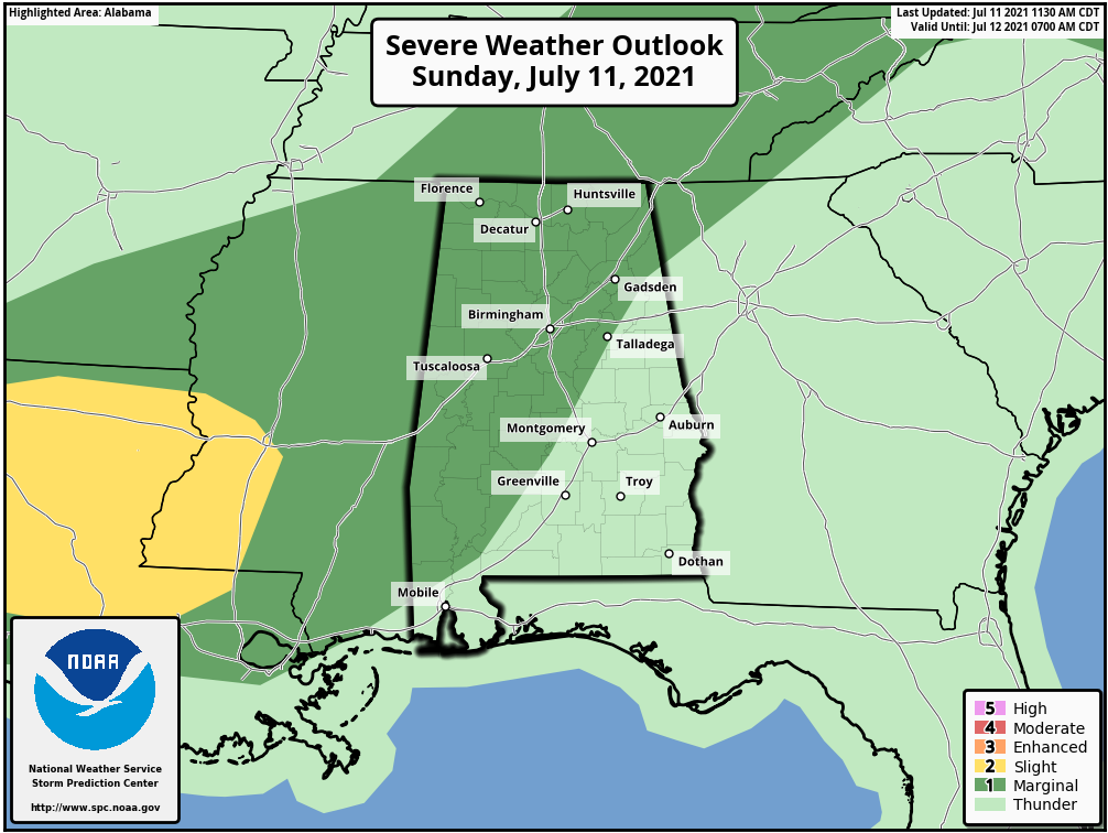
We will continue to monitor the storms through the afternoon for any that are able to become strong to severe. The threat from today’s storms is damaging winds, in addition to locally heavy rain and lightning.
Additional storms will probably form over Northwest Alabama late tonight, with more scattered to numerous storms on Monday.
Category: Alabama's Weather, ALL POSTS, Severe Weather
About the Author (Author Profile)
Bill Murray is the President of The Weather Factory. He is the site's official weather historian and a weekend forecaster. He also anchors the site's severe weather coverage. Bill Murray is the proud holder of National Weather Association Digital Seal #0001 @wxhistorianSubscribe
If you enjoyed this article, subscribe to receive more just like it.


