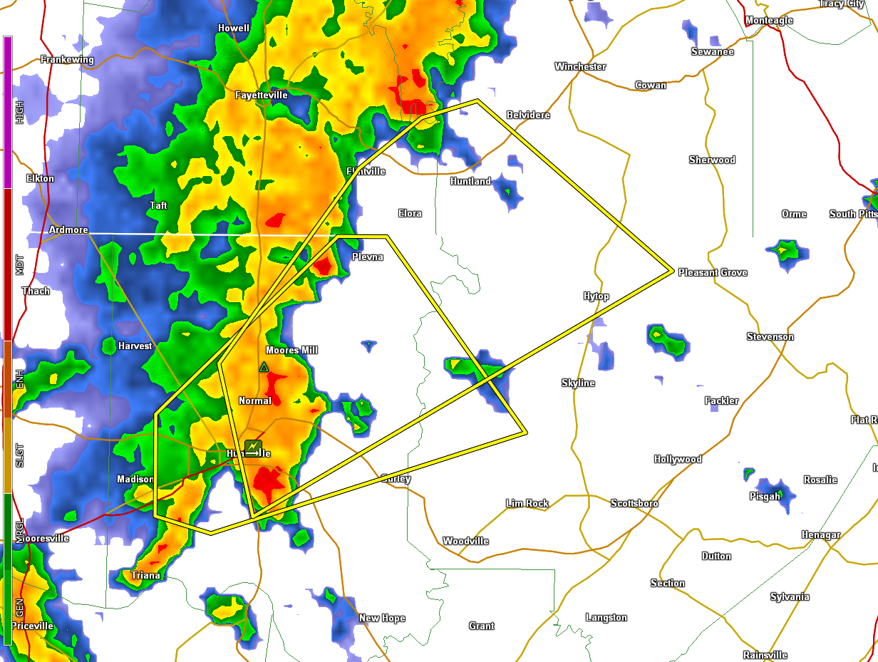
Severe Thunderstorm Warning for parts of Jackson, Madison Counties in AL till 4:45 PM CDT and Franklin, Lincoln Counties in TN
The National Weather Service in Huntsville Alabama has issued a
* Severe Thunderstorm Warning for…
Northwestern Jackson County in northeastern Alabama…
Northeastern Madison County in north central Alabama…
Southeastern Lincoln County in Middle Tennessee…
Southwestern Franklin County in Middle Tennessee…
* Until 445 PM CDT.
* At 411 PM CDT, a severe thunderstorm was located near Moores Mill,
moving northeast at 45 mph.
HAZARD…60 mph wind gusts.
SOURCE…Radar indicated.
IMPACT…Expect damage to roofs, siding, and trees.
* Locations impacted include…
Huntsville, Moores Mill, Meridianville, Hazel Green, Huntland,
Alabama A And M University, New Market, Hytop, Lexie Crossroads and
Maysville.
PRECAUTIONARY/PREPAREDNESS ACTIONS…
For your protection move to an interior room on the lowest floor of a
building.
Torrential rainfall is occurring with this storm, and may lead to
flash flooding. Do not drive your vehicle through flooded roadways.
&&
LAT…LON 3495 8598 3466 8658 3484 8663 3507 8643
3513 8634 3515 8626
TIME…MOT…LOC 2111Z 232DEG 41KT 3483 8646
HAIL…<.75IN WIND...60MPH
Category: Alabama's Weather, ALL POSTS, Severe Weather
About the Author (Author Profile)
Bill Murray is the President of The Weather Factory. He is the site's official weather historian and a weekend forecaster. He also anchors the site's severe weather coverage. Bill Murray is the proud holder of National Weather Association Digital Seal #0001 @wxhistorianSubscribe
If you enjoyed this article, subscribe to receive more just like it.


