Brief Update at 6:40 pm: Rain & Storms Pushing Into the Magic City
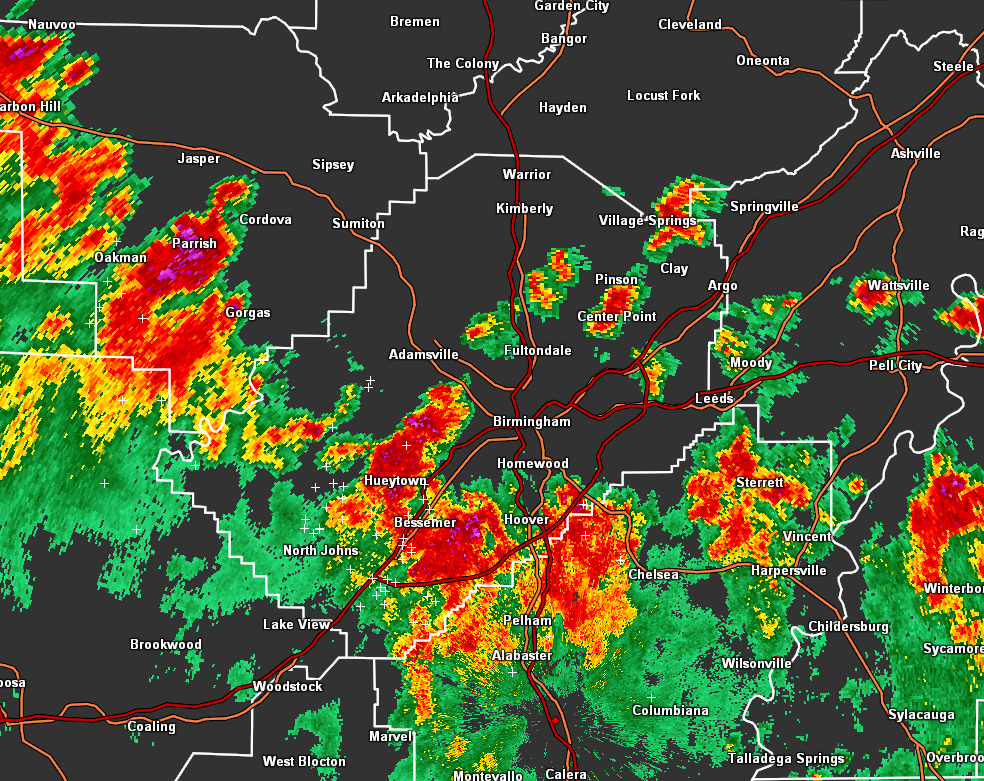
Unlike last night, the Urban Heat Island Effect is not the reason for the showers and storms that are pushing northward through Jefferson County. These storms are associated with a boundary that is moving northward and into an airmass that has been untapped throughout the day. The higher instability levels due to the daytime heating are allowing these storms to continue without losing much energy at all. The main threats from these storms will be from dangerous cloud-to-ground lightning and very heavy rain. Gusty winds may be an issue as well, but none of these are severe.
The boundary with these storms stretches from near Double Springs to Jasper to Homewood to Talladega to Wedowee and Woodland. Other scattered storms are out in front of this boundary, affecting cities such as Alexandria, Jacksonville, Odenville, Argo, Pinson, and Gardendale.
If we have any flooding issues throughout the remainder of the evening, we’ll post as soon as something has been issued.
Category: Alabama's Weather, ALL POSTS
About the Author (Author Profile)
Scott Martin is an operational meteorologist, professional graphic artist, musician, husband, and father. Not only is Scott a member of the National Weather Association, but he is also the Central Alabama Chapter of the NWA president. Scott is also the co-founder of Racecast Weather, which provides forecasts for many racing series across the USA. He also supplies forecasts for the BassMaster Elite Series events including the BassMaster Classic.Subscribe
If you enjoyed this article, subscribe to receive more just like it.


