

Afternoon Update: More Showers and Storms on the Way
The presence of an upper-level trough, disturbances in the flow, and very abundant moisture will continue to enhance our rain chances into the first part of the week across Central Alabama.
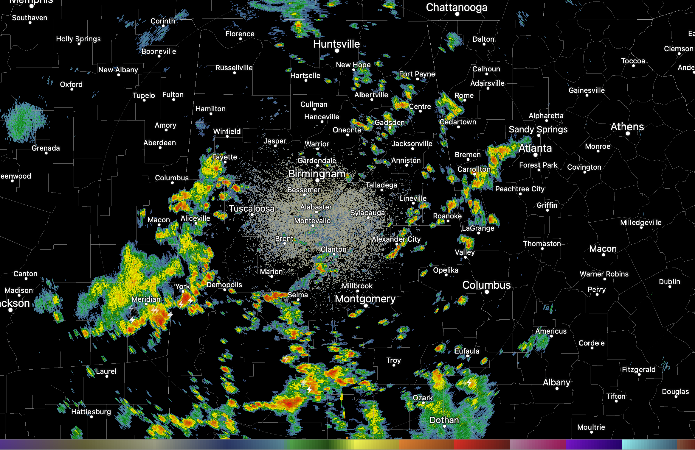
That will be the case this afternoon as the radar appears to have developed a case of Rubella. That measles rash will grow and expand through the next couple of hours.
Meanwhile, a more organized grouping of showers and storms was lurking near the Alabama-Mississippi border will probably build as it tracks east, probably setting up to be the third daily soaker in a row for parts of Central Alabama. With the very high preciptable water values and fairly slow movement, the storms will put down heavy amounts of rainfall in fairly short periods of time. The rain rates and saturated soils will lead to some localized flooding. Watch out for the lightning as well.
There could be a couple of stronger storms as well, with fairly high downdraft CAPE values from west of Birmingham down to Selma and Demopolis, so watch out for a couple of severe thunderstorm warnings and damaging wind gusts.
The storms will diminish toward sunset, before returning for Monday and Tuesday as well. Tomorrow promises a good deal of clouds and rain and storms, holding highs in the lower 80s.
The higher rain chances should diminish toward the middle of the week.
Category: Alabama's Weather, ALL POSTS
About the Author (Author Profile)
Bill Murray is the President of The Weather Factory. He is the site's official weather historian and a weekend forecaster. He also anchors the site's severe weather coverage. Bill Murray is the proud holder of National Weather Association Digital Seal #0001 @wxhistorianSubscribe
If you enjoyed this article, subscribe to receive more just like it.


