Late Morning Check on Central Alabama’s Weather
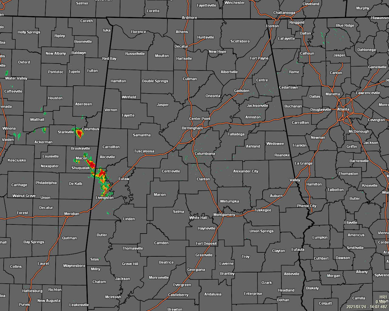
As of 9:07 am this morning, we are already seeing some showers and thunderstorms in the southwestern parts of the area, mainly affecting the northern half of Sumter County and the extreme southern parts of Pickens County. This activity is pushing off to the southeast at a rather slow pace. The rest of the area is dry with hazy skies and a few clouds. Temperatures as of the 9 am roundup were in the mid-70s to the lower 80s across the area. Alexander City, Pell City, and Talladega were tied as the cool spots at 75 degrees. The warm spot was Troy at 83 degrees. Birmingham was at 81 degrees.
Today’s forecast remains unchanged, with mostly sunny but hazy skies and a chance of widely scattered, mainly afternoon to early evening showers and thunderstorms. Some of these storms may not move all that fast, so I wouldn’t be surprised if one or two flood advisories are issued with heavier storms. Afternoon highs will be in the upper 80s to the mid-90s. Any shower and thunderstorm activity will dissipate through the rest of the evening, while nearly everyone stays dry through the late-night and overnight hours. Skies will be partly cloudy to mostly clear and lows will be in the lower to mid-70s.
It will pretty much be the same story for Sunday, as the day will be hot and humid with mostly sunny but hazy skies. We’ll continue to have your typical scattered afternoon shower and thunderstorm chances, with much of that activity ending before the late evening hours. Highs will be in the upper 80s to the mid-90s.
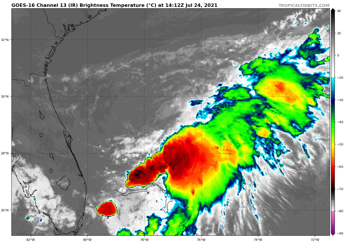
THE TROPICS: As of 7 am CDT this morning, the shower and thunderstorm activity has increased a bit this morning in association with the low pressure system located about 200 miles east of Daytona Beach, Florida. Nearby buoy observations also indicate that surface pressures have been falling close to the center of this system. However, the associated shower and thunderstorm activity remains disorganized and located primarily south and east of the center. Environmental conditions are forecasted to become a bit more favorable for development, and a tropical depression could form over the next day or so while the low meanders offshore of the Florida Peninsula. Interests in Florida should continue to monitor the progress of this system. An Air Force Reserve Hurricane Hunter aircraft is scheduled to investigate the system later today, if necessary.
Category: Alabama's Weather, ALL POSTS, Tropical
About the Author (Author Profile)
Scott Martin is an operational meteorologist, professional graphic artist, musician, husband, and father. Not only is Scott a member of the National Weather Association, but he is also the Central Alabama Chapter of the NWA president. Scott is also the co-founder of Racecast Weather, which provides forecasts for many racing series across the USA. He also supplies forecasts for the BassMaster Elite Series events including the BassMaster Classic.Subscribe
If you enjoyed this article, subscribe to receive more just like it.


