A Few Showers & Storms to Help Cool Off Those Very Warm Temperatures at Midday
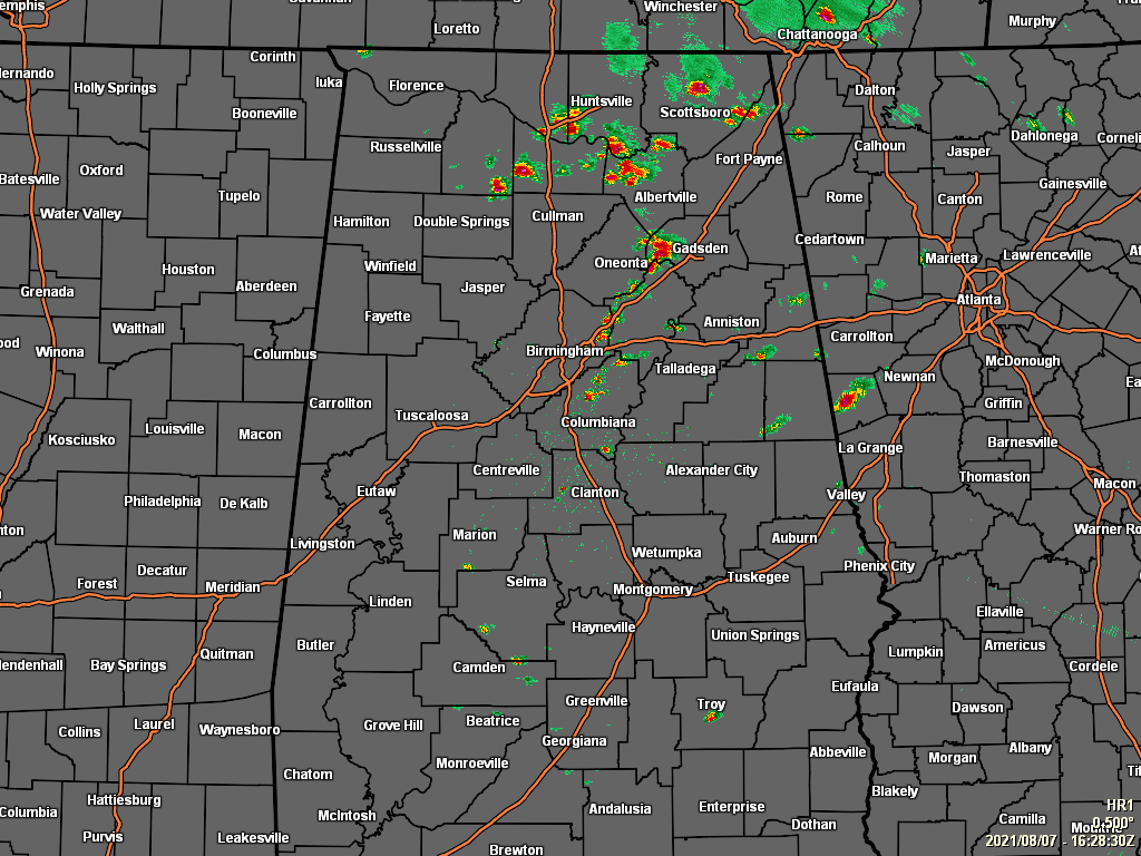
Radar as of 11:28 am shows that we already have some scattered shower and thunderstorm activity over mainly the northern and eastern parts of the area, with only a few isolated showers elsewhere. The heaviest activity at the moment seems to be in-between Oneonta and Gadsden in the western parts of Etowah County and the extreme eastern parts of Blount County.
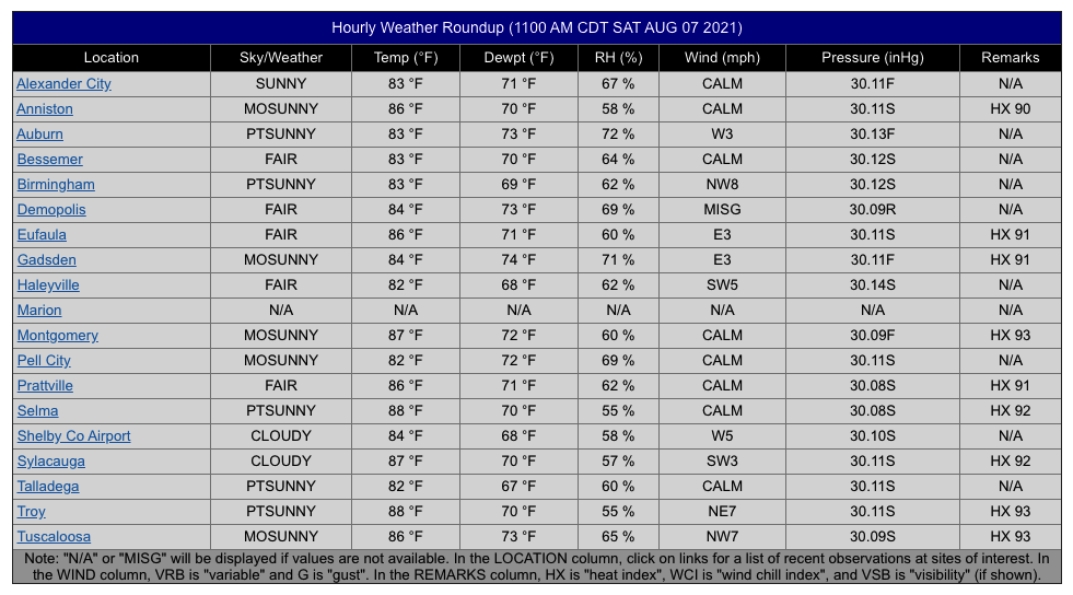
The 11 am roundup shows that skies are mixed from sunny in some spots to cloudy in others, with temperatures ranging throughout the 80s. Haleyville and Pell City are tied as the cool spots at 82 degrees, while Selma and Troy are tied as the warm spots at 88 degrees. Birmingham was sitting at 83 degrees.
FOR TODAY: A trough axis will continue to move through the area, helping with the development of scattered showers and thunderstorms today, but overall chances remain rather small for much of the area. Skies will be partly to mostly sunny where there are no showers, with highs in the mid 80s to the lower 90s. Much of the activity will dissipate later this evening, and we’ll be left with partly cloudy skies. A few locations may have some patchy fog form, especially in areas where rain falls during the latter part of the day. Lows will be in the upper 60s to the lower 70s.
SUNDAY: Sunday is trending drier and warmer as ridging starts to take over our weather pattern. Skies will be partly to mostly sunny, with only a slight chance of a few isolated showers or storms. Highs in the upper 80s to the lower 90s.
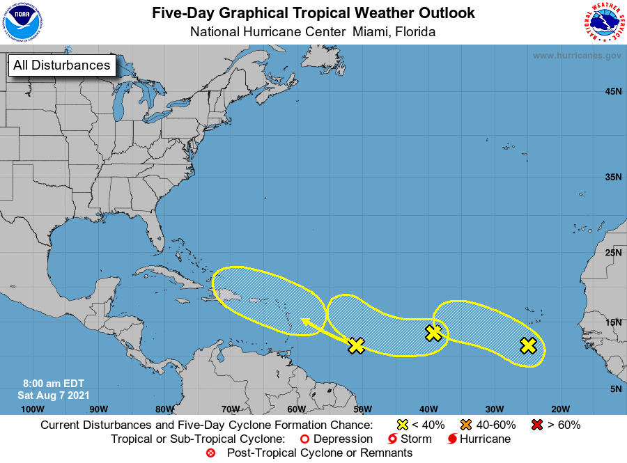
TROPICAL UPDATE: A broad area of low pressure located a couple hundred miles south of the Cabo Verde Islands is producing disorganized showers and thunderstorms. Although environmental conditions are only marginally conducive, some slow development of this system is possible during the next few days while the system moves west-northwestward to westward across the eastern and central tropical Atlantic at 10 to 15 mph.
* Formation chance through 48 hours…low…20 percent.
* Formation chance through 5 days…low…30 percent.
A small but well-defined area of low pressure located over the eastern tropical Atlantic about a thousand miles west of the Cabo Verde Islands continues to produce limited shower activity. Some development of this low is possible while it drifts toward the west-southwest or west over the weekend, and then moves a little faster toward the west-northwest over the central tropical Atlantic by the middle of next week.
* Formation chance through 48 hours…low…20 percent.
* Formation chance through 5 days…low…30 percent.
A tropical wave located over the west-central tropical Atlantic is producing limited shower activity. Significant development of this system is not anticipated as it moves west-northwestward across the Lesser Antilles and eastern Caribbean Sea during the early to middle part of next week.
* Formation chance through 48 hours…low…near 0 percent.
* Formation chance through 5 days…low…10 percent.
Category: Alabama's Weather, ALL POSTS, Tropical
About the Author (Author Profile)
Scott Martin is an operational meteorologist, professional graphic artist, musician, husband, and father. Not only is Scott a member of the National Weather Association, but he is also the Central Alabama Chapter of the NWA president. Scott is also the co-founder of Racecast Weather, which provides forecasts for many racing series across the USA. He also supplies forecasts for the BassMaster Elite Series events including the BassMaster Classic.Subscribe
If you enjoyed this article, subscribe to receive more just like it.


