Checking in on 94L
The disturbance 94L is approaching Barbados this afternoon. Recent satellite wind data indicate that a surface center may be closing off this afternoon. Here is the ASCAT pass at 2:07 p.m.
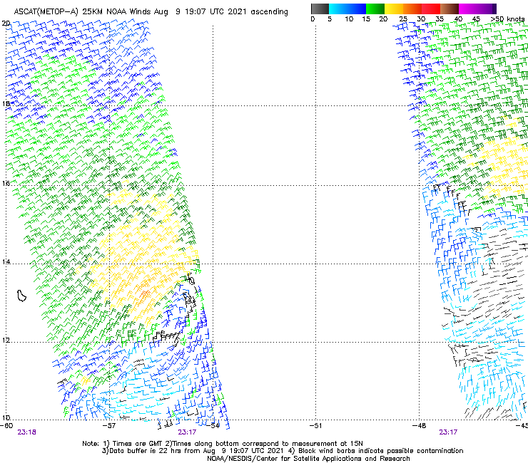
See that little curly q in the western part of the graphic? Those wind barbs show a nearly closed circulation. Winds at Barbados are out of the NNE at 6 knots with showers in the vicinity. We will be watching for backing winds at Barbados to indicate there may be a closed circulation in place.
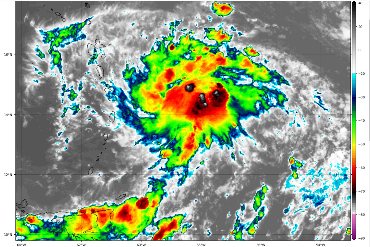
The convection has really increased to the north of what may be the center.
The system is moving over really warm water (29C) and it will be that way over the Caribbean as well. There is some high oceanic heat content water along the path in the Caribbean.
Mean winds over the Caribbean seem to point to a westerly and then west-northwesterly track which could keep it away from the islands of the Greater Antilles (Puerto Rico, Hispaniola) for a while.
The models are not in agreement with that concept though. The models seem to be trying to carry it to near Hispaniola and along the north coast of Cuba before strengthening it near South Florida right before landfall.
It’s still too early to determine where the system could end up if it develops. A more southerly track across the Caribbean could increase our threat across the Gulf region, but that is sheer speculation at this point. We will start knowing a lot more when we have a closed circulation.
Wind shear over the eastern Caribbean is in the 15-knot range, which is favorable for development. An area of 20-knot shear to the northwest of the storm seems to be retreating westward across the Caribbean and could keep the system strengthening.
It is not encumbered by dry air either, as it appears to be embedded in an area of deep moisture traveling along with it.
The Air Force Hurricane Hunters are tasked with a mission to fly into the storm early tomorrow morning.
The NHC has upped the chances for development to 80 percent, as we could be hearing something from them in the next few hours designating it a tropical depression or possible Tropical Storm Fred.
Category: Alabama's Weather, ALL POSTS
About the Author (Author Profile)
Bill Murray is the President of The Weather Factory. He is the site's official weather historian and a weekend forecaster. He also anchors the site's severe weather coverage. Bill Murray is the proud holder of National Weather Association Digital Seal #0001 @wxhistorianSubscribe
If you enjoyed this article, subscribe to receive more just like it.


