Center of Fred is Getting Very Close to the Shoreline of Cape San Blas, Florida
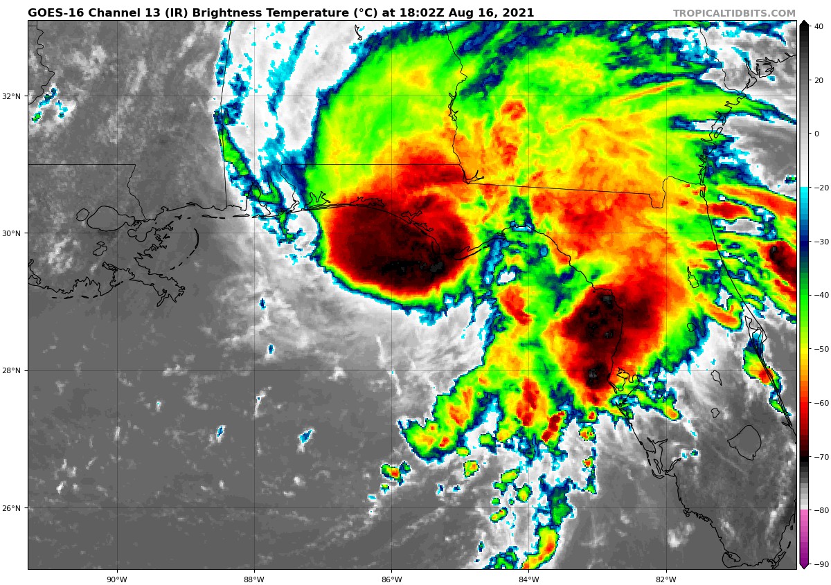
As of 1:05 pm, the center of Tropical Storm Fred was approaching the Gulf Coast and will soon start the process of moving onshore at Cape San Blas. Maximum sustained winds are currently at 65 mph and was moving to the north-northeast at 9 mph. Here is the latest precipitation reports from the NWS Tallahassee region:
Alligator Point … 4.33 in
Sumatra … 3.92 in
Apalachicola … 3.69 in
Eastpoint 1.4 NW … 3.07 in
Sanborn … 2.77 in
Nerrs Meteorological Site … 2.63 in
Panama City … 2.52 in
White City … 2.49 in
1.5 E Mcintyre … 2.31 in
St. Marks … 2.24 in
2.3 N Honeyville … 2.12 in
Wewahitchka … 1.85 in
4 SE Tyndall Afb … 1.62 in
Lynn Haven 0.4 E … 1.41 in
Parker 0.6 NNE … 1.39 in
Panacea … 1.32 in
Wilma … 1.30 in
Vernon 0.5 NW … 1.25 in
Lynn Haven 1.0 W … 1.24 in
Horseshoe Beach … 0.96 in
So far the strongest wind gust we have seen was 58 mph just to the. south-southwest of Eastpoint, Florida (recorded at 12:50 pm CDT). That same station has also recorded two different wind gusts up to 54 mph earlier today.
About the Author (Author Profile)
Scott Martin is an operational meteorologist, professional graphic artist, musician, husband, and father. Not only is Scott a member of the National Weather Association, but he is also the Central Alabama Chapter of the NWA president. Scott is also the co-founder of Racecast Weather, which provides forecasts for many racing series across the USA. He also supplies forecasts for the BassMaster Elite Series events including the BassMaster Classic.Subscribe
If you enjoyed this article, subscribe to receive more just like it.


