A Quick Check on Central Alabama’s Weather at 10 am
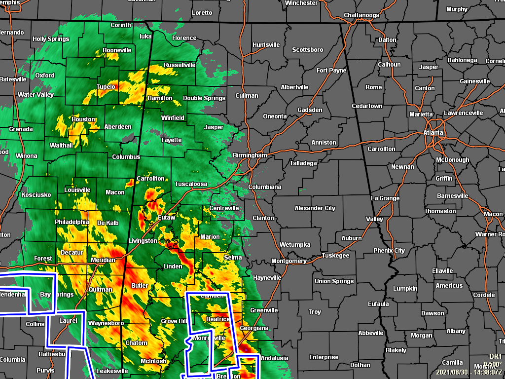
RADAR CHECK: At this time, if you are east of the I-65 corridor in Central Alabama, you are staying dry on this Monday morning so far. Most locations west of I-65 are getting a decent bit of rainfall from the outer edge of Tropical Storm Ida. So far, no warnings have been issued for the area, but several Flash Flood Warnings have been issued for the heavier rainband that is moving northward through the western parts of South Alabama. Throughout the rest of the day, the rain will spread northward and eventually eastward.
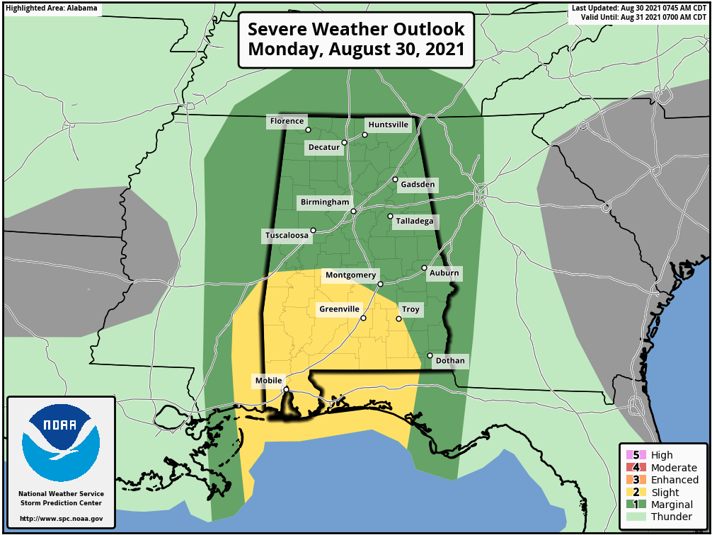
SEVERE WEATHER THREAT: Within these rainbands today, we do have the risk of tropical-induced spin-up tornadoes across the area. For now, the threat is over the western half of the area, and it will stay that way until around 10 pm tonight, when the bands move over into the eastern half of the area. A Slight Risk is up for locations along and south of a line from York (Sumter Co.) to Marion (Perry Co.) to Brundidge (Pike Co.), and a Marginal Risk is up for the rest of the area. Here is a breakdown on the timing for the threat of these tornadoes:
• Now through 4 am Tuesday: Southwestern parts of the area (south of a line from Aliceville to Orrville).
• Now through 10 am Tuesday: Along and west of the I-65 corridor.
• 10 pm tonight through 4pm Tuesday: Along and east of the I-65 corridor.
A Slight Risk is up for locations along and east of a line from Anniston (Calhoun Co.) to Sylacauga (Talladega Co.) to Autaugaville (Autauga Co.) on Tuesday. A Marginal Risk extends west of that to a line from Sardis City (Etowah Co.) to Chelsea (Shelby Co.) to Orrville (Dallas Co.).
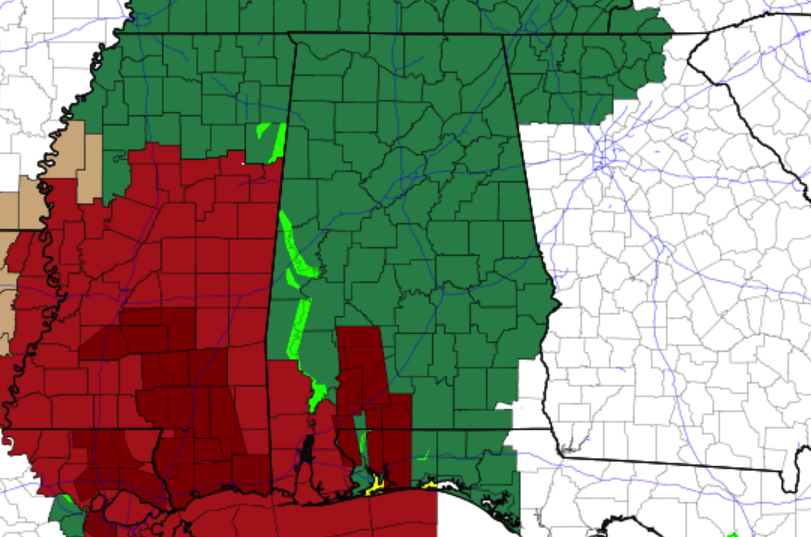
FLASH FLOOD WATCH: With the potential for rainfall totals reaching 3-6 inches across much of the area through Tuesday evening, NWS Birmingham has a Flash Flood Watch for all Central Alabama counties from now through 7 pm Tuesday. NWS Huntsville has done the same for all of the North Alabama counties, and it is set to expire at 1 am Wednesday.
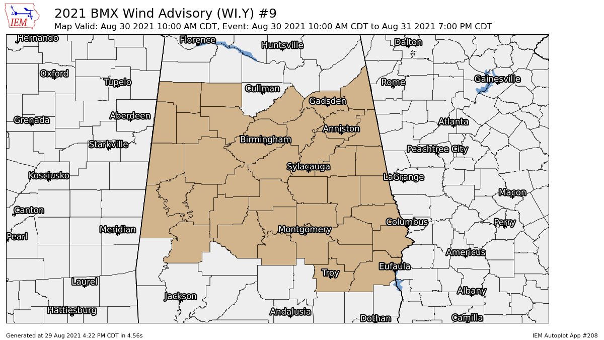
WIND ADVISORY: With the potential for breezy conditions across the area with wind gusts reaching 25-45 MPH, NWS Birmingham has a Wind Advisory up for all Central Alabama counties through 7pm Tuesday.
We’ll be with you through the entire event and will bring updates to you often.
Category: Alabama's Weather, ALL POSTS, Severe Weather, Tropical
About the Author (Author Profile)
Scott Martin is an operational meteorologist, professional graphic artist, musician, husband, and father. Not only is Scott a member of the National Weather Association, but he is also the Central Alabama Chapter of the NWA president. Scott is also the co-founder of Racecast Weather, which provides forecasts for many racing series across the USA. He also supplies forecasts for the BassMaster Elite Series events including the BassMaster Classic.Subscribe
If you enjoyed this article, subscribe to receive more just like it.


