EXPIRED — Tornado Warning for Parts of Pike Co. Until 2:45 pm
BULLETIN – EAS ACTIVATION REQUESTED
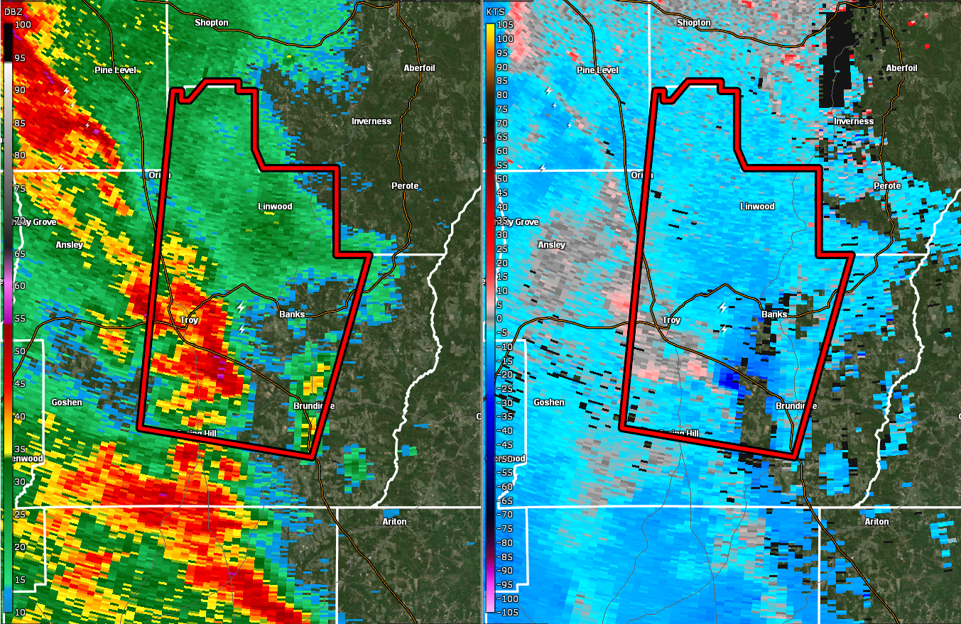
Tornado Warning
National Weather Service Birmingham AL
206 PM CDT Mon Aug 30 2021
The National Weather Service in Birmingham has issued a
* Tornado Warning for…
Central Pike County in southeastern Alabama…
* Until 245 PM CDT.
* At 206 PM CDT, a severe thunderstorm capable of producing a tornado
was located over Antioch, or near Troy, moving north at 30 mph.
HAZARD…Tornado.
SOURCE…Radar indicated rotation.
IMPACT…Flying debris will be dangerous to those caught without
shelter. Mobile homes will be damaged or destroyed.
Damage to roofs, windows, and vehicles will occur. Tree
damage is likely.
* Locations impacted include…
Troy, Brundidge, Banks, Linwood, Troy Municipal Airport, Antioch,
Troy University, China Grove, Sandfield, Brundidge Municipal
Airport, Monticello and Mossy Grove.
PRECAUTIONARY/PREPAREDNESS ACTIONS…
TAKE COVER NOW! Move to a basement or an interior room on the lowest
floor of a sturdy building. Avoid windows. If you are outdoors, in a
mobile home, or in a vehicle, move to the closest substantial shelter
and protect yourself from flying debris.
Heavy rainfall may hide this tornado. Do not wait to see or hear the
tornado. TAKE COVER NOW!
Torrential rainfall is occurring with this storm, and may lead to
flash flooding. Do not drive your vehicle through flooded roadways.
Category: Alabama's Weather, ALL POSTS, Severe Weather
About the Author (Author Profile)
Scott Martin is an operational meteorologist, professional graphic artist, musician, husband, and father. Not only is Scott a member of the National Weather Association, but he is also the Central Alabama Chapter of the NWA president. Scott is also the co-founder of Racecast Weather, which provides forecasts for many racing series across the USA. He also supplies forecasts for the BassMaster Elite Series events including the BassMaster Classic.Subscribe
If you enjoyed this article, subscribe to receive more just like it.


